Boyd's photo diary. |
|
|
|
|
|
|
|
|
Tue 31 May 2016
| |

An inquisitive audience at Scales
Farm, Cumbria. |
|
Mon 30 May 2016
Bank Holliday
Monday
| |
An evening bike ride through Brindle.
This view is from Denham Hill looking towards Winter Hill in the
distance. |
 |

Sunrise across Kem Mill Lane cricket
field, Whittle-le-Woods |

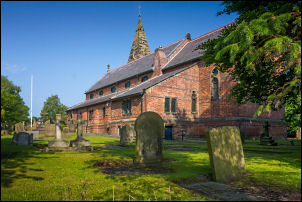
St John's Church in
the morning sunshine |

St John's Church in
the morning
sunshine |
|
Sun 29 May 2016
| |

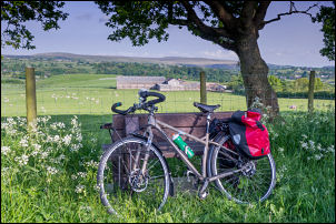
Late morning out for a cycle ride to
make the most of the sunny weather.
Lots of cyclists on the
Belmont road but none after Edgworth and Pickup Bank. |
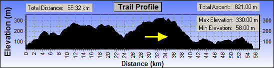
Profile of the ride. |

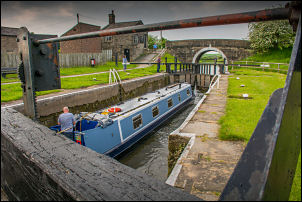
Sunny evening walk along the Leeds & Liverpool canal |

The sunshine brought the crowds out
to the Top Lock Pub |

Lots of green on Birchin Lane |

Hill Top Lane, Whittle-le-Woods |
|
Sat 28 May 2016
| |
Enjoyed a sunny bile ride via Rufford and West Lancs. This is St
Mary's Church Rufford. |
The clouds rolled in this evening for
my walk along the Leeds & Liverpool canal. |

Moody sky across the Leeds &
Liverpool Canal |
|
Fri 27 May 2016
Almost two years ago on
Wed 27th Aug 2014 I was out for a walk near Grimwith
Reservoir, North Yorkshire. While walking along the road I
noticed some flowers by Dibbles Bridge at the bottom of a steep
hill on the B6265 between Grassington and Pateley Bridge. They
had been put there by friends of James Nelson, a cyclist who had
crashed into the bridge parapet and fallen to his death on the
rocks by the River Dibb about 10m below.
What I didn’t know
was it was also the location of
Britain’s worst ever road crash.
Exactly 41 year ago, on
27th May 1975 a coach careered down the same hill after its
brakes failed. It crashed through the bridge parapet and landed
upside down by the river below.
Of the 45 people on board the
driver and 31 passengers died. |

Wed 27th Aug 2014 |

The
coach crash in 1975 |
Enjoyed a sunny evening
walk to Lower Kem Mill to look at the new allotments |

Rushes on the old mill lodge |

New allotments |
|
Tue 24 May 2016
| A lovely sunny morning for my walk on
the fells above Haweswater Reservoir |

Haweswater |
|
Mon 23 May 2016
| Stocks Garage in Higher
Wheelton stopped selling fuel in Feb this year as they couldn't
compete with the Supermarkets. The pumps and office are now
being demolished. |

Demolition |
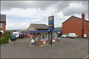
The
view in 2009 |
|
Sat 21 May 2016
| My wonderful Mother was
born 100 years ago today. She died in 2010 at the age of 94
after a long and very active life which was mostly spent helping
others. She was an active member of the Women’s Institute and
attended her last meeting a few days before her death. She
always committed herself totally to any organisation she joined
and would rarely miss a meeting. |
|
Her voluntary work took up much
of her time and she revelled in her main activity of ‘doing the
teas’. Some other activities included the Friends of Astley
Hall, Women’s Fellowship, Hollins Head Street Keep Fit group,
Chorley Gospel, U3A, and her local Walking Group. |

Mum on a cycling holiday
with Dad in 1938 |
 |

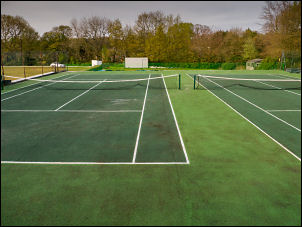
At Withnell Fold the tennis court
retaining wall is being rebuilt |

An evening walk to
Withnell Fold to have sandwiches for my tea on Mum's
memorial bench |
This afternoon enjoyed a walk around
Entwistle Reservoir and Edgworth |

Entwistle Reservoir |

Entwistle Railway Station c1903 |

Entwistle Railway Station
this
afternoon |

East Bungalow AD 1911 |
 |

West Bungalow AD 1911 |
 |
|
Fri 20 May 2016
| |
Out for cycle ride over
Belmont and Rivington. The contractors were out repairing the
foot path. |
 |
|
Thu 19 May 2016
| At lunchtime walked up to
Great Hill to have some sandwiches. In recent weeks the vandals
have been there and stolen the stone slab bench seats. |

Where the capping stones
used to
be |
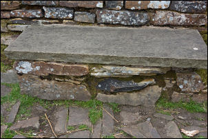
One of the remaining stones |
|
Wed 18 May 2016
| |
I'm leaving Ireland today
starting on the train from Tralee to Dublin then ferry to
Holyhead |

Tralee Casement Railway Station |

Leaving Tralee in an empty carriage.
It Killarney it filled up with a party of very noisy
schoolchildren |

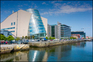
Arriving in Dublin |

Cycling through Dublin |
|
Tue 17 May 2016
| |

Descending a very wet and misty
Connor Pass |

View from my tent.
A stormy Tralee Bay |
Tralee Railway Station and
the end of my ride. It is also called
Tralee Casement. In 1966 the station was given the name
Casement in commemoration of
Roger Casement, one of the executed leaders of the Easter
Rising of 1916. |
 |
|
|
Mon 16 May 2016
|
Sun 15 May 2016
| |
After a long climb out of
Cahersiveen I came to the summit and site of the old Kells
Railway Station (1893-1960). |

Kells platform |

Kells Railway Station |

Kells Railway Station in use |
|
|
|
Sat 14 May 2016
| |
|
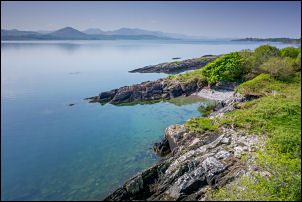
The coast near Ballylickey |
 |

At the summit of the Caha Pass is
this tunnel. It is the border between Cork and Kerry |
Coast from the Ring of Kerry |

Charlie Chaplin would take his
holidays at Waterville on the Ring of Kerry |

A lovely house in the garden |

Closer view of the house extension |
|
|
|
Fri 13 May 2016
The car replica is a
Memorial to the Fords of Dearborn.
Henry Ford's family came
from here and he visited in Aug 1912.
The model "T" Ford
became the car for the people and by 1927 over 15 million had
been built. |

Model
"T" Ford |

Bridge over the river at Skibbereen |

The cemetery outside Skibbereen has a
mass grave of some victims of the Great Famine.
The memorial
stone reads:
In Memory of the victims of The Famine 1845 - 48
whose coffinless bodies were buried in this plot.
A nearby
plaque says around 9,000 bodies are buried in the plot. |

Bridget O'Donnell and her two children 1849 |
 |
|
|
|
Thu 12 May 2016
| Heading to Ireland with my
bike to do some cycle touring. |

On the Swift ferry from Holyhead to
Dublin.
It was one and a half hours late! |
Dublin |

Cork Railway Station |
|
Tue 10 May 2016
| |
|
This evening at Chorley Historical and Archaeological Society
meeting at Chorley Library. Our speaker was David Ratledge who
gave a special presentation on the Roman Roads in Lancashire. It
was special because he has been using the relatively new tool of
LIDAR. Light Detection and Ranging (LIDAR) is an airborne
mapping technique, which uses a laser to measure the distance
between the aircraft and the ground. Up to 100,000 measurements
per second are made of the ground, allowing highly detailed
terrain models to be generated at spatial resolutions of between
25cm and 2 metres. |

David Ratledge |
The technique is able to resolve small variations of ground
level and can see through vegetation thereby giving a clear view
of variations that can’t be seen at ground level or conventional
photographic imaging.
There is a lot more information
via:
this link. |

The
main Roman Roads in Lancashire |
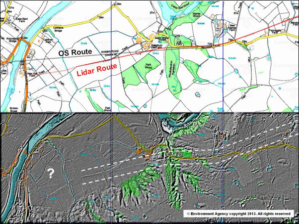
The
bottom part of the image shows how LIDAR shows extra detail |
|
Mon 09 May 2016
| Enjoyed an evening stroll
with members of Chorley Photographic Society up to the Pigeon
Tower above Rivington. It was a great evening for photographs. |
 |
 |
 |
|
Sat 07 May 2016
Today I attended the C.B.A.(Council for British Archaeology)
Spring Conference at the Staining Village Hall near Blackpool.
CBA 2016 Spring Conference ‘New Light on the medieval
archaeology of North West England’
Bob Dobson’s second hand
book stall had its usual selection of historical gems including
a set of The History of the County Palatine and Duchy of
Lancaster by Edward Baines revised and enlarged in 1888.
Bob sent me an email to say he sold the set later in the day. |
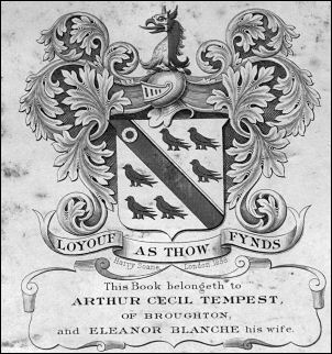
A previous owner of the Baines's set had stuck
this label inside:
It belogeth to Arthur Cecil Tempest of
Broughton, and Eleanor Blanch his wife. |
 |

Baines's History of Lancashire |
|
|
 |
 |
|
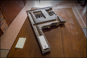
This was a guessing game. Nobody could identify what this item
was that had been rescued from a church. |
|
Thu 05 May 2016
|
Drove to Anglesey and Holy Island for the day to check a few
things and go for a short walk |
 |

Britannia Bridge across the Menai Straits. Designed by
Robert Stephenson and opened to railways 1850 and road added
1980. |
|
Image on right: Diving Observation Chamber used suring WW11 for
recovery from shipwrecks too deep for conventional divers. It
had a working depth of 300m. It carried enough oxygen for 3hrs
operation. |
|
|

South Stack Lighthouse |
From South Stack car park I walked up
Holyhead Mountain or Copa Summit on Holy Island. It is 220m
(722 ft) and the highest point on Anglesey. There is the trig
post and remains of a Roman Tower. |
 |

Wide view of Cemlyn Bay on Anglesey |
Returned to the mainland via the original
Menai Suspension Bridge designed by Thomas Telford and
opened in 1826 |
 |
As soon as I returned home walked to the Polling Station at
the Whittle-le-Woods Village Hall to vote in the local elections
and for Police Commissioners |
 |
During the evening cycled to Withnell Fold to look at
the work being done by the tennis courts. The retaining wall was
unsafe and is now being re-built |
 |
 |

The old bowling green cabin |
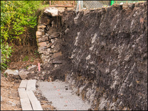
Concrete base for the new retaining wall |
|
Wed 04 May 2016
 |
|
This evening at Wigan Archaeological Society to see presentation
by Lancaster and District Heritage Group about their recent
excavations on a roman site by near the River Lune. The image
shows a digital representation of where the Roman Fort was. |
|
Mon 02 May 2016 Bank Holiday Monday
This afternoon was the
17th Whittle-le-Woods Duck
race on Waterhouse Green by the River Lostock.
|
 |

|
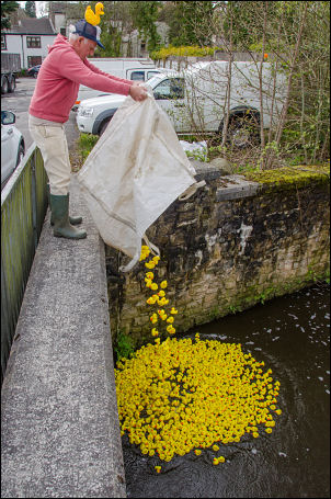
Start of the race |
 |

The winners pass under School Brow Bridge |

On an evening cycle ride I saw this view from the bench by
Denham Hill looking towards Great Hill |
|
Sun 01 May 2016
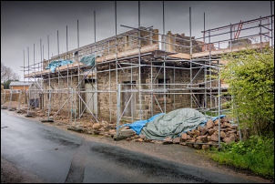
Barn being converted on Windmill Ln., Brindle
|
 |
|
|
|
|
|