|
|
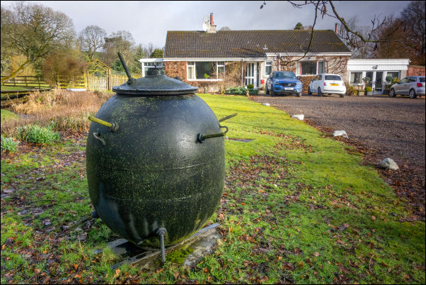
Eddleston garden feature |
|
Lots of heavy rain through the night but it stopped briefly in
the morning. Unfortunately as I was about to pack up it started
again and very heavy with a strong wind. I had to put full
waterproof on to complete my packing and I set off still wearing
them. It was an easy climb on the road and as I reached the highest
point the rain stopped and thankfully the wind was behind me. I had
a clear view of the rolling hills ahead and most of my way down to Eddleston
was downhill. On the outskirts of the village I was riding past the
drive of a bungalow when I noticed a WW2 mine mounted in the garden. |
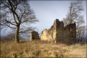
Uttershill Castle |
I stopped to take a photo and the lady of the house came
out to ask if I was looking for somewhere. When I said I was
photographing the mine she said it was OK to have a closer look. She
also said it was a birthday present to her from her husband. I
continued into Eddleston and the main A703 road where I turned left.
I had less than 3 uncomfortable miles to ride on it as the traffic
was busy and fast. I was very glad to turn right and follow the
minor road up a zig zag in a NE direction. The wind was getting
stronger and on the higher section of road I stopped to shelter
behind a tree while a squall of hailstones passed by. I continued
with a helping tailwind until I reached the left turn on to the B6372. I already knew I would then be heading into side and
headwinds. It was tough going even though I was mostly heading
downhill towards Penicuik. It started raining again on the final
steel descent. I noticed a ruin up to my left so wheeled my bike up
there to have a look. It was Outtershill Castle and looked like
someone had been trying to restore it but had stopped some time ago.
Some containers were adjacent but they were locked and didn’t look
like anyone had been there for some time.
Apparently it dates
from the 16th century an Alexander Archer drawing from 1836 shows it
in ruins
https://en.wikipedia.org/wiki/Uttershill_Castle |
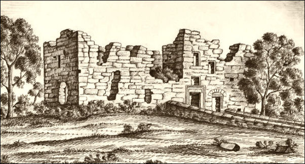
Uttershill Castle by Alexander Archer 1836 |
|
I
continued my descent in to Penicuik. Over the bridge I headed up
into the town and stopped when I saw the Pen-Y-Coe Press building.
It is mostly a stationers and printers and I went in for a look. The
man was very helpful and told me about the Paper Mills that used to
be in the town. There was an adjacent museum but it was closed. He
opened it for me and took me in for a short look. |
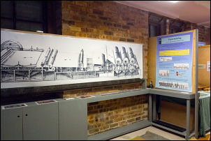
Pen-Y-Coe Press museum |
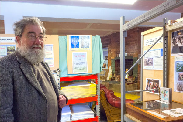
Roger Hipkin of the Pen-y-coe Press gave me a special tour of the
museum |
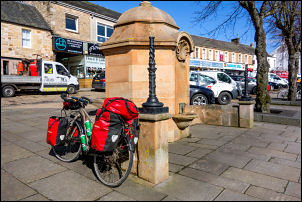
The
Old Well |
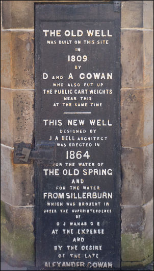
The Old and New well |
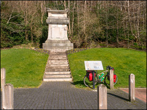
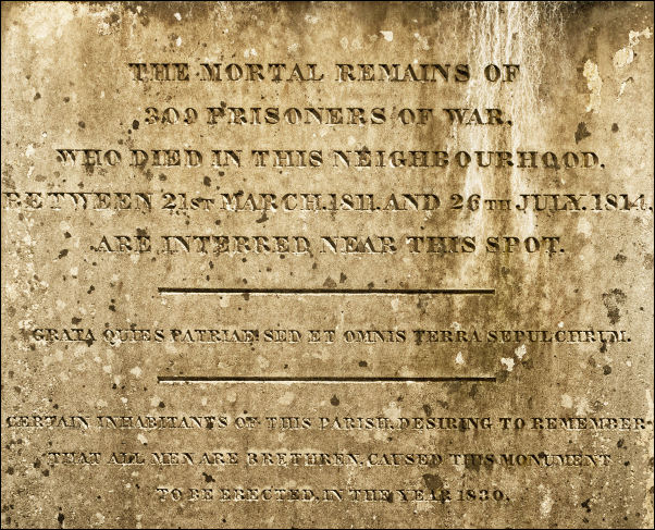
Sepulchral Monument. |
In the town I
called at Lidle to buy some water and returned to have a look at the
Old Well monument. A descended back down to the bridge and through
the housing estate where Valleyfield Paper mill used to be then up
the hill to what the old map calls a Sepulchral Monument.
The
panel reads 'The mortal remains of 309 prisoners of war, who died in
this neighbourhood, between 21st March 1811, and 26th March 1814,
are interred near this spot. Certain inhabitants of this parish,
desiring to remember that all men are brethren, caused this monument
to be erected in the year 1830.' |
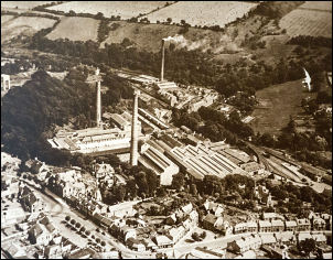
Penicuik Paper Mills now long gone |
|
I continued along the cycle
track which follows the line of the old railway. At the River North Esk I came to a large field and decided to camp as there was
sunshine reaching the site and I was able to dry my tent. |
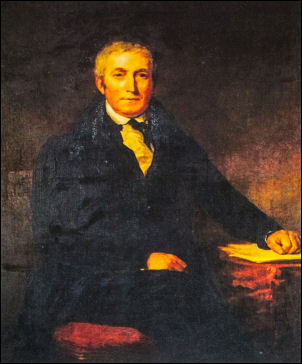
Alexander Cowan (1775-1859)
Paper-maker and Philanthropost |
|
|
The
panel reads 'The mortal remains of 309 prisoners of war, who died in
this neighbourhood, between 21st March 1811, and 26th March 1814,
are interred near this spot. Certain inhabitants of this parish,
desiring to remember that all men are brethren, caused this monument
to be erected in the year 1830.' |
|
I This is the first outing for my new petrol (multi-fuel) stove. Gas
is great but is a problem in cold weather, petrol isnt. |
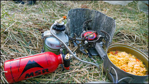
Cooking tea. The red container is petrol but it is currently
connected to the gas canister. |
|
|