|
It was cloudy but thankfully no rain as I put the tent away. There
hasn't been any vehicles over the pass road during the night but
shortly before 7 a.m. a couple of builders trucks came up from the
Glen Garry side. I set off at 6:50 a.m. and started the long descent
to Glen Garry. It felt quite chilly so I had my windproof jacket on. |
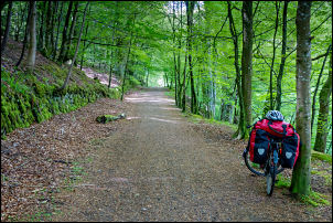
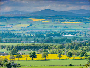
Descending to Glen Garry |
The old A9 |
|
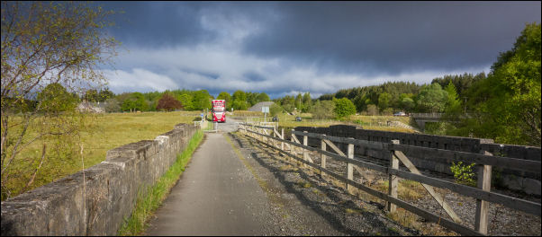
Crossing the railway line & then the river I came to the line of the
old A9 Road. The left turn is the new A9 but I turned right to
follow the old road down towards Blair Atholl. It is no longer a
through road to traffic but is open to pedestrians and cyclists. The
riding was extremely enjoyable and I made good progress with ease. |
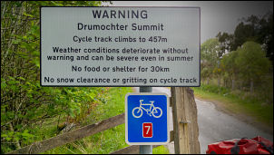
Warning |
|
Eventually the road reached the B847 which I joined to follow it as
far as Bruar. This is roughly where I'd originally planned to camp
and I'm glad that I didn't press on yesterday as the site I'd
planned was not very good. The old main A9 is now the B8079 and I
followed it in to Blair Atholl. |
Leaving Bruar |
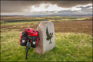
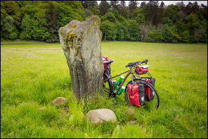
There was nothing of interest for me to investigate so I continued
towards Killiecrankie. Just before the village I noticed the gate in
the field to the left was open and in the middle of the field is the
Claverhouse’s Stone.
|
Claverhouse's Stone |
|
The stone marks the point where John Graham of Claverhouse,
1st Viscount Dundee, leader of the Jacobites was fatally wounded and
died at the Battle of
Killiecrankie on 27 July 1689. I rode my bike to the stone, took
a picture and returned to the road. The battle was the first of the
Jacobite Risings. |
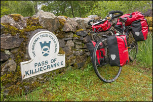
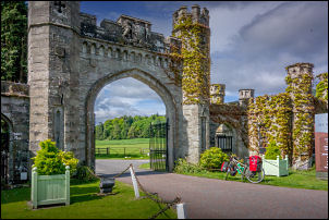
Pass of Killiecrankie |
|
There was a steep climb out of the village and I followed it to the
pass of Killiecrankie sign which is also the location of the
information centre. The centre was closed. I continued along the
road into Pitlochry, which was quite busy. Before leaving the town I
took a right turn down a small road and continued on down to the
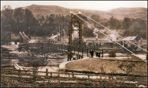
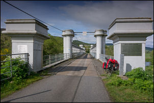
delightful Port na Craig Suspension Bridge over the river. It was
built in 1913 and replaced an earlier ferry which had been running
since the 13th century. There were many people using the foot bridge
and it was a delight to wheel my bike across. |
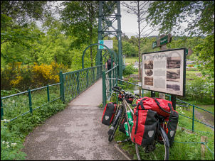
Port na Craig Suspension Bridge |
Site
of the old ferry |
Site of the old ferry |
It is the Port na Craig Suspension Bridge a public footbridge
'erected in memory of Lt. Col. George Glas Sandeman of Fonab, opened
by the Marchioness of Tullibardine on Empire Day 1913'.
It
was not until after the death of Queen Victoria, who died on 22
January 1901, that Empire Day was first celebrated. The first
'Empire Day' took place on 24th May 1902, the Queen’s birthday.
Although not officially recognised as an annual event until 1916.
Empire Day remained an essential part of the calendar for more than
50 years, celebrated by countless millions of children and adults
alike, an opportunity to demonstrate pride in being part of the
British Empire. By the 1950’s however, the Empire had started to
decline, and Britain’s relationship with the other countries that
formed the Empire had also changed, as they began to celebrate their
own identity.
Political correctness appears to have 'won the day'
when in 1958 Empire Day was re-badged as British Commonwealth Day,
and still later in 1966 when it became known as Commonwealth Day.
The date of Commonwealth Day was also changed to 10th June, the
official birthday of the present Queen Elizabeth II. The date was
again changed in 1977 to the second Monday in March, when each year
The Queen still sends a special message to the youth of the Empire
via a radio broadcast to all the various countries of the
Commonwealth. It is now largely forgotten anniversary. |
1913
view of the suspension bridge |
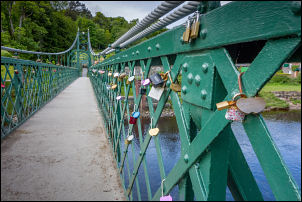
Locks on the bridge |
|
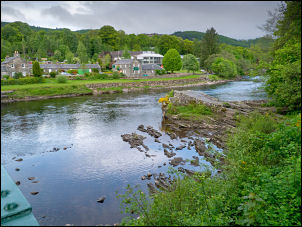
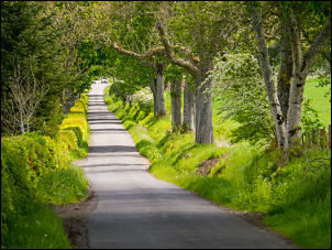
On the far side I turn left to join a narrow road which follow the
valley on the west side. Although there was a lot of up and down it
was a very enjoyable route for cycling. Eventually I reached
Logierait Village and left the road to join a short stretch of cycle
track to a bridge over the River Tay. This Bridge originally carried
the railway between Perth and Inverness. The last train passed in
1965 and a local pressure group managed to preserve the bridge and
convert it to a Road Bridge. |
Logierait Bridge |
|
I joined the main B898 and followed it south to where it joins the
main A9 Bridge over the Tay. The cycle track follows the footpath
across the river then heads back under the bridge to follow the
river back into Dunkeld. It is not surface but is a rough track that
emerges into parkland then onto the main road in Dunkeld. By now the
earlier cloud and overcast weather has improved and sun was shining
through. |
Old road into Dunkeld |
Dunkeld |
Above Loch of Lowes |
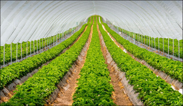
Crops under plastic |
|
In Dunkeld I changed into short sleeves and started the climb out of
the town towards Loch of Lowes. I left the main road to turn right
along a quiet lane by a golf course that follows the south side of
the Loch. There was a steady climb and then a descent with lovely
views. During the day I had passed the corpses of three deer that
have been killed by passing vehicles. They were in a varying state
of decomposition and the last one was lying by the road in a bloated
state. Fortunately the wind had taken the smell the other way. |
View from Northballo |
|
The sun has come out and I had a lovely warm ride through the quiet
lanes all the way to Coupar Angus. I went into the Scotmid
Supermarket to buy a 5 litre container of water and then continued
south along the lanes to my planned camp in a Pine Forest at
Northballo. I reach the car park and followed the forest track round
to the north side of the hill. Id previously checked the area on
Google Maps but as I reach my planned camp I realised there was not
a clearing as I’d hoped. |
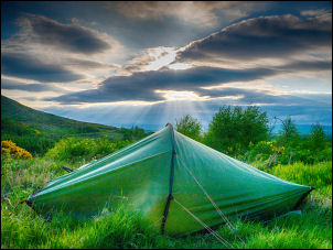
Camp 3 by Northballo |
|
I continued round the hill to re-join the road at the south
end but by now I've lost a data signal and there was no signal for
my phone. I descended to the first car park I'd arrived at where I
knew there was a good signal. I finished up camping where I first
arrived at the forestry track. The sun was no quite warm as I
pitched my tent. I had nice views to the north and a good signal for
my phone. |