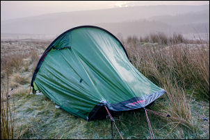
It was misty and sub-zero when I woke
up with ice on the tent and frost on the grass. I was packed up and
away by 8 a.m. but had to alter my original planned route due to the
reconstruction works along the track further on. I decided to return
to the main road, the A6024, and descend into Holmfirth. It was very
misty as I cycled along the rough track to join the main road and
here I stopped to put on over gloves and windproof for the long cold
descent.
Frosty tent in the morning
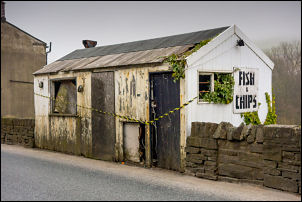
On the approach to Holmfirth I came across a very old and
dilapidated chip shop which was last used over 10 years ago. I spoke
to a couple of local ladies and one said she used to work in it. The
other lady said that at one time somebody was living there.
Old Chip Shop
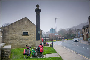
In
Holmfirth I stopped by a stone post which has an inscription on it
reading “This stone was erected In 1801 to commemorate the short
peace called The
Peace of Amiens” then a line marking “the height of
the flood caused by the bursting of the Bilberry Reservoir February
1852 whereby 81 lives were lost.
Holmfirth
I headed east on the very long climb out of Holmfirth on the
A635. It was very uncomfortable because of a constant stream of
traffic and even though I tried to ride on the path in places I had
to stop because of bushes growing in from adjacent fields. At Denby
Dale I had another climb as I rode along the A636 but thankfully the
traffic was not as bad. The weather continued quite calm and
overcast and eventually I reach the outskirts of Wakefield were
there was sign for the town by the road.
Wakefield
It was rather premature as
the next sign said Wakefield was 5 miles away. I eventually reached
the town and to the cycle route which avoided the town centre. As I
was leaving I stopped briefly to have something to eat then
continued towards the Aire and Calder Navigation Canal.
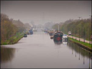
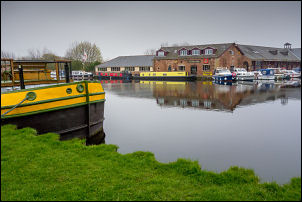
Aire and Calder Navigation Canal
Before the canal there was a large area of reconstruction and it
turned out to be a bypass and associated industrial units about to
be built. I reach the bridge over the canal and headed north along
the main towpath, which was delightful cycling.
Aire and Calder Navigation Canal
Many boats were moored and as I rode a cyclist came the other way
and stopped for a while to have a chat. I reached the large basin
called Stanley Gate Ferry where I pushed the bike over a pedestrian
bridge then onto the road to head east towards Castleford.
Stanley Gate Ferry
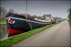
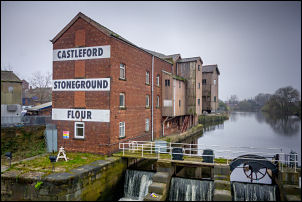
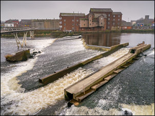
The road was relatively quiet and I continued into the centre of
Castleford town. I stopped by the river and a relatively new
footbridge which gave a good view of the weir and Stone Ground Flour
Mill on the bank. My original plan was to ride along the main road
but I decided to use the footbridge instead. It was quite
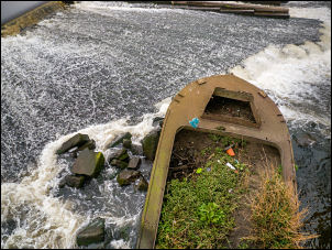
interesting seeing an old barge below the bridge which must have
come over the weir many years ago as the barge was rotting away.
Castleford & footbridge over the River Aire
Allinsons Flour Mill. The flour mill was built in 1898 and
originally called Queen's Mill. Dr Thomas Allinson pioneered the
benefits of eating, especially baking bread with stone ground
wholemeal flour. The mill was acquired in 1921. The River Aire
powered the mill through a large waterwheel until the 1970s. Today
it continues to mill high quality wheat using the traditional method
of French Burr stones to make wholemeal flour.
Allinsons Flour Mill & River Calder
Weir
on River Calder
Stranded barge
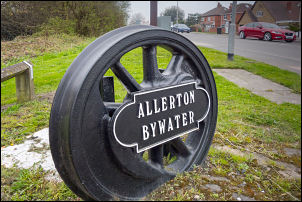
I joined the A656 and headed north for a mile on the very
busy road. I left it at Allerton Bywater and stopped briefly to
photograph an old steam train wheel which has been used to hold the
Allerton Bywater name. I was then on a quiet road to Fairburn
heading east along the lakeside. This was a route I had used
previously and it was nice to be riding on quiet lanes in the flat
countryside.
Fantastic use of a train wheel for a nameplate
It was still overcast and fairly hazy so distant views
were obscured. In Gateforth village I stopped to sit on the bench by
the bus stop and have something to eat. My next objective was Selby
and as I rode into the town I made a diversion to the Tesco
supermarket to buy some water. I continued through the town then
crossed the River Wharf by the Swing Bridge stopping briefly to take
some photos. The bridge was operated manually from 1791 to 1970. It
was then re-constructed and mechanised.
Selby bridge old wheel from 1791
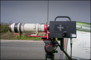
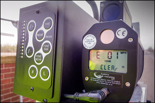
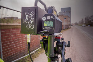
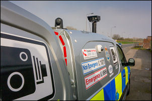
IAs I left the town I noticed a Police Van on the far side of the
road with a static camera on a tripod two police women operating it,
presumably checking for speeding motorists. I stopped and walked
across the road to have a look at the camera was mounted on a tripod
outside the van. They are normally inside the van looking out
through a small window. They were quite friendly and happy to
discuss the equipment which seem to check for speed and automatic
reading of number plates.
Watch
your speed
Watch your speed
Watch
your speed
Watch your speed
I continued
north along the A19 which thankfully had a very good cycle path I
reached the village of Riccall were the cycle path runs through the
village and just as it leaves joins the line of the old Selby to
York railway which is now a cycle track. I joined this track and
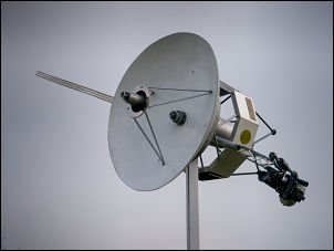
continued north towards York. I haven't been on the cycle path long
when I came to the pole on the right with a 1/3 scale model of
Voyager space probe.
Voyager 1/3 scale
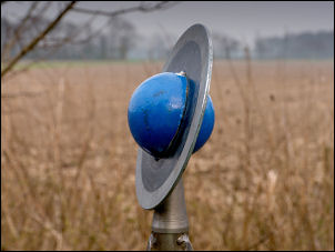
It is the outer structure of a scale model of the Solar System which
has the Sun just on the outskirts of York. A short way on was a
signpost leading up to a ramp which had a scale model of Pluto on
the top and some seating benches around. There were two cyclists
there whose bikes were on stands and partly obstructing the way. We
chatted briefly and I left and continued north towards York. The
next Planet model was Neptune and as I continued along the long
straight cycle track I could see yellow dots away in the distance
and as I approached I could see they were yellow bags of dog muck
strewn along the sides of the track.
Uranus
I had
planned to camp somewhere near here so decided to continue until I
have done at least 50 miles for the day. Fortunately I reached the
model of Uranus at 50.64 miles and shortly afterwards found a wide
grass area to the side of the cycle track. This is where I decided
to camp.