|
It was a very calm night but still
misty and drizzly first thing. I didn't want to pack the tent up in
the rain so I waited till 7:55 before setting off. It was still
quite gloomy as I re-joined the path of stone slabs down Blakely
Clough until I came to a large square stone structure with a mast
and solar panel on it. It looked like a water tank connected to an
underground culvert. A steep, muddy and slippery descent took me
down to Wessenden Brook and a footbridge which took me to a short
path up to a vehicle track. |

The path heads down Blakely Clough |
|
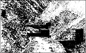
Blakely Clough in Wainwright's book |
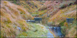
Blakely Clough today |
|

The misty A635 |
I turned right and followed it along
the valley side to Wessenden Lodge which was a large gated property
with outbuildings but no sign of anybody about. There were several
deer in an adjacent enclosure. The track continued up past Wessenden
Reservoir and continued higher to Wessenden Head Reservoir. The
weather continued murky and drizzly so there wasn't much to see. The
track left the reservoir and climbed to Wessenden Head Road where a
flower and teddy bear memorial tied to a fence post on a bend
indicated another tragedy. The road soon joined the main A635
Holmfirth to Manchester road but the mist continued to swirl around
as I carefully crossed to avoid the speeding traffic. |
|
I left the road to
follow a straight path out onto the moor heading for Black Hill. The
visibility became even less and the very wet ground and deep rushes
flanking the path meant that I was soon soaked. |

The streams are very uninviting |
|
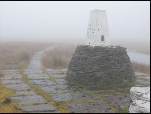
Black Hill trig point in the mist |
The flat stone sets forming the path
are now being reclaimed by the moors as rushes and heather are
engulfing and covering them. It is good that they are there but in a
few more years they won’t be much use if no maintenance is carried
out. The trig column on the summit of Black Hill loomed out of the
mist. It was a strange apparition as it is mounted on a high stone
pillar in the middle of black bog. |
|
Like me he was just
planning to do 4 days of the Pennine Way. I came to a road at Gill
Bridge and followed it up along Gill Lane to a Church just before
the village of Cowling. I was off the official route but was finding
interesting things to see. One was the amazing 1875 Wesleyan Chapel
of four storeys. The map shows the path heading across a footbridge
and up the hill to the A6068. |
Coming off Black Hill |
|
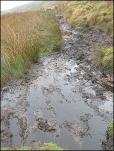
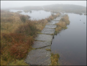
The Pennine Way lives
down to it's reputation |
The path continued on over the top and
started down on wet slippery stone flags. Misty hills started to
appear in the distance but the stone slabs stopped, leaving a
horrible black stinking bog to cross. The path beyond followed along
the top of the edge of the fell before starting down at Laddow Rocks
to descend down to Crowden Brook. The path wasn't all that good and
I was glad to reach the short stretch of field near Crowden and a
tarmac road. I'd had enough of the wet moors for one day. The track
took me down to the very busy A628 but fortunately I only had to
cross it and not walk along it. |
|
A nice path trough
pine trees took me to the Torside Reservoir embankment where I
crossed over to start the climb after reaching Reaps buildings. The
path was steep but steady and took me to Clough Edge where I had a
good view down in to Torside Clough. On a good day the view down in
to the deep valley must be spectacular but today it was mist and
gloom. The path levelled off and was fairly good to follow. I'd
planned to camp up ahead near Wildboar Grain as the map shows a spot
called John Track well and I was hoping for some decent water. When
I reached the area I couldn't find any. The map doesn’t show a
specific location for the well. The main path carried straight on
but the map showns the Pennine Way route crossing the Clough and
heading up Wildboar Grain. I descended, crossed over and set off
upwards for a short way before I found a flat spot and reasonably
clear water nearby. |

Torside Reservoir overflow |