|
|
|
Considering the temperature dropped to
-3degC overnight I had a warm and comfortable night. It stayed
mostly clear and there were nice views of the constellations and
distant lights to the north of Shap. My original plan had been to
stay here for the day but the morning weather forecast gave bad
weather for tomorrow so I decided to wait for sunrise and set off.
Cloud and snow rolled in before daybreak but didn’t last long. I
wasn’t in a rush so it wasn’t until 9:20 before I got going. |
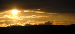
Sunrise. |
|
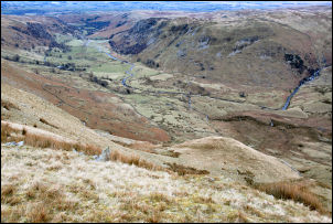
The view down Swindale. |
I took a direct line
up the steep valley side to get to the top of High Blake Dodd. There
was no sun but the views were impressive as I looked back down. The
promontory I’d camped on looked out of place. As I reached the
summit the cold wind began to bite. I’d put my waterproof over
trousers on to keep the wind out and I was glad I did. The gradient
eased but the wind didn’t. Before long I’d reached the summit of
Selside and its summit cairn but I didn’t hang around and continued
along the fence line towards the un-named summit ahead. I find it
strange that some summits are still without name or marker, almost
like an un-named grave that holds someone of note that will
eventually be forgotten. |
|
At Captain Whelter Bog I crossed the
fence and headed across the fell to the stone marker that has the
inscription 1911 Edward Dodds. I’d brought some water and a
scrubbing brush to try and read the other inscriptions but the sub
zero temperature didn’t help the cleaning process and all I got was
frozen slush on the slate. I did my best to interpret the carvings
and moved on. I reached the Haweswater Tunnel survey pillar and
continued up to Branstree. It is interesting to note that the new
post and wire fence that runs from Selside Pike is a replacement of
an earlier post and wire fence that has been uprooted and dumped on
the fell. No attempt being made to remove the dangerous wire from
the environment. Landowners with this disregard for the countryside
have no right to criticise people who walk on the fell. |
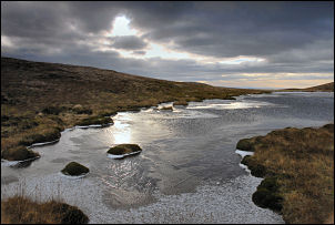
Small Tarn near Branstree. |
|
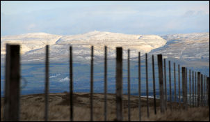
Great Dunn Fell in the distance.
The Radar Station can just be seen on the summit. |
I descended to
Gatescarth Pass and was glad of the frozen ground as I crossed the
bog to the main path. There were some walkers about as I started the
path up towards Harter Fell but I’d already decided that I’d try and
find a pitch below the summit as water would soon be a problem and I
didn’t want to walk as far as the other side of Nan Bield Pass.
About half way up I crossed the fence and found a flat spot with
some shelter and pitched the tent. It was quite a walk to get water
but the views made up for it. The down side was that I was in
earshot of the main path and many walkers are unable to trek the
fells without shouting and screaming.
|
|
|