|
Day01 Thu 25th July 2024 |
Day02 Fri 26th July 2024 |
Lat/Long: 53.594512, -02.490951
OS
Grid ref: SD 67510 11020
|
|
|
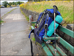
Packed backpacking gear to try and get weight down as far as
possible. Decided to use Akto tent as much lighter than Soulo &
my route will be relatively low level & no strong winds
forecast. Also using my lighter small down bag and not much
heavier hollofil bag. Managed to get pack down to 15kg. Walked
to bus stop and caught 09:40 125 Bolton bus via Chorley to
Walker Fold Lane end bus stop arriving at
10:25am. The
weather was mild & overcast so good for walking. |
Walker Fold Road bus stop. |
|
There was soon a sign saying |
Smithills Estate |
Over the summit. |
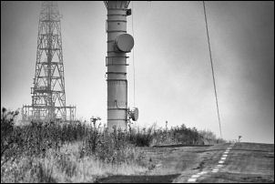
Base of the mast. |

Road closed. |
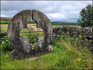
Scotchman’s Stump or Post. On it is a small plaque that
states: “In memory of George Henderson, Traveller, native of
Annan Dumfriesshire who was barbarously murdered on Rivington
Moor at noonday November 9th 1838, in the 20th year of his age.” |
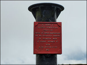
Scotchman's Post (sic) |
|
I walked along Walker Fold Road as far as the Smithills Car
Park. The refreshments cabin was open & I fancied a cup of tea.
I scanned the price list but couldn't see any tea, just various
types of coffee & nothing less than Ł3.50. I didn't stop but
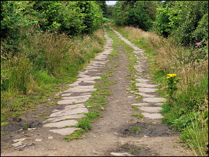
pressed on to the old stone flag track that serviced the coal
mines, brick & tile works. I continued up to the large Brick &
Tyle site by the access road to the Winter Hill masts where I
stopped for lunch. I continued along the road to the Winter Hill
mast buildings only to find the gated closed & locked. Some
vehicles were there & men apparently doing maintenance work. The
annoying thing was that there’s a diversion sign at either end.
I walked round by the boggy moor to find the minor path down to
Rivington Road. There is another descent path from the trig
point but it is horribly wet lower down. I took the lower path
down towards the reservoir. At the road I turned left to head up
the road to Hordern Stoops. |
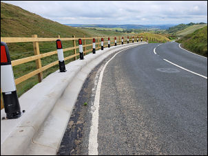
New safety barrier. |
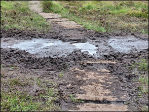
Path sinking in the mud. |

Winter Hill masts. |
|
|
|
On the bad bend I noticed a new concrete safety barrier had been
built. At the summit I joined the Spitlers Edge path towards
Great Hill. I took a photo of the source of the River Yarrow
marker post but the website shown doesn't work. Most of the
continuing path was easy walking due to the stone slabs.
Unfortunately in a couple of places the slabs had sunk into the
mire & muddy diversions were needed. |
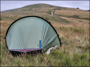
Camp below Great Hill. |
I reached the shelter stones as
Great Hill & was able to have a welcome sit down. My objective
is Drinkwater's ruins and shortly after setting off again were
visible in the distance. At the ruins I turned right to climb up
the higher area behind where I found a good pitch site by a
stone slab with a good view of the 4,500year old Round Loaf
burial mound. After pitching the tent I took my water bottles
down to the spring only to find someone had thrown several
stones in to fill it up. I pulled the stones out but had to wait
for the water to clear before I could obtain water. Back in the
tent it wasn't long before the rair arrived. |
|
|
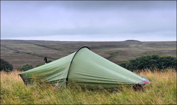
Camp with Round Loaf on the horizon. |
|
|
|
|
|