|
Yesterday's evenings clear sky was gone and there was mist
overnight and a bit of drizzle as I packed the tent away. There
was a chill in the air as I set off so I wore my windproof
jacket. I follow the main Rossendale Way track heading south and
down towards the main Rochdale Road. it was nice to see a
boundary marker post with an ordnance Survey bolt benchmark on
the top. |
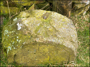
Bench Mark & bolt. |
|
I reached the main A680 Rochdale Road and thankfully there was a
footpath as it was extremely busy with lots of heavy lorries. I
was on it for less than a mile until I took a left branch down
the minor Bleakholt Road. Left at the bottom I crossed the road
to follow a fenced off path down along the fieldside. I crossed
the motorway by a minor bridge and down along tracks to emerge
at the A676 road and a bridge over the River Irwell. |
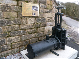
Site of Croft End Mill. |
This was the site of Croft End Mill. I was now on the main
road through Ramsbottom and turned left to head into the town. I
came to a garage where there was a shop and I called in to buy
some iced cakes to get my sugar level up. |
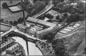
Croft End Mill |
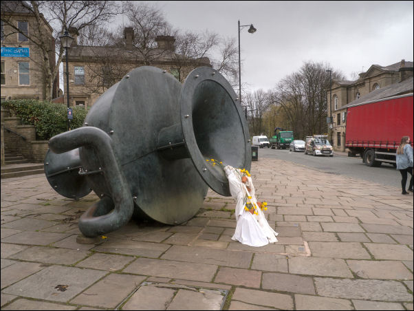
Tilted Vase. |
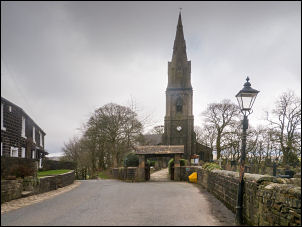
I continued into the town and the main crossroads to the Tilted
Vase Bronze vessel by Edward Allington (1951–2017) which was
erected in 1998. It was a pleasant morning and I enjoyed a few
minutes sitting down for a rest. I set off up the minor road
heading towards my next main objective of Peel Tower.
|
|
It was a steady climb at first and at a sharp left-hand bend the
road is incredibly steep and a handrail is provided on the
right-hand side for pedestrians. I reached the summit by the
Emmanuel Church and followed the flat road for a while before
turning up a minor track to the right and the access road to
Peel Tower. |
Emmanuel Church. |
|
It is interesting that up here is the isolated Moor Farm near
the tower which appears to be occupied. There were now plenty of
people around and many mountain bikers at the Tower. I didn't
stop long but carried on heading roughly north across the moor
towards Harcles Hill. Before the hill there is a left branch
which I took to head for the deep valley of Redbrook. |

Holcombe. |
|
|

Peel Tower. |
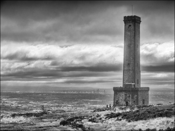
Peel Tower with Manchester in the background. |
|
It was a good path but had occasional stretches of bog. As the
path reached the rim of the valley it headed off away from the
route I needed so I picked a careful steep descent down to the
lower path. Once on it the walk down to Redbrook was easier.
Then up the other side where there had been some erosion and the
steps were in a bad way. The track continued along the hillside
and at Larkhill became a more substantial track which I followed
on to the small car park at Crowthorne Delph. |
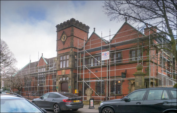
Crowthorn School. |
|
From here I had a good view of the landscape to the west and I
could see Winter Hill and even the hill I was heading for at
tonight's camp. I followed the road down to Crowthorne School
which is now converted to another use then turned left on
Broadhead Road for about a mile and into Edgeworth. There are
some shops at the crossroads but they all had limits as to how
many people could be in at one time. I couldn't see much to buy
in the way of food and a wall next to the shop had a sign saying
‘do not sit on wall’. the place seemed rather unfriendly so I
crossed over and headed down the hill towards Turton Bottoms. |
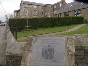
Barlow Memorial Institute. |
The Barlow Memorial Institute in Edgworth opened 30th
Oct 1909 to the memory of James and Alice Barlow. |

Holcombe. |
|
IOver the bridge I climbed up to the B6391 and then to the
access road to Turton Tower. There were plenty of people around
and the car park was nearly full. I had a look in at the side of
the tower, peering in through the gates and it seemed open. I
returned to the track and headed west up and over the railway.
There is an impressive Bridge here with a Turret Tower and steps
up giving a high-level view of the railtrack. A lot of bank
stabilisation work had been done and it looks like it had only
just been finished. I followed the farm access track north which
is also the Witton Weavers way. |
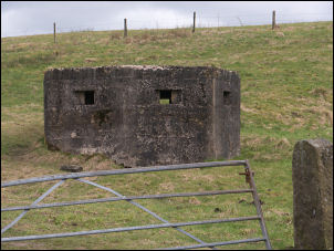
Pillbox by the road. |
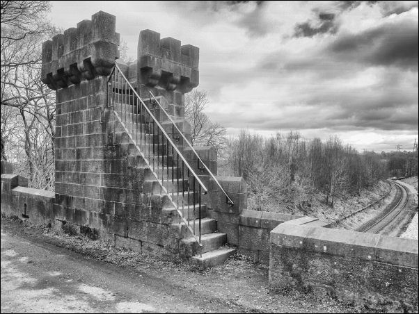
Railway Bridge viewing platform. |
|
I turned left through a wooden gate and into a very wet field
where the path heads up the hillside. Higher up I reached a
minor farm track and a large barn. When I was last here I got
water from a pipe spring at the rear of the barn. I was very
relieved to see that it was still there and I filled my two
water containers with clear water. I still had a way to go to my
camp and with over 4 kg of water on my pack it's made it heavy
going. Fortunately the path was excellent and easy going under
foot. At the south end of Cheetham Close I went through the gate
and turned right to head steadily up on a good path until I saw
the Trig Post up ahead. |
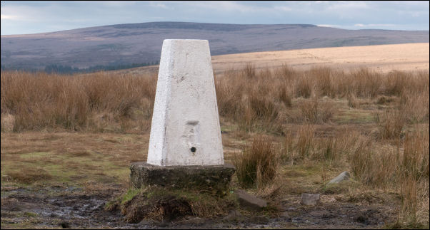
Trig Post. |
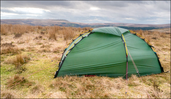
Camp no3 with Winter Hill in the background. |
I stopped briefly then continued to my planned camping area. The
map shows a stone circle but I could only see the occasional
stone and nothing seemed to be of significance. I found a good
spot to put the tent up and walked to a nearby wall to find a
couple of fallen flat stones to bring back for my stove to sit
on. I pitched my tent with a good view of Winter Hill out of the
door. It was a little windy so I put all the pigs in for my
Hilleberg soulo tent. Yesterday I’d emptied my main 230g butane
camping gas cylinder. Now I used my smaller cylinder that I'd
decanted pure propane into and used that. it worked extremely
well in the colder morning conditions.
|
|
|