A calm night with little wind and some views around sunrise.
I packed my tent up and was on my way around 08:30 a.m.. I
descended back to the stream, crossed over and continued on the
Rochdale Way route. However, I wasn't on it long as I needed to
climb to the summit of Great Hill and the wind turbines. |
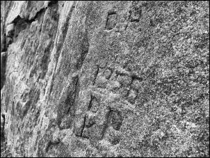
Graffitti on the rock. |
|
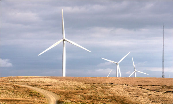
The map doesn't show any paths but the whole moor is now covered
in wind turbines. as I climbed to the northwest a track appeared
which I followed up to the network of access roads. The wind
farms are huge structures and extremely impressive as I walked
along to the west. There was little to see as I continued along
for several miles until I reached the area of Rough Hill. |
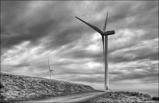
Wind Turbines. |
|
The Wind Farm Road started its descent but I left it at an area
of disused quarries and headed south. There was a very steep
descent of Middle Hill until I reached a junction of wet muddy
paths at the bottom. Ahead of me was Brown Wardle Hill and I had
two choices, right or left. I took the left track which is the
Rochdale Way which was rather rutted and muddy in places. The
descent was fairly steady and I eventually reached the track
above Whitworth where the golf course is. I was now on the
adopted road and descended steeply down passing St Bartholomew's
Church and into Whitworth. |
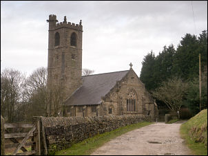
St Bartholomews. |
|
I called in the Post Office to ask if they made sandwiches. the
man said no as there was already a sandwich shop close by. I
asked directions and was told just around the corner. Obviously
to a stranger that is completely meaningless. Along the main
road I asked a lady where a sandwich shop was. She pointed to a
small cafe called Saints and Sinners with a table and chairs
outside on the pavement. |
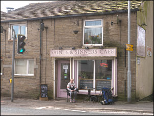
Saints & Sinners Cafe. |
Butty for lunch in Whitworth. |
|
Inside a very cheery young lady said she could make any sandwich
I wanted so I ordered a ham cheese salad sandwich. I paid £3.45
and when it was ready she brought it outside to the table. I sat
eating my sandwich lunch as the traffic whizzed by. I followed
the road down into the valley crossing the line of the old
abandoned railway. I then climbed a very steep network of roads
through Hallfold until I emerged onto a muddy track at Fold
Head. The track headed southwest passing a group of houses where
I left to follow a path northwest above Spring Mill Reservoir.
The path was well made and descended down to cross Prickshaw
Brook at a wooden footbridge. Adjacent to the bridge was a
concrete vehicle bridge which seemed rather odd as there was no
track to reach it. A steep diagonal climb took me up on the
continuing Rossendale Way where I walked above the valley edge
until I reached a wall and the track then vanished to nothing. |
I headed off across featureless moor to reach a track at
Bagden Hillocks where I turned left to reach the main Pennine
Bridleway. This is the Rooley Moor Road and runs right over the
moors between Rochdale and Rawtenstall. It was the road to
service the many quarries that used to work in the area. I
continued north and then turned left along a minor track which
serviced Ding Quarry. |
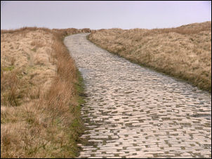
Rooley Moor Road also known as
the
Cotton Famine Road. |
|
I reached the quarries and have a very complex route to follow
to get through as there was an intricate network of tracks and
many blocked by floods. On the hills around where more wind
farms and I eventually emerged on the west side of the quarries
to join the wind farm access road. My planned camp was about 1
mile ahead and the weather was deteriorating and cloud was now
covering the hills. I stayed with the access road and hoped I'd
find water. I crossed a valley where there was a reasonable
supply of water passing under the road and I found a level area
above where I could pitch my tent. However I checked my phone to
find the data signal was extremely weak. |

Crossing the old quarry. |
|
I decided to press on until I came to the main Rossendale Way at
it's summit above Grain Brook. This is the old Coal Road and
just above it I found a flat area which made a good pitch for
the tent. The phone signal was slightly better and I had good
views to the south and east. I decided to camp here so left my
sack and returned to the embankment over the valley to collect
water and then pitched my tent. Away in the distance I had an
impressive view of Manchester and it's tall buildings. However
the afternoon sunlight soon faded as cloud rolled in and stayed
through the night. |
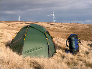
Camp no 2. |
View from my tent. |
|
|
|