|
There was some rain overnight but none in the morning.
Thankfully the tent wasn't too wet as I packed the camp away.
Some clear areas were in the sky as I set off to continue north
through the Meldon Hills. The climb is relatively easy and the
sun broke through for a while to illuminate the surrounding
hills. After the long descent to Eddleston I turned left up the
access drive to Barony Castle Hotel. |
Preston Railway Station |
|
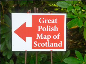
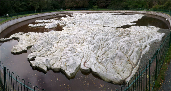
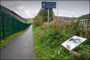
The climb was steep but not too long. I followed the signs to
the 'Polish Map of Scotland' that took me round to the rear. I
left my bike and walked across the footbridge the 50m wide
structure which is the largest relief map in the world. It was
commissioned by Jan Tomasik in 1975. He served in the Polish
Army in WW2 and stationed in Scotland. The weather was
deteriorating as I walked round the map to get various views of
Scotland. |
The Great Polish Map of Scotland.
Mapa
Scotland. |
It was the dream of a former Polish soldier who helped
defend Scotland from the threat of Nazi invasion during the
Second World War – to create a fabulous sculpture of his new
homeland. Now, the Great Polish Map of Scotland – the world’s
largest 3D terrain relief model of a nation, which had lain
abandoned, damaged and overgrown, has been restored to its
former glory.
The map was the brainchild of Krakow-born Jan
Tomasik (pron. Tomaashik), a sergeant in the 1st (Polish)
Armoured Division, who had been stationed in Galashiels and had
married a Scottish nurse in 1942 after being treated in the
town’s Peel Hospital for the effects of a wound.
|
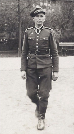
Jan Tomasik |

Polish Tank Crew in training |
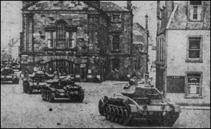
Polish tanks in Haddington 1943 |
“The Great Polish Map of Scotland” was built over six
summers between 1974 and 1979. It was mainly the work of a small
group of Poles from the Jagiellonian University of Krakow,
Poland, led by the map’s main designer, Dr. Kazimierz Trafas.
They were assisted by staff from the Hotel Black Barony (Barony
Castle) and Polish exchange students visiting Britain. |
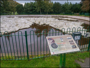
Map and information board |
|
The rain increased as I left and by the time I'd reached the
busy A703 it was very heavy and I had to put my rain cape on.
The road was uncomfortable riding due to lots of traffic and no
cycle track. Just over a mile outside Peebles I left the main
road to turn right down a minor lane that took me into Peebles
and on to the Tesco supermarket. |

Rainy road to Peebles |
|
The rain was heavy again as I went inside to buy some jam
doughnuts. I'd parked my bike by the bike stands and there was
already a bike there. When I came out I started to eat a
doughnut when the lady who owned the bike came out with her
shopping. She had small Karrimore panniers to carry it. We
started chatting and she turned out to be a keen cyclist with
lots of experience. |
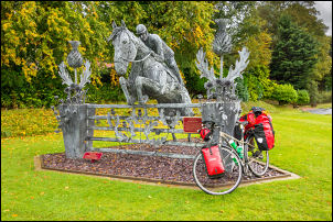
Sculpture leaving Peebles |
|
She had even ridden across New Zealand. She said she used to
write for a local newspaper under the name of Peebles Peddler I
think. The rain eased and I set off again to join the Tweed
Valley cycleway where it enters the old railway tunnel under the
road. I rode down into the valley and made easy progress in the
dry. At the old station at Cardrona there had been a diversion
as new houses had been built on the route of the old railway. I
stopped to eat the last of my doughnuts then continued to the
next bridge. |
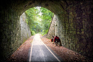
Cycle track along the old railway |
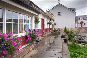
Cafe at the old Railway Station |

Cafe entrance |
|
On the far side I stopped to read an information board about the
old railway bridge that used to be on the site. A runner
approached with his dog and stopped to chat. It turned out he
was also a cyclist. I mentioned the lady cyclist I’d spoken to
earlier and he knew of her. I think he said she was called
Fiona. I also mentioned Colin the furniture maker cyclist at
Stobo and he knew him as well. I continued into Innerleithen
then north through the golf course. The weather darkened as I
continued up the long climb. |
Innerleithen by the old Railway
Station |
|
It isn't very steep, just long. The heavy rain started again so
I had to put my cape on. I stopped at the summit to photograph
the Piper's Grave where I was able to take my waterproof off and
start the long descent. It was now dry and the roads looked like
there hadn't been any rain. At the end of the long descent I
reached the bridge and turned right to continue on the B709
towards Heriot. |

Leaving Innerleithen by the Golf
Course |
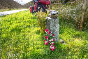
Piper's Grave |

Nearing Heriot |
|
I continued down the lovely valley by Heriot Water until
reaching the houses and playing field where I'd camped last
month. I knocked on the door of the Old Police Station but there
was no answer. I used their water tap on the outside wall to
fill my large water bottles then wheeled my bike to the bottom
of Shoestanes Road and the play area. I pitched my tent under
the trees at the same location as last time. |
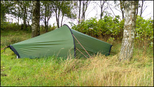
Camp in Heriot |
|
|