Thanks Winslow for a comfortable night on the Sanctuary grass. I was
packed up and away by 7 a.m. and continued along the excellent cycle
track to the next road. I crossed over and continued on cycle route
51 until it degenerated into a rough farm track that headed off
through the fields with several gates and very dodgy gate catches.
However it was much better than the roads which were extremely busy
with commuter traffic travelling way too fast. To my left I could
see the route of an old railway and the track eventually crossed
over it at a bridge.
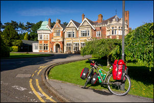
Arriving at Bletchley Park Mansion
I stopped to have a look at the old track bed which now a very
rutted farm track. Just as I stopped a cyclist approached from the
other direction and we had a brief chat, he was on his way to work.
We both agreed that the old cycle at the old railway would make an
excellent cycle track into Milton Keynes. The rough track continued
until I met the main road which thankfully had a decent cycle track
adjacent. I continued towards Milton Keynes and the Sherwood Drive
to Bletchley Park which was one of my main objectives. It wasn’t yet
open to the public as I was too early but I spoke to the security
guard who let me cycle up the access road and between the huts up to
the main Bletchley Park Mansion. It looks absolutely fantastic in
the morning sunshine.
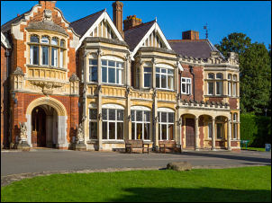
Bletchley now
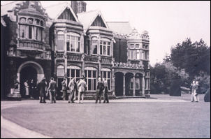
Bletchley 1938
As I left one of the cleaners seems rather annoyed that I was on
site before 9:30 when the public would be admitted. I said my
goodbye to the security guard telling him I plan to return for a
proper paid visit. The cycle route continued towards Milton Keynes
and through the middle of the Brunel shopping centre where I escaped
onto the streets before following the road out. The cycle tracks by
the very busy main roads were really good and I reached Caldecotte
Lake check where I stopped at a bench with delightful grassy
surroundings giving no indication of the proximity of Milton Keynes.
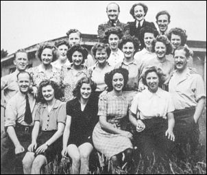
Bletchley Park workers
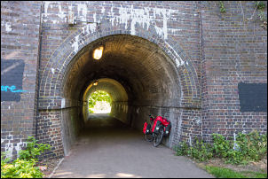
I returned to the cycle track by the main road and further up
followed an underpass to head north. I left the busy road to follow
a B road through Woburn Sands and came to a shop where I stopped for
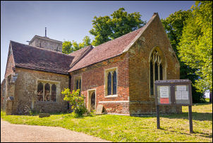
a while to buy some cheese sandwiches. I carried on in the morning
sunshine to the village of Woburn where I turn left and saw a very
nice church which I photographed before continuing along an
incredibly straight road heading up the hill.
Milton Keynes
Railway
underpass Milton Keynes
Woburn
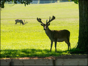
At the start of the climb a road to the right was signposted to
Woburn Abbey. I wasn’t planning to visit but I rode down just to
have a look. The grounds were opene but at the gates the woman told
me if I wanted to go in for a ride I would have to pay. There were a
few deer around and I took a picture or two before returning to the
road and starting the long steep climb. The the narrow country lanes
continued for a while until I reached a roundabout and joined the
very busy road. At the next roundabout I turn left to join a cycle
track that is shown on the map. I couldn’t find it so reluctantly
returned to the very busy road where there was no cycle lane.
Further along I came to a sign pointing towards my next objective
and taking me on a cycle track across Fields. This is not shown on
the map. It emerged onto the road but fortunately there was now a
cycle track that I could follow all the way into Shefford town.
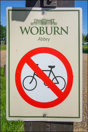
No cyclists in Woburn
The road out of the town was the B658 which I followed north and
even though it is a B road is very busy with traffic and large
lorries. I reached a roundabout and turn right towards Biggleswade
but still I had very heavy traffic. In Biggleswade I called at the
supermarket to buy some water and then decide what to do. My
original plan was to camp in the area but I hadn’t done enough miles
and it was still early afternoon.
All Saints Croydon
I rode through the town and headed out on the B1040 towards Potton.
It was still busy with lots of traffic but on the entry to Potton I
noticed a footpath off to the left which had an area near the road
where a tent could be erected. It was still too early so I continued
through the village and on into Gamlingay. My water bottles were now
empty so I stopped at a garage and the man pointed into a tap on a
wall across the yard. With my bike water bottles topped up I
continued through the village and then heading east towards Hatley
St George.
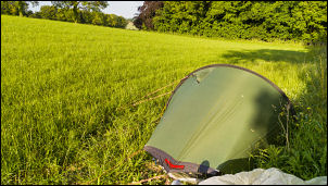
Camp near Croydon
It was now mid-afternoon and felt quite hot in the sun. I came
to a sign pointing across the fields showing a bridleway with a
distance marker to Ermine Street. It didn’t look good for the bike
so I continued on the road to descend and then turn left into the
small village of Croydon. I followed the minor road to the war
memorial cross where I turn left up a short steep hill past All
Saints Church. Behind the church was an open field which I thought
would make a good camping spot. I checked the church to have a look
inside but it was locked. There were vehicles going up and down the
road so I reasoned I needed to be out of sight so crossed the field
to the far side and into a slight dip where my tent could not be
seen from the road. I camped in the shade of a large tree as the sun
was still hot.