|
Overnight the rain stopped and the
wind dropped. However, they were both replaced with thick mist. I
packed and continued north. I hadn’t gone far before I’d dropped
below the cloud and could see the landscape below. The moorland road
continued for several miles until I reached a tall wayside stone
cross. The descent started and for quite a while I could free wheel
for ages and take in the surrounding scenery. |
|
|
I descended into civilisation in Casterton but
soon reached a steep left turn and a climb back to the deserted
moors. Over the top I started my descent again and reached Liverton
Mines where I didn’t see any evidence of mines. At the A174 I turned
left and continued to a steep descent then steep climb into Carlin
How. I could see the blue North Sea through sunshine as I descended
to Saltburn-by-the-Sea. I reached sea level with a steep climb
ahead. An information board was by the wall so I stopped for a look.
The illustration showed a steeply inclined lift from the top road
down to the start of the pier. I decided to have a look. Everything
was closed but the lift seemed to operate at weekends. The pier
buildings were closed and looked as they were unlikely to ever open
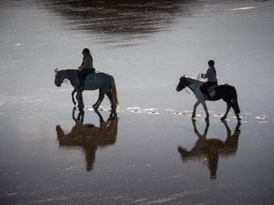
again. The pier itself was open so I wheeled my bike to the end and
enjoyed the sea views. Several horse riders cantered under the pier
and across to the waterline. |
|
|
|
|
I returned to terra firma and
continued. A steep track took me up to the road level where I
followed a continuing cycle track. In front of me was a older
cyclist on a road bike. I followed him for a while then when we
reached the cycle lanes near Redcar cycled alongside for a chat. In
the town he turned off left while I continued to Morrisons to buy
some water. It was past midday and I was feeling hungry. I fancied
some chips but there wasn’t a chippy to be seen. The main road
towards Middlesborough wasn’t enjoyable but at least there was a
cycle track. Unfortunately the route went into a housing estate and
vanished. |
|
|
|
Here is
where the cycle track vanished |
|
|
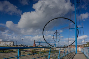
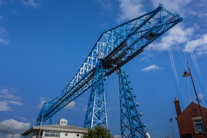
I asked some boys the way to the
transporter bridge but they didn’t know. Finding my way was
difficult as there were no signs to say where the roads went. I
reached the football stadium where I’d been 2 years ago when I was
here and followed my previous route. At the transporter bridge I
found it was closed as expected. |
|
|
|
Approaching the Transporter bridge |
|
|
|
|
|
|
Vulcan
Street Wall 1887, Middlesborough.
All that remains of the
Vulcan Street Saltworks |
|
|
It was supposed to be open but the man
said it would be at least another 2 months. I followed the cycle
track along the river to the next bridge. |
|
|
|
|
Industry
on the north side of the Tees |
|
|
|
|
Industry
on the north side of the Tees |
|
|
That was also closed and the cycle track to it was
closed as well, with no sign to say what to do. I asked a man on the
track how to get on the bridge and he told me of the flights of
steps. I had to take my paniers off to get up. At least I’d got
access and crossed the River Tees. On the far side I was back on
main roads but kept to the cycle paths. It was Friday afternoon and
everyone seemed to be heading home. When the cycle tracks ended I
had to ride back on the road. I was very thankful to reach the turn
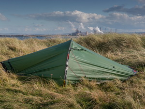
off to the car par for the Tees Bay North Gare Breakwater. After the
car park I cycled along a soft sandy track to the breakwater. I
returned to find a grassy area between the track and golf course.
There was a nice flat spot to pitch my tent. |
|
|
|
Camp on
North Gare Breakwater |
|
|
|
|
|
|
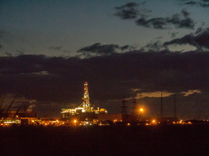
Evening
view from the tent |
|
|
|