|
Heading for a cycle ride from Leeds to
Hartlepool onthe east coast. To get to the start I left home at
05:50am to cycle to Blackburn to catch the 06:55 train to Leeds. It
was a dark but uneventful ride and I arrived in good time.
Unfortunately the ticket office was closed but should have been
open. It eventually opened when a queue had formed. I got my £10:50
single ticket just as the train arrived in the station. The bike
carriage didn’t give much guidance. There was one of those ludicrous
bike cupboards and another cyclist put his bike there but it was far
too small for mine with panniers attached. |
|
|
|
Blackburn Railway Station |
|
|
I removed my panniers and tied my bike
to the carriage side. Later I found a 3 tip up seat alcove in the
next carriage so moved my bike there. At Halifax the train was
getting very full and by the time we reached Leeds it was packed. I
got my bike off and wheeled it across the station to search out the
lift up to the walkway then down to the exit area. Outside the
station the weather was fine and I started by part wheeling and part
riding my bike into Leeds. |
|
|
|
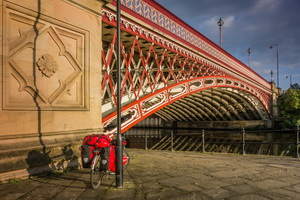
The
Bridge at Crown Point |
|
|
I headed across town to the pedestrian
walkway over the River Aire then the riverside track to the Royal
Armouries Museum. For the first part of my ride I would be on the
Trans Pennine Cycle route by the river and assumed the signs would
make route finding easy. I was wrong as the sign by the museum
didn’t match my map. I followed my map and rode along the river. The
track surface was a mixture of compacted gravel with occasional
muddy patches. I had to cross over the river near some Industrial
Units and the sign pointed me into the Industrial area. A man there
pointed me in the right direction. |
|
|
|
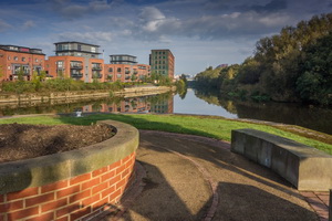
This is
where the River Aire splits
into the Aire and Calder Navigation |
|
|
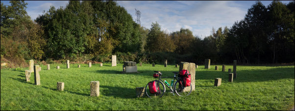
An interesting circle near Thwaite Mills |
|
The river here is split into river and
canal and the cycle track ran along the middle. It was enjoyable
riding with varied views through an avenue of trees. When I had to
cross the water again the sign pointed me up a ludicrously steep
muddy track to the bridge. Once over there no way down to the path
other than two flights of concrete steps. A cyclist arrived and
confirmed this was the only way down. He kindly stopped and helped
me down with my bike. I was now out into a rural landscape and nice
views. |
|
|
|
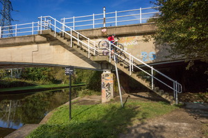
The
stairway is the official cycle track. |
|
|
Eventually I left the river at
Mickletown and rode through quiet streets. At the main ‘A’ road I
managed to ride on the footpath to Castleford where I turned north
on the A696 to Allerton Bywater. I turned right along a very rough
road with deep potholes heading towards Fairburn. For a while it was
nice riding along but the skies turned dark and the rain started. I
had to stop and put on full waterproofs. I continued to Selby where
I stopped at the Tesco store to buy 2*2lt of water. I chatted to one
of the car park attendants about bike lights and bike security. The
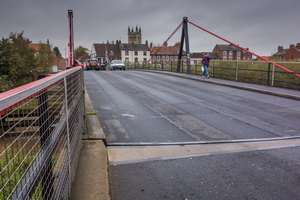
rain had stopped so I removed my waterproofs and headed north over
the swing bridge. |
|
|
|
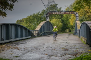
Control
Room at Selby Swing Bridge |
|
|
Leaving the town I used a footpath for
a while and was passed by another touring cyclist riding in the
road. He had panniers similar to mine but much more battered and
used. He looked a serious tourer with long hair and long beard. I’d
already put my waterproofs on as the rain had started again. Further
up the road I passed him as he’d stopped in a bus shelter to put his
proofs on. |
|
|
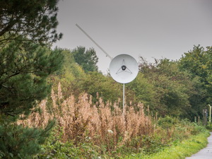
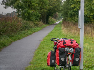
Eventually I left the main road to
head out along the cycle track along the line of the old railway
between Selby and York. It was lovely flat tarmac and an added bonus
was Pluto. |
|
|
|
|
|
|
Selby to
York cycle track |
|
|
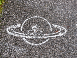
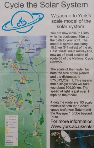
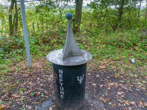
An information board showed a map of
the track and points were the planets of the Solar System had scale
models on plinths at their respective correct distances. Near Pluto
was a model of the Voyager space probe. I rode along the track that
seemed relatively new but was concerned that it would suffer future
problems with roots growing under it and lifting the tarmac. This
was already happening in places. |
|
|
|
|
|
|
|
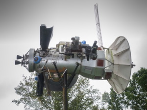
Cassini-Huygens Space Probe
1/3 scale model |
|
|
|
|
Just
after leaving the ferry |
|
|
The cycle path
between Hornsea & Hull has already been ruined by this. Passing the
planets of the Solar System was an added bonus. I reached my planned
camp much sooner than expected. I decided to continue to see what
lay ahead. A sort of cafe was located by the track with tables,
chairs and a tent but nobody was using it. This was where Saturn was
plus a model of the Huygens probe. The track crossed the bridge over
the River Ouse but I didn’t want to go any further so looked for a
suitable place to camp. All areas of open grass were filled with
piles of dog excrement so I rode back the way I’d come to a more
isolated location where I was able to leave the track and camp at
the edge of a field. |
|
|
. |