|
The rain was very heavy during the
night but had eased considerably by morning. I’d packed a very soggy
tent away and was on my way by 07:20am. The cycle track continued
for a couple more miles into Innerleithen where I had to join the
busy A72 which was packed with morning commuter traffic. |
|
|
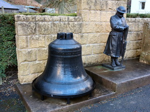
At Walkerburn I stopped to photograph
a large bell with a half size soldier statue next to it. A bronze
plaque was adjacent but the writing was so tiny as to be illegible.
A short way on was the full war memorial. Next to the bridge was a
‘Gents’ sign on a wall and old cast iron gents urinal. It was in a
disgusting condition and inside someone had defecated all over the
floor. |
|
|
|
The old
Mill Bell and half size Soldier |
|
|
I continued east, not enjoying the
ride one bit. I got to the Clovenfords left turn and thankfully the
traffic eased a bit. At Clovenfords I headed north on the B710.
There was a long climb at first but over the summit I had great
views ahead even though the cloud was quite low. A long descent took
me to Bowland and an interesting gatehouse. I saw a lot of
construction work going on by the bridge and assumed the bridge was
being repaired. It wasn’t, so I assumed the adjacent A7 was being
improved. I joined the A7 here and headed north towards Stow, my
next objective. As I rode I looked across the valley to the left to
see an amazing amount of work going on along the old railway line.
It looked like a new railway was being built. Arriving in Stow I
stopped to look at the old packhorse bridge then rode to the Post
Office to ask about the railway. The lady told me they were totally
refurbishing the railway at a huge cost. |
|
|
|
1655
Bridge to Heaven at Stow |
|
|
I was amazed as apparently it wouldn’t
provide a link between other parts of the network. Heading out of
Stow I had a very steep climb where I had to push the bike for quite
a while. |
|
|
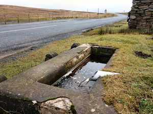
After the steepest bit I was able to
ride for a while and reach a nice summit area with a stone cairn
with the inscription 1911 - 2011 but no mention what that signified.
Adjacent was a spring and trough. |
|
|
The ride over the summit area was
remote but interesting. My concern was the strengthening wind that
was a cross wind but would be a head wind from Lauder. I descended
into Lauder and was disappointed not to find anything of interest. I
headed SE along the A68. I soon turned off to the right to take an
almost deserted road that headed to the same destination of Earlston.
The road undulated quite a lot then descended to an ancient bridge
into the town. I headed east on the A6105 for a few miles then took
a right fork to Mellerstain House. The road bypasses the house so I
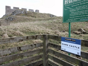
didn’t see anything of it. Through some very quiet lanes I reached
Hume Castle, a much more interesting objective than the closed
Mellerstaine House. |
|
|
|
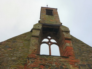
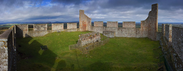
Hume
Castle c12th century |
|
|
|
|
I could see the
castle from a distance of several miles. There was a small car park
where I left my bike then a short walk up a grassy path to the
hilltop castle ruin. It looked remarkably intact on the outside as
if it had been rebuilt. I left the ruin to start at a 6 mile battle
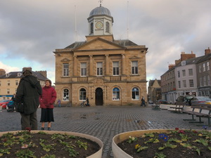
into a headwind into Kelso. I bought some water at the Co-op then
descended into the town. At first there wasn’t much to see. The worn
and shiny cobblestones were a concern because of the gaps between
many. |
|
|
|
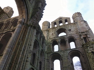
Cobbled
Kelso, not so cycle friendly |
|
|
|
They were unsafe to
cycle over. The ruined Abbey was quite impressive. I crossed the old
bridge to the south then rode round the park area to return over the
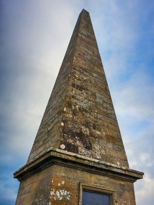
new bridge. I left the town to the NE to the Thomson’s Monument
where I managed to pitch my tent before heavy rain hit. |
|
|
|