|
Overnight was mostly heavy rain but by
morning it had eased. I wanted to get away without delay so had to
pack the tent in the dark. I was surprised how many vehicles were
using the road as I packed up. I set off just after 7am and soon
realised why the road was so busy. To the south is the B797 which is
the only other access to the M74 road from the Sanquhar area. |
|
|
|
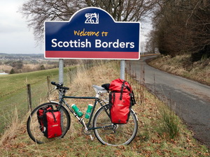
Reaching
the Scottish Borders |
|
|
That road has a high pass whereas this
doesn’t. As daylight arrived I was able to see the more gentle
ascent and lower summits. I reached Crawfordjohn and turned right
away from the main road. It was a minor road with a very poor
surface in places. There were some ups and downs but generally an
enjoyable ride though the mountains. Approaching the B7078 I could
see signs of the old road and bridge and the B7078 was the main
England Scotland road before the M74 arrived. I turned right and was
glad to use a partly overgrown cycle track. I reached the roundabout
by the M74, crossed over then passed the Abington services to the
A73. |
|
|
|
Over
Biggar Water at Broughton |
|
|
At the next roundabout I turned right
on to the busy A702 which partly follows the line of the main
Edinburgh rail track. I was glad to reach Coulter where I turned
right on to a minor road. Passing the school I turned left to the
church where an impressive war memorial was sited in an alcove by
the wall. I stopped to take some photos then started a series of
climbs. I had good views across to Biggar then passed Goseland Hill
to the south before descending to Broughton. |
|
|
|
|
|
I followed a minor road which is
signposted as a cycle way and justifiably so. It was narrow, quiet
and mostly good to ride on. One steep section took me to a good
vantage point before descending down towards Stobo. Last month I was
passing here in the rain and stopped at the bus shelter for
something to eat. Today is better weather so I pressed on to the
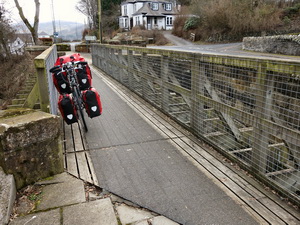
A72. I soon left it and descended to cross the River Tweed at the
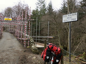
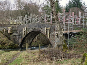
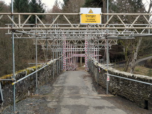
1883 Manor Bridge. The left turn I wanted to take had a closed sign
but I cycled to the bridge anyway. It was the Old Manor Bridge dated
1702. |
|
It was covered in scaffolding and
temporary repairs. Fortunately I was able to get my bike across. A
steep climb to Manor Swere followed where I had to push my bike up
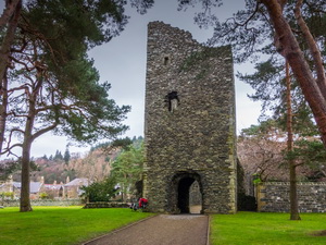
the very steep hill. Great views of Peebles were at the top then a
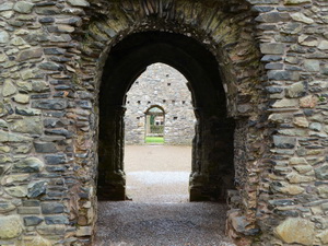
steep descent into Peebles. I headed back to the old ruined Kirk
which I visited last month but pouring rain meant I couldn’t take
any pictures. |
|
|
This time was better as the rain held
off and I was able to wander round. Nobody else was visiting. I rode
to the nearby Supermarket to buy some water. |
|
|
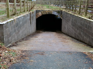
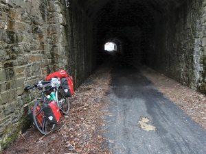
Then I continued along the
Innerleithen road for a short way before following the start of a
cycle track that ran under the road on the line of the old railway.
It was nice to ride along it in the dry, though the sky was still
overcast. |
|
|
|
Start of
the cycle way along the old railway |
|
|
|
|
Cycle
track now under the main road |
|
|
|
|
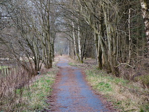
Cycle
track along the old railway line |
|
|
The route is a wonderful mix of open
views and tree lined sections. At Cardrona I stopped to photograph
the old Railway Station ticket office which still exists on its
original platform. |
|
|
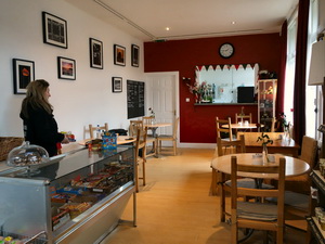
The structure is wood and now
converted to a cafe and shop. I called in to ask if any photos exist
when it was a working station. She said no. I continued through the
housing estate and back to where the track follows through another
golf course. |
|
|
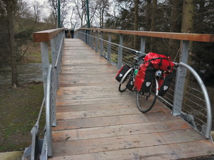
The rail track embankment was on my
right and trees and river Tweed on my left. It was surprising to see
how high some of the flood debris was still clinging to some of the
trees. At the new steel footbridge I decided to stop for the day and
camp. I found a fairly secluded pitch behind some pine trees. I’d
ridden 48 miles. |
|
|
|
Footbridge over the River Tweed |
|
|
|