|
There was heavy rain through the night
but the wind reduced. I'd hoped for an early start but the rain
continued until 9am and I didn't want to walk in the rain if I could
help it. I was on my way at 8:45 and continued up the path which
climbs steeply to an old mine working. The entrance is collapsed but
the spoil heap has made a flat area that makes a nice place to stop
and take in the view. There is also a flat grassy patch where the
mine entrance was which would make a good tent pitch but with no
water nearby and no mobile signal it's not practical. Continuing up
I joined the main path up to Dale Head summit and its magnificent
cairn. |
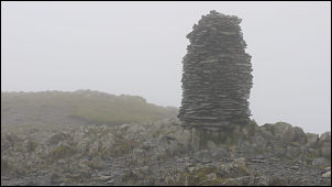
Dale Head summit in the mist |
|
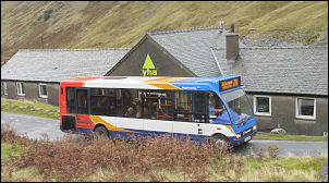
77A Bus over Honister |
I was now in cloud
so wasn't able to take advantage of the viewpoint. Turning left I
set off down the very wet path to Honister Pass. It wasn't long
before I was below the cloud and able to see the Honister quarry
workings below. More torrential rain came and I wondered once again
why the Met Office bother to put out forecasts as today was supposed
to be sunny all day. This morning’s forecast on the radio made no
mention of storm force winds. I reached the touristy cafe and shop
at the quarry but had no wish to call in. I crossed the car park and
followed the path along the route of the old tramway. |
|
It’s a long straight and steady climb
then over the drum house summit and down to Dubs Hut. I stopped at
the hut to check that all was OK there as its been a few years since
I was last here. The path below took me to Warnscale Beck where I
had to use stepping stones to cross. |
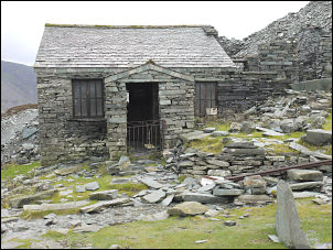
Dubs Hut |
|
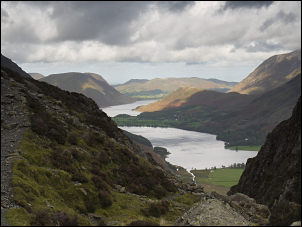
View of Buttermere
with Crummock Water in the distance |
I followed the path
to Blackbeck Tarn where there are superb views down towards
Buttermere. Following the path up I came to Innominate Tarn the
place where the ashes of the late Alfred Wainright were scattered. I
still wonder why he chose this spot as its not particularly scenic,
especially on a wet, cloudy and windy day like today. Over Hay
Stacks the path was fairly indistinct in places and I finished up
descending to Scarth Gap on the wrong path. |
|
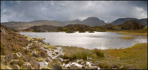
Innominate tarn looking SE to Great Gable |
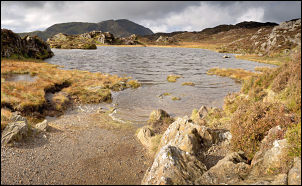
Innominate Tarn looking NW |
|
No damage was done and I was soon back
on track and on the climb to Seat. The wind was picking up again and
becoming quite a problem. The steepest part of the day was the climb
to High Crag up Gamlin End. It was a steady plod up a good path.
Over the summit the going continued to be very tricky in the
battering wind. A few walkers were around and as we approached our
greetings were lost in the hurricane. It took ages to get to High
Stile and then Red Pike and I realised that my plan of camping high
were too dangerous. Over Red Pike I started my descent to find safer
ground. At the branch path to Little Dodd there was a good spring
but it was still to exposed so I continued my descent. Before
reaching Scales beck I found a spring and flat patch to pitch my
tent at just over 500m. I decided to call it a day and camp for the
night. At least I had a nice view across to Mellbreak and behind the
distant Solway Firth and mountains of Scotland. |
|
|
 Return to
Whittle Wanderer
Return to
Whittle Wanderer