|
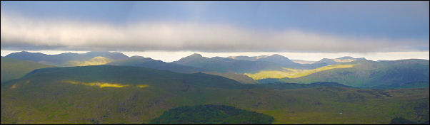
Morning view from the tent. Great
Gable is in the centre |
|
Overnight the wind
increased considerably and the temperature plummeted. By morning it
was less than 2degC, which is quite low considering how close it is
to the longest day. I went for a wander around my tent about 6:30am
accompanied by my second mug of tea when I heard voices. Walkers
were already coming up the path from Thirlspot on the Thirlmere
side. They must have left before light. My planned day was over
familiar ground so I didn’t need to set off too soon. I took in one
last view of the panorama from Sca Fell to past Great Gable then set
off at 9:40am. I was soon on the main path towards Whiteside. It is wide and easy at first then
narrows and descends quite steeply. Below I could see a couple of
cyclists struggling to push their mountain bikes up towards me. When
I reached them they said they’d probably taken a wrong turn
somewhere. I looked at their map and reassured them that they were
on the right track for Helvellyn and Dolywaggon Pike, which was
their planned route. Approaching Raise there were more people about
and on the summit the sun broke through for a while which warmed
things up a bit. The cloud was quite high so I still had good views
all round, though it continued relatively cold. I descended towards
Sticks Pass and recent work on the footpath up from Grenridding
stood out starkly. At the saddle I didn’t stop but carried straight
on up Stybarrow Dodd. A brief glance back showed a large group of
walkers crossing the pass from the Glenridding side. A lot more
people were about now and many were on my path. |
|
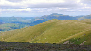
Approaching Watson's Dodd with Skiddaw in the background |
All were taking the
route over Watson’s Dodd but I took the slightly shorter direct path
towards Great Dodd. Many people were on their ways down but I didn’t
speak to them as I took yet another short cut, this time the narrow
and underused path across Millgill Head. It is much
more exciting than going over Great Dodd and joins the main path at
Little Dodd. The descent to Calfhow Pike must be the driest I’ve
ever seen it. Most times the path is almost running in water but now
it is dry as dust. |
|
To the north was Clough Head, my day’s
objective. But I couldn’t take the direct path as there is no water
up there. I cut across the pathless fell towards Jim’s Fold where I
knew there was a stream and good water. It would be quite a carry
but hopefully worth it. When I got there the stream was running well
in spite of the recent dry weather. I filled my water bag and set of
to carry it 200m up to Clough Head. After a while I joined an
unmarked path which climbed steadily up the grassy SW ridge. |
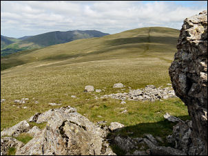
From Calfhow Pike to Clough Head |
|

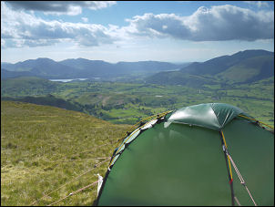
Clough Head summit with shelter and trig point |
The views were
impressive all the way up and just below the trig point and stone
shelter was a grassy plateau. I pitched my tent but the grass was
deceptive. Just under the surface it was very stony and it took a
long time to find a spot where I was able to push the tent pegs in
far enough. At least with stony ground like this if a peg can be
pushed in far enough it is very secure. |
|
I certainly needed the
security as the wind was quite strong and I don’t think I could find
a more exposed place for the northerly wind if I tried. There were a
few people about during the early afternoon but after that nobody
visited the summit, which I find surprising as it gives such good
views. |
From Clough head looking towards Keswick |
|

Sunset over Skiddaw from Clough head |
|
|