|
After my last journey with multiple
bus journeys before 9:30am, the bus pass watershed, I’d learnt my
lesson. I caught the 05:40am bus to Preston and bought a senior
explorer ticket for £5.90 which is valid in Lancashire and Cumbria.
I reached Preston then walked to the Railway Station where I had
some time to kill before the 06:40am Glasgow train arrived. At
Oxenholme the Windermere train was waiting and in Windermere I had
another wait for the 08:18am 555 bus which I caught to Rydal. |

St Mary's Church, Rydal |
|
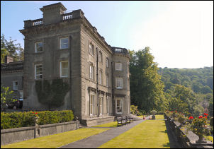
Rydal Hall |
I stopped briefly
to have a look at St Mary’s Church which was built in 1824 by Lady
le Fleming of Rydal Hall. William Wordsworth worshipped here and was
the Church warden in 1833. Further up the lane I turned right into
the grounds of Rydal Hall. After taking a few photos I continued
along the lane to the camping ground behind the buildings. I saw the
Yurt tent of the designer Dianne Standen but it only seems to be
open on Sundays. The path follows a track through the woods which
goes to Ambleside but my objective was Rydal Head to the north and
my map didn’t show any path going that way. At the first gate I left
the track and headed straight up the hillside and into the woods. |
|
It was a picturesque area and I soon
reached a green path heading my way. The morning was now warming up
and the damp woodland surroundings had brought out all the flies.
This is my least favourite time of year not just because of the
flies but also the flourish of tree growth and large amount of pale
green everywhere. Give me autumn and winter any day. I was fighting
a losing battle with the large flies. They were huge and looked like
harrier jump jets landing on me. They were painful as well. One
landed unnoticed on my hand and had punched a hole in my finger
which bled for quite a while after I’d brushed the fly off. Even my
shirt didn’t stop them trying to suck my blood. I left the wooded
area after Birk Hagg and at last had a good view of the high fells
ahead. The flies were still around but less numerous. |
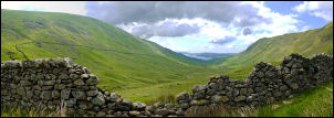
On the way up to Rydal Head |
|

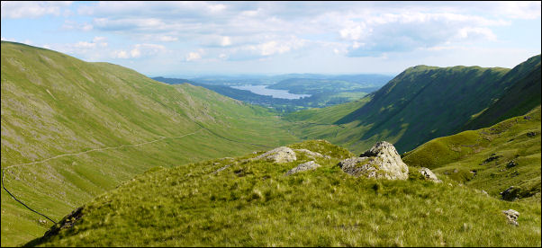
View of Windermere from Rydal Head |
My planned camp was
high up in Rydal Head at a spot I’d seen on Google Earth but wasn’t
sure if it would be suitable. I followed a path along the valley
bottom which eventually petered out at the last gate. This is an
area which doesn’t seem to get many walkers due to the lack of paths
showing use. I crossed an interesting area showing signs of ancient
dwellings but nothing was shown on my map. I kept scouring the head
of the valley through the binoculars to see if the area I’d chosen
for a camp was feasible. The more I looked the more I realised it
wasn’t. |
|
Looking back to Rydal from Camp_1
below Fairfield |
|
Up to the left was a better looking
area. The map shows it as Calf Cove and Black Crag so I decided to
investigate. A wall circles the head of the valley which is mostly
intact but there is a fallen section just below the cove where I was
able to cross. Surprisingly there is also a lone tree, the only one
for miles. The climb was steep but stead and when I reached the cove
there was a stream and good places to camp but I decided to try
higher and climbed to the top of Black Crag where the views were
much better. There was even a small stream nearby so I didn’t have
far to carry water. The weather continued fine and warm with hardly
a breath of wind. Later in the day the wind increased a bit. |
|
|