|
The day dawned a complete contrast to
yesterday. It was overcast, cold in comparison and cloud started
rolling over the fell tops. I was on my way just before 9am but as I
got higher I wasn’t sure which would be the best way to climb out of
the valley as cloud had obscured the higher slopes. I reached the
area called Nettle Cove on the map and found large areas of nettles. |
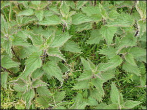
The nettles of Nettle Cove |
|
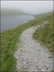
The path descends to Grisedale Tarn |
I don’t think I’ve
seen nettles this high before. The altitude is higher than 600m. I
kept climbing up steepening ground but managed to keep to grassy
areas which are much easier to cross than the stony scree. The
gradient eased and I found myself on the southern approach path to
Fairfield summit. I was in thick cloud so had to follow the cairns
to find the larger cairns that mark the summit area. My next
objective was to find the descent path down to Grisedale Hause. In
poor visibility this must be one of the hardest paths to find as the
first part off the summit is unmarked and it isn’t until it starts
to descend steeply down that marker cairns appear. A compass is an
essential piece of kit in these situations. The descent is very
steep and loose underfoot. With a heavy pack it is one of my least
favourite paths. I don’t carry a walking stick but this is a time
one would be useful. I was extremely thankful to reach Grisedale
Hause and join the main path down to Grisedale Tarn. There is a flat
grassy area at the summit of the hause and I noticed a green tent
pitched there, but no sign of anybody. |
|
Further down the path there were a few
people about. I crossed the stepping stones at the Tarn outlet and
set off up the steep path to Dollywaggon Pike. I’d dropped below the
cloud at the Hause and could see where I was going. As I climbed I
was soon back in it and lost all views. The climb is on a well made
path and at the top it continues easily by Dollywaggon Pike, High
Crag and Nethermost Pike. There is a minor path going over the
summits but in the thick cloud that would have been pointless. I
came to the junction where the path comes in from Thirlmere and
starts the final push to Helvellyn. Part way up I made a detour to
the east to have a look at the 1890 memorial to Charles Gough who
died near the spot in 1805. |
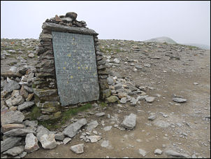
The memorial to commemorate Charles Gough, immortalised by William
Wordsworth. Gough died attempting to cross Striding Edge to reach
the summit in 1805, and his faithful dog stayed by his body for 3
months until both were discovered. |
|
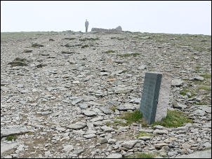
Memorial to the first aeroplane to land on a mountain in Great
Britain.
John Leeming and Bert Hinkler successfully landed and took off
again, in 1926
They flew in an Avro 585 Gosport |
I also had a look
down at the walkers crossing Striding Edge on their way up to where
I was standing. I crossed the grass back to the Helvellyn path and
continued to the shelter where many were sheltering. I pressed on to
the trig point where I managed to get some views as the cloud had
started to lift. |
|
An Avro aircraft similar to the one
that landed on Helvellyn in 1926 |
|
My planned camp was by Brownrigg Well
about 500m to the west so I started down the easy slope. As I
approached the well, which is a natural spring issuing from the
rocks; I found a good flat grassy area just above the spring. I
decided to camp here as I’d camped next to the spring on previous
occasions. The cloud had now lifted and the views were excellent, if
a little hazy. |
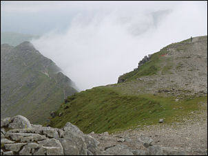
Looking down from Helvellyn to the misty Striding Edge |
|
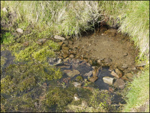
One of the best water sources.
Brownrigg Well is reputed to be the highest spring in England. The
altitude is 863m (2831ft) |
I cooked some lunch
and sat there taking in the views. An elderly walker approached on
his descent to the old lead mine workings. He told me of the time he
saw a young man brewing up while camping on the summit of Helvellyn.
He’d carried his water all the way up from Glenridding unaware that
water was near the summit. The man told me he’d shown the youth
where Brownrigg Well was then continued on his way. |
|
|