|
Another very calm night but this time
a bit colder at 2degC. There was thin cloud and no sun as I set off
down the track to the main A59 Blubberhouses Road. There is no
footpath by the road so I didn’t want to be on it longer than
necessary. I turned left and headed down towards Bolton Bridge. In
just over a mile I reached Summerscales and a short stretch of the
old road. It was nice to see one of the original mileposts still in
place and surrounded with daffodils. I left the old road and turned
right up a farm track. |
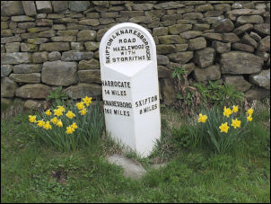
The original milepost |
|
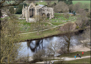
Bolton Abbey across the river |
My next objective
was the ruins of Bolton Abbey and this way I would avoid the traffic
on the A59. I was unfamiliar with the area and overshot my turning.
I soon realised my mistake, retraced my steps a short way and joined
the track over the brow to the next valley of Pickles Gill Beck.
There was a small house below nestling near the valley bottom but my
way was by the higher track. It descended past Noska Head and down
to Town Head Farm. Then I came to Storiths Lane at Storiths. I
turned right then left down the track to O’Th’ Hill Farm where a
wooden gate took me down a walled path with Bolton Abbey directly
ahead across the River Wharfe. |
|
The gloomy weather
had brightened a bit and the abbey ruins looked very impressive. At
the river bank I had the choice of crossing by the stepping stones
or the wooden footbridge. Unfortunately a few of the stepping stones
near the middle of the river were out of place so I took the easy,
and safe, option of crossing by the footbridge. |
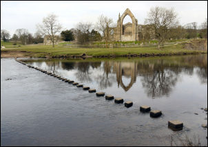
Stepping stones across the Wharfe |
|
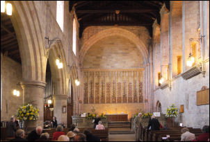
The Priory Church Bolton Abbey |
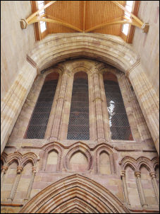
The Priory Church Bolton Abbey |
|
I wandered over to
the ruins and considering that it was a Sunday morning I was
surprised that I was the only person there. Walking round to the
church attached it was a different matter. Many people were arriving
to join the Sunday morning service. I was stood there in my scruff
with backpack on. An elderly man commented on the pack I was
carrying and asked where I was heading. I told him and he then asked
if I’d like to look inside. So I took my pack off and spent a few
minutes in the church before resuming my walk. |
|
I walked up the
road to have a look at the Cavendish Memorial and its fountain
before returning along the road to pick up the path at Bolton Hall
then up to Westy Bank Wood. It was interesting to see a cast iron
plaque in the wood saying ‘replanted 1898’ as the pine trees didn’t
look that old. Out of the wood I crossed open fields to Middle Hare
Head and on to the road below Lower Barden Reservoir. Just over the
cattle grid I crossed over and picked up a track heading up on to
the moors. |
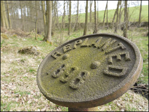
Replanted 1898 |
|
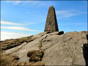
War memorial obelisk |
I followed it for a
few miles and the only people I saw were mountain bikers. The
annoying thing is that higher up was a sign saying ‘No Cycling’.
Authorities who erect such sign should be ashamed and remove them
immediately. My next objective was the war memorial On Watt Crag As
I reached the summit I could see it in the distance but there was no
direct path. The path shown on the map took a long 2 mile detour to
the west so I took the direct line. A steep descent took me down to
the boggy Yethersgill Head then I started a difficult climb through
deep heather which just comes second to trying to make headway
through soft waist deep snow. I could see the memorial ahead but it
didn’t seem to be getting any closer. I reached an interesting
boulder outcrop then crossed the wall to the obelisk that marked the
war memorial. It was extremely tall and fittingly placed on a
prominent position. |
|
The weather had
cleared quite a bit since this morning and I had a nice view of the
Yorkshire dales all around. I followed the wall to the NE where I’d
hoped to camp near Threapland Gill, but I had no idea if there would
be enough water. The wall gave some shelter from the increasing wind
and the sun actually felt warm. The gill was fairly substantial and
there was plenty of water. I found a nice grassy patch to pitch my
tent and was pleasantly surprised to see a view of the last camp if
my last camping trek across the valley. |
|
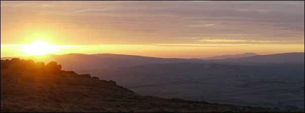
Sunset from the tent with Ingleborough
visible in the right of the picture |
|
|
 Return to
Whittle Wanderer
Return to
Whittle Wanderer