Day 2 of my Cycle Ride across Scotland. I was packed up and away
around 8 a.m. and wheeled my bike along the sandy path to the
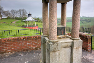
Alexander Park. Instead of joining the road straight away I wheeled
my bike up the path to the bandstand area and an old drinking
fountain which was dry.
Drinking fountain
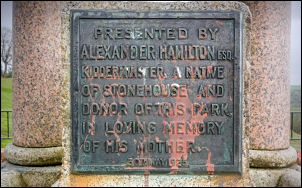
Presented by Alexander Hamilton Esg. Kidderminster. A native of
Stonehouse and donor of this Park in loving memory of his Mother
30th May 1925
Drinking fountain
It was very overcast as I joined the road to ride into Stonehouse. I
was concerned about the weather forecast and the strong head winds
that I would have to cope with. I headed up the long climb of Spital
Road in a south east direction and then continued to the B7078 and
in to Blackwood. I turned left down Lanark Road heading towards
Lanark but didn't plan to stay on the main road the whole way. At
the bottom of the hill I crossed over the River Nethan then up the
climb to Auchenheath. This is where I left the busy main road to
turn right up Newkayes Road. I was right to come this way as there
was hardly any traffic as I headed east and up the steep hill to the
water supply reservoir. The last bit was very steep so I got off and
pushed. The far side was an easy descent but the very strong
easterly headwind made it rather uncomfortable. The last time I was
here I continued the descent down to the main A72 road. However that
meant following the very steep climb up into Lanark so I turned
right off along a minor lane before reaching the A70 road. It turned
out to be an excellent decision as I followed the lane through the
countryside with some exceptional views in spite of the very hazy
weather. I headed south east and eventually came to the main A70
where I turn left on a very rough cycle track but fortunately I was
only on it for a short way. I soon turned right to follow another
narrow Lane to Carmichael. The wind was causing a lot of problems as
I was mostly heading straight into it. Through Carmichael I turned
right to the Farm called Syde then a sharp left to continue along
the lane under the north side of Tinto. Even on the flat I was
struggling to maintain 6 miles per hour in the strong headwind. I
reach the main A73 road and crossed it to reach Thankerton where I
stopped on the bridge over the railway which was the line I used to
get to Glasgow yesterday. A few miles to the north is Carstairs
junction where the line splits to serve Glasgow and Edinburgh.
Through Thankerton I crossed the bridge over the River Clyde and
continued east. As I continued there was a road coming in from the
left but my route was to the right. Unfortunately there was a sign
saying road ahead closed. Further along was a pile of old tarmac
lying part way across the road. I continued hoping that it was just
roadworks and a pedestrian access would still be available. I came
to some machinery and a lorry in the road doing some surface
maintenance. I was able to wheel my bike by the lorry and continue.
Unfortunately more roadworks were underway a head and a large
barrier across the road.
I ignored the workers and wheeled my bike past and was able to
squeeze past the barrier. I continued the climb up the hill to the
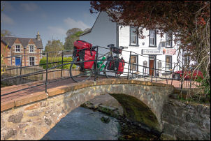
next road junction. I continued into the town of Biggar and wheeled
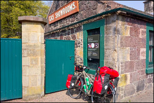
my bike over the Old Pack Horse Bridge. Down a minor Lane I visited
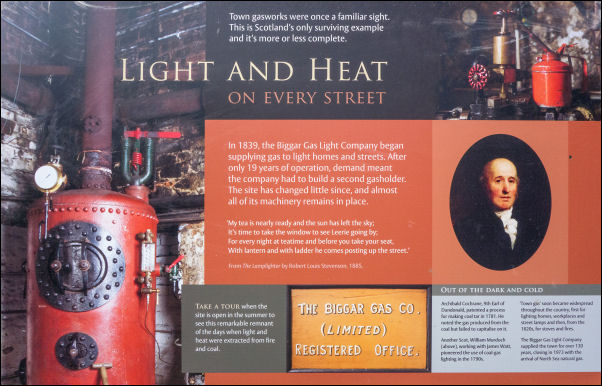
the entrance to the Gas Museum but as expected it was closed. The
sign says it is open summer weekends. I returned to the pack horse
bridge and sat on the bench to have something to eat and a drink.
Pack horse bridge over Biggar Burn locally
know as the Cadgers Brig
I left the town to the south along the lane and headed uphill and
then turn left to follow the lane east along the side of the Valley.
It was still difficult in places battling into the head winds. I
reached Broughton and turn right at the A701 where I headed south
for a while and joined the B712 on the left.
The Gas Museum was closed
Biggar Gas Light Company 1839
I wasn't on it long as I turn left down a minor lane to cross the
bridge over Biggar Water. I found an excellent spring where I could
have camped but there was no level ground anywhere. I continued up
the hill and then descended to join the B71 to which I followed
northeast through Stobo. This is a road I don't like as there is no
cycle track and it is quite busy. I continued to the main A72 where
I turned right then immediately left along the narrow lane heading
up into the Meldon Hills. My planned camp was up by the car park and
public conveniences which are now closed.
However I stopped about a kilometre short and checked my phone to
see that there was a signal. Below the road and by the river was a
good camping spot and above the road was a small stream with clear
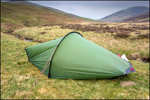
water. I decided to camp here for the night. From my tent door I
could see White Meldon which I had visited previously on a walk to
investigate the summit earth ramparts of the ancient hill fort.
 Return to
Whittle Wanderer
Return to
Whittle Wanderer