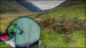
It was a calm overcast night and an early morning temperature of
5degC. There were two car parks below and both had overnight vans in
them.
Last night's camp
I was on my way by 8am and started the gentle descent towards
Moffat. There were a few minor climbs but nothing steep. There had
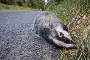
been a lot of road kill yesterday which was universally pheasants. I
didn’t see any this morning except for a dead badger.
Badger road kill
It had been killed about the middle of the road but it lay by the
side of the road and I could see by the blood trails that it had
been dragged there. It was still warm. I rode in to Moffat and
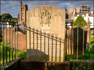
turned right to wheel my bike into the old graveyard. Just as I
entered a man came up and asked me about my bike and what I thought
of the Rolhof gears. He was a keen cyclist and had driven past me on
the road earlier. We chatted for a while but he seemed to be in rush
and was probably on his way to work. I wheeled my bike to the grave
of
John Loudon McAdam (1756-1836) and took a photo.
I’ve visited it before but it was always raining. This morning the
weather is fine and the sun had recently come out. I took some
photos, wheeled by bike back to the gates and cycled to the M74
roundabout to join the B7076 heading north.
I knew I had a long climb ahead but the gradient was steady and not
too steep anywhere. Riding up the narrow valley means the M74 and
railway were never far away and I saw a variety of trains using the
line. I only saw one cargo train pulling tankers and the rest were
either Virgin or Trans Pennine Express.
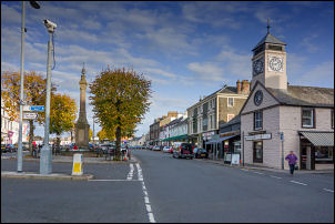
Moffat
After 10 miles I reached the cycle track that runs parallel to the
road and cycled over the summit to reach the turn off at Elvanfoot
onto the A702. It’s a road I’ve never driven or cycled along so was
looking forward to new territory. I wasn’t disappointed and enjoyed
riding the quiet road through a wide valley.
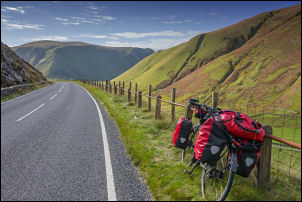
A702
There were many wind turbines on the hills and the high altitude is
why they’d be positioned there. My gps showed and altitude of over
300m for most of the valley until I rounded a right hand bend and
started my descent. The scenery was very impressive as I freewheeled
down the winding descent. I’m glad I was riding down as the other
way would have been a long tough climb. At Carronbridge I joined the
A76 and rode the 2 miles into Thornhill.
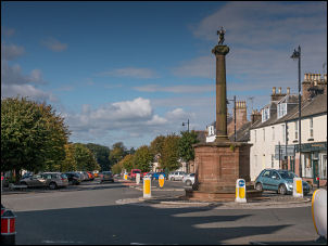
Thornhill
Just before the monument at a roundabout I called at the
Co-operative shop to buy water it was 49p for a 2lt bottle. I left
the town and followed a narrow lane down to the bridge over the
River Nith. My plan was to camp here so I spent some time finding a
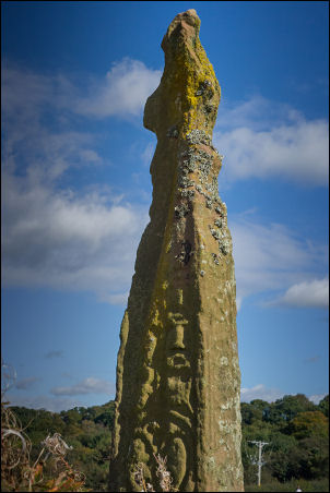
suitable spot. Firstly I had a look at an ancient Anglo-Celtic cross
sits alone in a field dating from the late 9th or early 10th
century. The Dumfries Museum web site records this as "the only
Dark Age cross in Dumfries and Galloway .... carved with
Northumbrian-style decoration.”. It was very eroded. There was a
nice path by the river to the north but from the road were steep
steps to access it. I found a gap by a gate to wheel my bike into
the field and bypass the steps. The path followed the river and near
a wooden bench I stopped to put my tent up. There were a few dog
walkers later in the afternoon.