Steady light rain was
pattering on the tent when I woke up and was still there as I packed
up camp. I rode across the grass back to the road where there was a
waste bin for me to get rid of two days of rubbish. I rode on with
just a waterproof top on as the rain wasn't heavy. The road ran
above Borthwick Water to Roberton. Shortly after I started the climb
to Alemoor then descended to Alemoor Reservoir where the road
crosses a causeway across the reservoir. As I left the reservoir
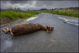
there was a dead deer, possibly a roe deer, in the road.
Roadkill. A bit too big for the pot
Next to it was a
vehicle number plate and piece of a front bumper. It must have been
very recent as the body was still warm and fresh blood on the road
by the mouth. I continued up the steady climb onto the remote moors.
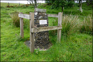
As I passed a group of trees set back from the road I noticed a
stone pillar and plate mounted on the top. I walked over to
investigate the plate which read 'Site of Redfordgreen School 1885
to 1955' There was no evidence of a building having been here and no
sign of any housing nearby.
Site of Redfordgreen School 1885 to 1955
Having it all to myself
There must be an interesting story about a
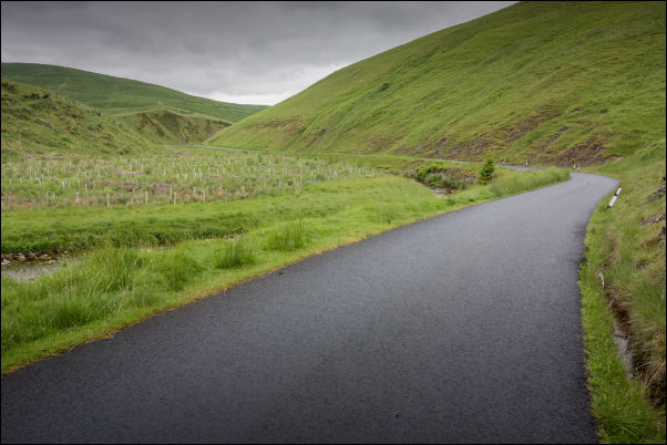
school at such a remote location. I continued over the remote moors
until I started an impressive descent through steep sided glens to
Tushielaw. I stopped by the bridge and heard the roar of an engine.
A classic open top car approached round the corner and roared off in
the direction I'd just come from. The two male occupants were well
wrapped up including full head gear. Two more similar cars followed
a few seconds later.
Innerleithen Golf Club
I turned north then soon started
another long climb to the NW. It was steady but long and once over
the summit had a long descent to the main A708 road at the Gordon
Inn. It is a cross roads and I crossed the main road to start on
another long climb. A sign said the road would be closed from the
20th June so as it’s the 17th I was OK. As I started the climb a
touring cyclist came down with a full set of panniers on rear and
front. Further on were some barriers at the side of the
road and behind them was a lot of erosion caused by the nearby
river. I suspect the road closure is for the repair work. It was
another steady climb but once over the summit I had a very long
descent into a much wider landscape. In the distance was
Innerleithen, the first town since Hawick. As I rode into town I
passed the point where the cycle trail from Peebles joins the road.
It follows the line on the old railway line and is a delight to ride
on. The rain began to increase though still not too heavy. There
were plenty of people around as I rode through the town and several
cyclist sat outside a cafe. I turned north on the B709 and headed
off into remote countryside. Leaving the town the road passes
through the middle of Innerleithen golf course. The wet and gloomy
conditions didn't help the ride and it seemed to take a very long
time to get to the first summit. The descent took me to the road
junction where I turned left to head up another long climb. The rain
continued and increased as I reached the planned end of my day's
ride. I was hoping to get water from a culvert deep under the road
at an embankment and camp further up just off the road near the
summit. The water turned out to be down a very long steep bank and I
didn't fancy getting my cycle shoes covered in mud. I continued and
hoped to find water further on. On the descent I came to a gully on
my right and through a gate was a large concrete cistern set in the
hillside. Behind it was some flat ground where I could erect the
tent and not be seen from the road. The water was very peat stained
but I have plenty of gas to boil it. It was good to get in the tent
and out of the rain.