The thick cloud continued overnight but fortunately no rain. I was
able to pack up a dry tent and was on my way about 07:20am. I
continued along the cycle trail even though my original plan was to
follow the forest road. The cycle trail was very undulating and took
a much longer route as it followed the shoreline.
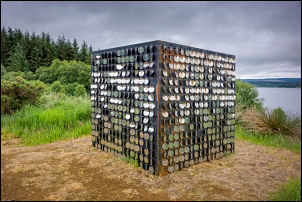
Art
by Kielder Water
Art by Kielder Water
There were was a good information board
about the colliery working that had an inclined railway linking with
the original railway that is now below the reservoir of
Kielder Water. I eventually re-joined the forestry road but it
was loose gravel and difficult to ride on. I reached the car park by
the reservoir dam.
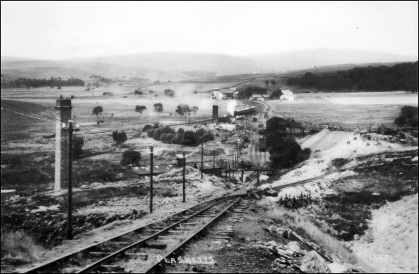
Site of the incline down to the site of Plashetts Colliery. See
picture below.
Same view as above when the colliery was
in operation
A memorial plaque said it was opened 26
May 1982 by the Queen. The main access seems to be the road along
the top of the dam because my way was straight on and it was still
loose gravel. The cycle track then followed a muddy rutted farm
track that eventually reached the back of some housed. A short way
on it thankfully reached the tarmac road. There was a lot of up and
down before I reached Lanehead where I turned left and started the
climb.
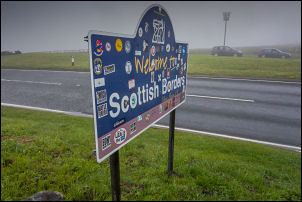
Carter Bar summit
My original plan was to ride via Highgreen
Manor but I changed my mind when I saw the narrow lanes head. I
headed for the B road over Troughend Common instead. The road was
much better and hardly any traffic. I had a head wind but wasn’t too
concerned as I assumed I would reduce as I descended to the A68. It
was a long descent to the main road. I turned left to head NW
towards Carter Bar. I had more of a side wind now and the going was
steady but slow. I stopped briefly at Camien Cafe which is
advertised as the last cafe in England.
Hawick in the rain
A group of motorcyclists were in the car park and one said he’d come
from Edinburgh where it was raining hard. I pressed on and while
stopping briefly to check my map a touring cyclist overtook me. He
only had 2 rear panniers but they were very large and wide. As I
continue I could see him up ahead and our speeds were almost the
same so for the rest of the ride to Carter Bar summit I could see
him up ahead. At the base of the climb light rain started and was
with me the whole way up. It’s not a steep climb but is several
miles long. The summit is the England Scotland border with a cafe
van and Scotsman selling trinkets to the tourists. I stopped at the
stone boundary sign and continued as a coachload of Japanese
tourists arrived. The cyclist I'd seen was sat behind a wall
sheltering from the wind and rain. I turned off the main A68 on to
the A6088 and a very long descent down to Chesters and Bonchester
Bridge.
I had another long climb but nothing like
Carter Bar. There followed and impressive descent along a winding
road through valleys. I reached the main A7 and turned left into
Hawick. I stopped at Morrisons supermarket to buy water and some
biscuits. I left the car park by a walkway then over one of the old
pedestrianised bridge. I took a route along cycle tracks and over
pedestrian bridges. Heading through the park I came to the Museum.
It was free so I went inside for a while to shelter from the rain. I
left and stayed on the paths till I came to a large mown field which
was also a rugby field.
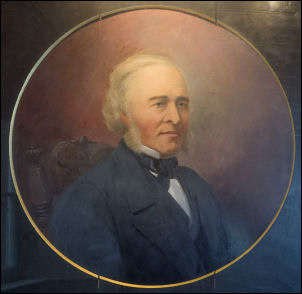
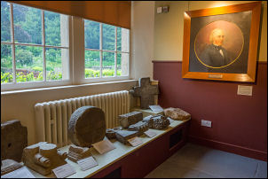
Hawick
Robert Michie (1807-1875) First
President of Hawick Archaeological Society from 1856-1857
Hawick Museum
The far corner was suitable for a pitch so I rode over and
pitched the tent. One of the Council workmen saw me and drove over
on his tractor. He was only curious about where I'd come from and
said it was OK to camp. Around 18:00 there was a lot of loud music
and shouting from a car park at the far end of the field. It sounded
like a rave was about to start but when I looked out it was a group
of keep fit people exercising.