|
There was a lot of rain overnight but
it eased by first light. As I packed the tent away it had stopped
and the tent wasn’t too wet as I packed it away. I wheeled the bike
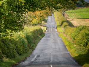
to the road and set off towards Auchterarder. There was morning
sunshine but it still felt cold. The road was quiet but had quite a
few undulations. The final approach in to Auchterarder was a long
climb. |
|
Just before reaching the main road I
came to a new roundabout in the middle of a new housing estate.
There were no direction signs to I continued straight on only to
find I was in a dead end. The correct way was right at the
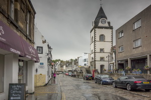
roundabout. Auchterarder was dull and uninteresting so I pressed on.
I joined the minor B8062 heading east and enjoyed the ride as there
were nice views. On the final approach to the village of Dunning I
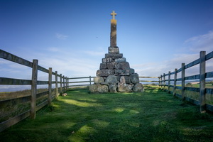
saw an enclosure in a field with a stone monument to
Maggie Wall who was burnt here as a witch in 1657.
There is a lot of controversy about Maggie and several stories
relating to her death. She wasn't burnt here but in a wooded area a
few miles away. |
|
|
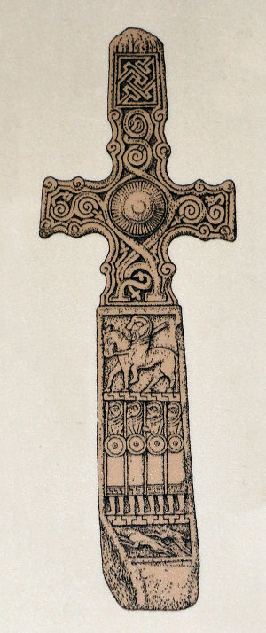
I continued in to Dunning and stopped
to look at the picturesque and interesting St Serf’s Church. The
church was open and there was a man in the gatehouse that was there
to answer questions and lead conducted tours. Inside the church was
the Dupplin Cross. It is a carved monumental Pictish stone dating
from around 800 A.D. Apparently it was moved here from a hillside to
the north in the 18th century. Presumably from the Dupplin Loch area
about 4 miles to the north. |
|
|
|
|
|
The weather forecast was for more rain
so I set off to continue my journey. I followed the sign to the
Yetts of Muckhart and started the long climb up the B934 over the
Common of Dunning. The climb was steep but steady and short bursts
of rain. Over the summit I had a very strong head wind on the
descent. I’d only seen one vehicle since leaving Dunning but as I
approached the bottom of the descent I saw several. |
|
|
|
|
|
|
Look
Aboot Ye in Clackmananshire |
|
|
My original plan was to camp in the
area but I’d managed to get ahead of my plan so I could reach
Queensferry. I reached Yetts of Muckhart but had to stop for a while
due to heavy rain. On the A823 the weather deteriorated and at one
point I thought it best to stop and shelter under a tree while the
rain passed. Approaching Dunfermline I joined a cycle track that
seemed to be on an old railway route. |
|
|
|
|
First
view of the Forth Bridges |
|
|
|
|
Crossing
the Forth Road Bridge |
|
|
The cycle route runs all the way
through Dunfermline and at one point seems to squeeze between the
gardens of two houses. The wind was very strong as I got my first
distant view of the Forth Bridges. Through Inverkeithing I headed up
to the cycle track over the Forth Road Bridge. It was still very
windy and storm clouds were blowing in. The sky was mostly clear for
my ride over. |
|
|
|
Lots of
locks on the bridge |
|
|
At the Queenferry end I called in to
the Supermarket to buy a 5lt bottle of water but as I came out there
was torrential rain. I waited and sheltered until it passed then
continued along the cobbled street by the Firth of Forth. I had a
wonderful view of the Rail Bridge which I still think is much more
picturesque than the Road Bridge. |
|
|
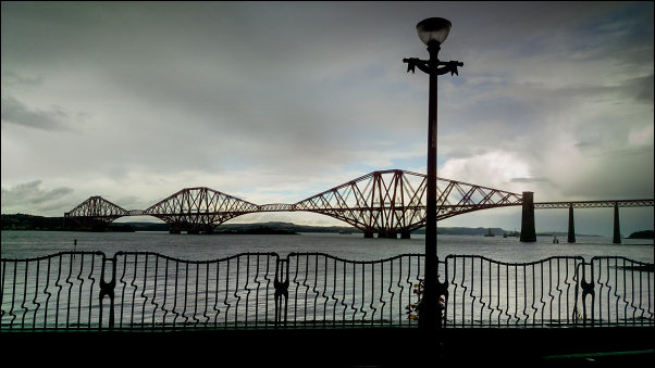
Forth Bridge from Queensferry |
|
I called in to the Information Centre
by the slipway to confirm that is where the vehicle ferries used to
use before the road bridge was opened in 1964. |
|
|
It was. I followed the track east and
on through the woods to Hound Point. This was my camp for the night
and one of my favourite spots, even though I’ve only camped here
once before. |
|
|
|
Forth
Bridge from Hound Point camp |
|
|
|