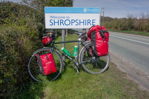
|
Set off on bike shortly after 5am to
cycle to Preston Railway Station. I arrived in good time to catch
the 06:17 train from platform 6 to Birmingham International. It was
a clear morning and I was able to watch a lovely sunrise across
misty fields as we approached Wigan. At Birmingham I had to wait for
the 08:49 Hereford train to Worcester. |
|
|
|
Changing
trains at Birmingham New Street |
|
|
|
|
Outside
Worcester Railway Station |
|
|
|
|
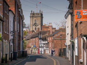
Worcester where Charles II escaped |
|
|
There was no defined bike storage
space so I had to use the wheelchair carriage. I reached Worcester
still in sunshine and had to wait for the lift down to street level
as there were 2 women with push chairs. Previously the rail website
had said the lift was out of action but I'm glad it was working. It
was too small to take a bike and I had to lift the bike end up. |
|
|
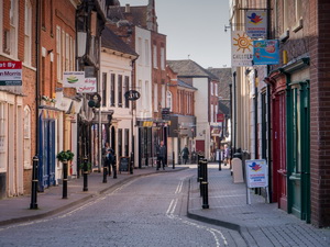
It is obvious that bikes were never
considered during the initial design. Down at street level I set off
riding but soon had to get off and wheel my bike as I approached a
one way system, the wrong way. I reached New Street and King Charles
House. This is where King Charles II escaped after the Battle of
Worcester in 1651. It is now a cafe. The narrow streets were very
picturesque in the sunshine. |
|
|
|
|
|
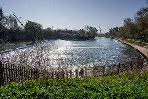
I headed south to Powick Bridge where
there had been battles at the start and end of the Civil War. I
don't know how much of the bridge dates back to 1651. I followed a
nice cycle track along the River Severn then left the city along a
busy road to Holt Heath. |
|
|
|
|
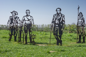
Metal
Men by the River Severn |
|
|
|
|
Metal
Men by the River Severn |
|
|
|
|
|
|
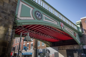
Bridge
over Severn at Worcester |
|
|
|
|
|
The earlier cool sun had now warmed up
and I was able to ride with a short sleeved top on. The earlier flat
roads were getting more hilly as I approached Stourport. On the
B4194 I turned off to the right to follow the Mercian Way which
headed back to the River Severn. A steep descent took me down to the
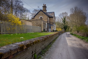
river and there was a nice preserved railway station on the way. |
|
|
At the river the road ended but there
was a pedestrian footbridge. On the far side people were sitting out
in the sunshine adjacent to a pub. |
|
|
|
Footbridge to Upper Arley |
|
|
|
|
|
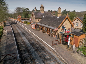
I had a steep climb up to the Arley
estate then a narrow lane before descending through parkland back
down to the river and a wider bridge. I joined a cycle track of
mixed surface. A few miles from Bridgenorth the track surface
deteriorated and one section was so rough and steep I had to push my
bike uphill with great difficulty. I can't understand how it ever
got a cycle track rating. At a reservoir and sailing club I had more
rough riding before thankfully reaching the road on the approach to
Bridgenorth. In the town I crossed the bridge to call in the
Co-operative shop to buy a 5lt of water for £1.19. I returned over
the bridge and continued along the no 45 cycle track which took me
across some sports fields and certainly wasn't a cycle track. Back
on the road for a while the track left to follow an old railway
track. |
|
|
|
|
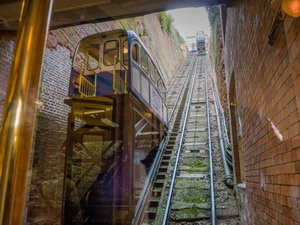
Bridgnorth Cliff Railway Station |
|
|
|
|
Bridgnorth Cliff Railway Station |
|
|
|
|
Cycle
track by the old railway |
|
|
|
|
|
Cycle
track on the railway |
|
|
|
|
|
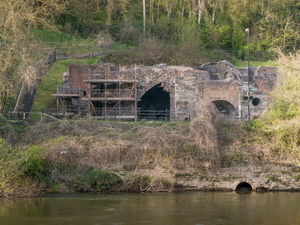
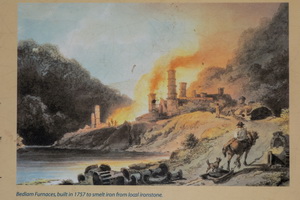
Bedlam
Furnace across the Severn |
|
|
|
|
Bedlam
Furnace built 1757 |
|
|
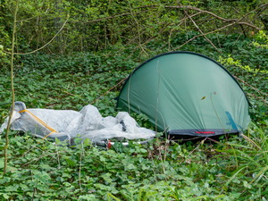
The cycle trail was very rough and
must be a terrible ride in wet weather. Signs were inconsistent and
confusing. Permissive path and No Public Access were shown together.
I'd hoped to camp by the River Severn here but every gate had a
fishing club sign saying no public access. The fishermen have
sterilised access for many miles. I had to ride on for another few
miles until I found an isolated length of abandoned railway across
from the old Bedlam Furnace site on the far side of the River
Severn. I found a camping spot in trees on some rough ground where I
had to do a lot of stamping down of undergrowth to get my tent up. |
|
|
. |