|
Heavy rain overnight stopped before
daylight and there was a cold clear sky. Sunrise didn’t warm things
up and it was -2 degC first thing and not much warmer as I was
packing the tent away. Considering it was Monday morning the traffic
wasn’t as bad as I’d expected. The first part of my ride was along
the same route as last month as far as Eccles. |
|
|
|
|
|
|
|
|
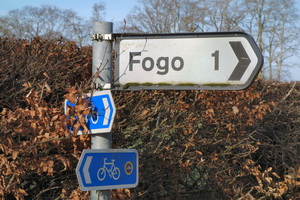
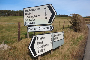
At the busy A697 I crossed over by the
large garage and continued a couple of miles before turning left on
to minor lanes. The lovely sunshine continued and it was delightful
cycling. Across the B6460 was a confusing road junction off to Fogo
on the right. I stopped to photograph the sign and a van overshot
the turn off and had to reverse up. The actual place of Fogo must be
off a side road because I didn’t see it. |
|
|
An amazingly long straight road took
me towards Gavinton and I could see its Church spire for a
considerable distance directly in line with the road. A small stoned
area on the right was called Butter Well but it was dry. A right
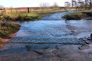
turn took me to more minor lanes towards Duns. A steep descent took
me to a ford which at first sight looked OK. Cobbles on the river
bed looked even better. Nearby was a footbridge but I went for the
ford instead. It’s a good job I didn’t clip my left foot in the
pedal because as soon as I rode in the bike slipped from under me.
The cobbles were covered in slime by the pollution. |
|
|
All I got was a wet left foot. I
wheeled my bike over the footbridge. A cycle route sign had pointed
to the road but no warnings were given about the ford. A steady
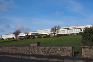
climb up and I was in Duns to collect some supplies from the Co-Op
shop. Just as I entered the town I was puzzled by a large white
building on the left. All the doors and windows were blanked off.
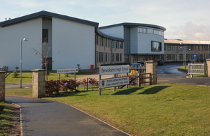
Opposite was a new school. I asked a man passing by and he said the
building was the old school and had been empty for years. It was
listed and couldn’t be demolished. Proposals to convert it to other
uses have failed. |
|
|
|
|
|
|
|
|
I left the Co-Op and headed north on
the A6112 through Preston. For a while the road wound round and
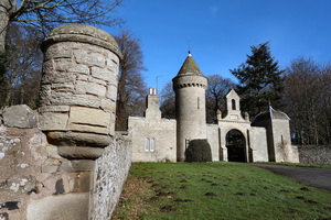
upwards but the climbs weren’t too long. At a sign for a Broch I
turned left down a steep descent on a narrow lane then the start of
my main climb for the day. |
|
|
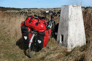
The steepest climb of the day followed
immediately but I managed it without getting off. The next few miles
were generally up to a high point with a trig post on the right in
the verge on Quixwood Moor. A short way ahead the Southern Uplands
Way footpath joined the road from a field on the left then soon left
down a farm track to the right. |
|
|
At the next wooded area I got my first
view of the North Sea and the white Torness Powere station ahead.
The sun was still out but it was chilly making the descent rather
cold. In Cockburnspath I stopped by the garage to see it there was a
water tap to fill my containers. I couldn’t see one so pressed on. I
inadvertently finished up cycling along the A1 but luckily found a
side track under the railway and back on to the road. Along the lane
a farmer stopped his tractor and chatted a while. He had work to do
and I continued to the cycle track by the busy A1. I wasn’t on it
long before turning right down the lane to the caravan park. I saw
the same lady as last time as I stopped to fill my water bottles
from their tap. |
|
|
I rode on along the John Muir trail to
the Torness Power Station seaward path. This time I took the upper
trail which was a bit rough and stony in places. It gave me good
views of the sea and also the power station. Being early and with
good weather I continued past the old limekiln where I camped last
time and headed for Church Point and the cross memorial. |
|
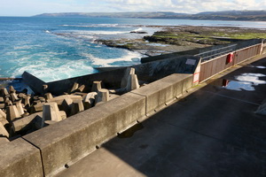
|
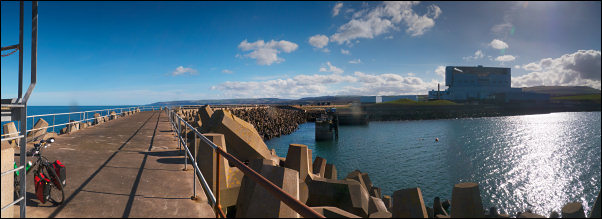
Torness Power Station from the harbour
pier |
|
Just where the sand stats a group of
men where tidying up the floor of a ruin and laying flags. I spoke
to them and they were the Bowe Brothers who owned the land. The
older said it was OK to camp at the point. I wheeled my bike to the
same spot where I camped last year and was surprised to see the flat
stones for my cooking stuff exactly as I’d left them. |
|
|
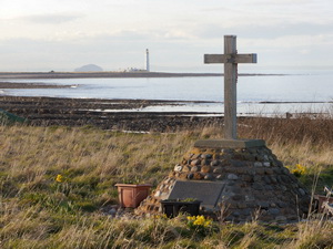
|
Memorial
Cross with Bass Rock in far distance |
|
|
I left the bike and wandered up to the
Canongate Boys memorial where a man was sat on the bench. We chatted
for a while then I returned to the bike and set up camp. I’d ridden
across Scotland for the first time with the satellite tracker and
the batter power was still going strong at just under 70% |
|
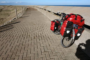
|
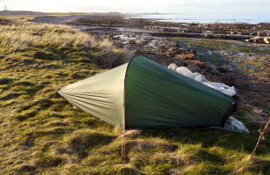
|
Spectacular camp at Chapel Point |
|
|
|