|
The temperature overnight was around
0degC and it was fairly windy. First thing I had a distant view of
the sea across Morecambe Bay but the cloud level was ominously low.
By the time I started to pack my gear into the rucksack I looked out
of the tent to see nothing but mist. I'd been looking forward to the
walk along Walna Scar but today wasn't to give any views so I'll
have to put it on the list for a future visit in better weather. I
headed north through the gloom with my compass at the ready. I could
see far enough to keep on the right route and soon found a faint
path which I followed along Walna Scar to Walna Scar track. As I
approached the track I could see that vehicles had been driven up
the rise of Walna Scar, causing tracks and ruts. |
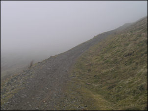
Walna Scar track |
|
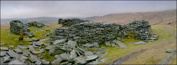
Old Quarry Buildings |
|
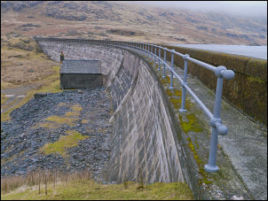
Seathwaite Reservoir dam. |
The Walna Scar road is sometimes used
by off road vehicles by enthusiasts who delight in driving over high
and remote tracks. At the track I was still in mist. I turned left
and descended SW to the large area of old quarry workings. At about
500m I dropped below the cloud level and had a view of the valley
below. I stopped briefly among some of the old quarry buildings
before continuing down the track. I was now descending parallel to
Long House Gill and followed it down to the branch track to
Seathwaite Tarn. I'd lost a lot of altitude to get here and I'd now
have to regain it by walking up the reservoir access road to regain
it. The alternative would have been to cross the open, rough and
very wet Seathwaite Fell. There was no competition. I'd come the
right way. |
|
The track to the reservoir wasn't
tarmac but it had recently been surfaced with shale and was easy to
walk along. The gradient was steady and where streams had been
crossed the culverts had parapet walls at just the right height to
sit on and have a brief rest. The curved sweep of the reservoir dam
came in to view with its small stone hut at the base. I followed the
path along the top and occasionally peered over the edge to look
down in to the clear cold water. Directly ahead was Troutal Fell, my
next objective. Only the base was visible as the rest was in cloud.
I was expecting a difficult climb through rocky outcrops but was
pleasantly surprised to find a faint path heading up the grassy
slopes. It was a pleasant climb even though I couldn't see anything.
It must be very impressive in clear weather. |
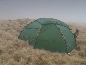
Misty camp below Grey Friar. |
|
My planned camp was just to the south
of Grey Friar. I'd seen what looked like a small tarn on Google
Earth but when I got there it wasn't a tarn but a muddy depression
mostly filled with ice and sheep droppings. Certainly not a suitable
water supply. There were still a few snow patches around and they
would have been a water supply as a last resort. I found a good spot
for the tent then set off in search of water. Most of the ground was
frozen but I eventually found a dribble of water to fill my
container. The weather continued cloudy, windy and occasional rain. |
|
|
|
|
 Return to
Whittle Wanderer
Return to
Whittle Wanderer