|
The night was fairly calm with a
slight mist but first light approached the wind got stronger and
there was enough mist about to obscure the valley bottom. I wasn’t
in a particular rush to get away as the planned route was relatively
easy going along a mix of path, minor road and canal bank. I was on
my way by 8:40am and continued along the path edging the moor in a
NE direction. Eventually I reached the car park at Norlan Town as
was surprised to find a rubbish bin in the corner where I could
unload the empty and crushed water containers. There was an
interesting War Memorial with a Celtic design in stone. |
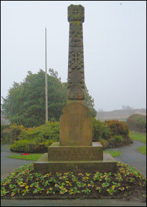
War Memorial at Norland Town |
|
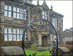
Fallingworth Hall dated 1642 |
I passed the School
and down the narrow lane to the Impressive Fallingworth Hall dated
1642. Further down was the Blue Ball Inn with a ludicrous looking
half blue sphere on the front wall. Still farther down I left the
road after another old hall being refurbished and followed an old
track down to a lower road then down Fall Lane to the railway and
then the Rochdale Canal. I joined the towpath and wandered along
aimlessly. |
|
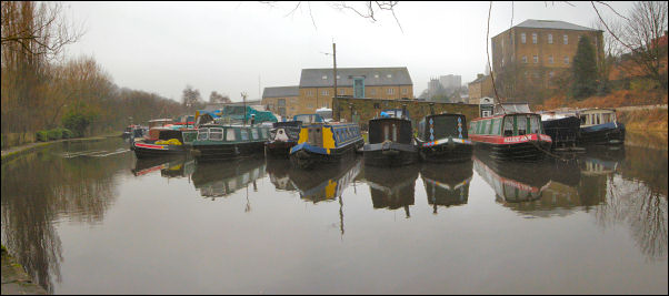
Canal Basin at Sowerby Bridge |
|
Passing through
Sowerby Bridge the canal goes into tunnel but there is no way marker
to show where the towpath goes. I guessed the route was across the
busy main road and up a branch road. I found the canal again at a
very interesting deep lock directly at the other end of the tunnel.
I soon left the town and was in open country again.
It was so nice to have easy walking and taking in the passing
scenery along the canal. The weather continued dull and overcast
with slightly increasing drizzle. The only down side was the
constant presence of piles of dog excrement which seemed to have the
highest density per mile of any canal towpath I’d walked along.
Every marker post and, every mooring bollard had piles of it round
the base. Somehow the gloomy weather seemed to suit the towpath
views and mirror flat canal surface. The miles slipped by as I
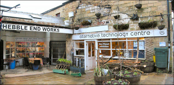
headed towards Hebden Bridge but at Luddendenfoot I was stopped in
my tracks by a sign by the towpath. "Hickory’s Cafe". A short way
off the towpath in the middle of a small industrial estate was the
cafe. I went in and enjoyed a delicious bacon sandwich and proper
mug of tea. It was an enjoyable break and I resumed my walk with
batteries re-charged. I had to cross the road again at another short
tunnel and then I was on a long straight stretch that took me in to
Hebden Bridge. |
|
By the canal at Hebden Bridge |
|
As the canal goes
through the town it is evident how much man-made work has shaped the
valley. Multi storey terraces of stone houses, the canal lifted over
the river Calder and the canal basins and warehouses that would have
seen the products of industry moving too and fro. Approaching
Stubbings Bridge I saw a ginnel to the right and followed it down to
a footbridge over the river then I crossed the road to Head up
Church Lane. |
|
At the first sharp
bend a lesser but wider road continues. I followed it up the valley
side. I was now above Colden Clough and I followed it to Hebble
Hole, which isn’t a hole, and the point where the Pennine Way
crosses. I turned right to cross the river at the interesting stone
footbridge and followed the Pennine way route up through the fields
across the road and up to High Gate Farm and May’s Aladdin’s Cave
shop. By now the slight drizzle was a lot heavier and the wind was
much stronger. I saw the young lady in the farmyard who OK’d me to
pitch on the small camping ground. There is still no charge for
camping. It was a delight to fill my water bag from the crystal
clear spring in the farm yard. It was still quite windy as I
struggled to erect the flapping tent. As I inflated my carry mat the
internal cells separated causing the top end to inflate like a
balloon. This is the second time I’ve had this happen with one of
these mats. |
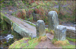
Stone footbridge at Hebble Hole |