|
It was still very overcast and cloudy
so I delayed my start till just before 8am so I had enough daylight
to see. The path was on the other side of the wall but fortunately
there was some loose wire fencing across a gap of collapsed wall so
I used that. I was now on familiar territory as I walked this path a
couple of weeks ago. There was swirling mist as I followed the wall
to the Crowd Stones where the wall turns to the left. The stones are
fairly insignificant but there are a couple of small quarry pits
that would have been used to supply stone for the walls. |
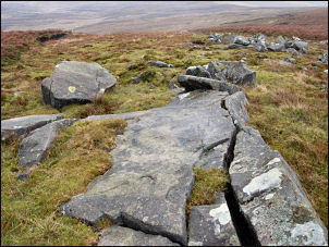
Rock outcrops on the way to Raven's Castle |
|

The Cross base at Cross of Greet |
The descent to the
Cross of Greet was very wet and I had to make a wide detour to get
round a deep wet area. I reached the deserted Lyth Fell road and had
a quick look at the stone cross base before crossing over and
heading into new territory for me. I was heading for the trig point
on White Hill but couldn’t find any discernable path along the way.
The ground conditions could only be described a horrible and
unbelievably wet. I would recommend anybody only to do this route
during a drought. Eventually I reached the trig point and continued
along the fence to the rocky outcrops at Botton Crag. I turned right
to follow the fence to a point above Shooters Clough where I took a
direct line down the hillside to the Hornby Road track. |
|
I turned right and
followed it to the gate near the summit. It was nice to walk on firm
ground for a while but that was about to stop as I turned left and
followed the fence first down then up the hill towards the mist. It
was very wet underfoot and didn’t improve until I’d reached Wolfhole
Crag. |
|
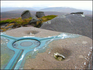
The triangulation plate on the Wolfhole Crag post |
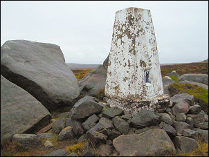
Trig post on Wolfhole Crag |
|
The mist had now
lifted a bit and I followed the wall to the track at Brown Syke. I
crossed the track to follow the fence towards Grey Crag. It was
interesting walking across an area of totally bare peat with nothing
growing out of it. I can’t imagine how such a large area of ground
could have its entire surface heather etc stripped off. |
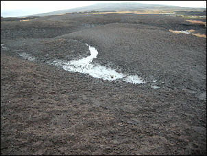
Desolate moor on Brown Syke |
|
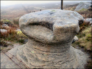
Queen's Chair on Ward's Stone |
I followed the fence but the ground
continued wet. The climb steepened and I came to the rock formation
called ‘Queen’s Chair’ with a bench mark chiselled on the top. Also
cut in the rock were the initials WM. I made a bit of a detour from
the main path to visit the trig point which is one of two on the
summit of Ward’s Stone plateau with less than a kilometre between
them and only 1m in height I set off through the mist to the second
trig point and came to the small tarn that is shown on the map. My
planned camp was further to the west and off the summit but as the
wind wasn’t too strong I decided to camp here and hope for a clearer
morning and some views. For this walk I have been using my Peak2
petrol stove as I was expecting cold weather and petrol performs
well no matter how cold it gets. I’ve always found gas quick, clean
and odourless but a complete pain in cold weather. However, because
of the fumes from the petrol stove I can only use it outside the
tent, which wasn’t much of a problem as I could operate it through
the open door. If I’d had heavy rain that could have been a problem
so I think in future the petrol stove will have to be consigned to
none back-packing camping. |