|
The 05:40am bus was on time and a
£3.60 fare took me to Preston Bus station. It was dark as I walked
through Preston but thankfully the overnight rain had stopped and
all that was left was the streetlights reflecting in the puddles. At
the station I was planning to catch the 07:44am Glasgow train as far
as Lancaster but then I noticed the 07:40am train to Glasgow also
stopped at Lancaster. I caught it as it would theoretically give me
another 4mins for my next connection. I had plenty of time as I
crossed over the footbridge to catch the 07:10am train to Leeds as
far as Giggleswick. It was 7am and the train was already waiting at
the platform. It was only two carriages which were open for
passengers to saunter aboard and pick which seat they wanted. We set
off on time and I tried to read the newspaper as it was still dark
outside and there was nothing else to look at. I soon gave up as the
carriages were bouncing up and down so much I couldn't keep the
paper still enough to read. |

Preston Railway station |
|
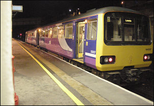
The Leeds train about to leave Lancaster |
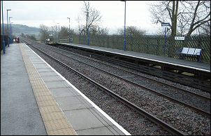
Giggleswick Railway station platform |
|

Ruin below Big Hill on Giggleswick Common |
I reached
Giggleswick just before 8am and I was the only person to get off,
though a couple of people did get on. It was overcast and fairly
gloomy when I set off but at least it wasn't raining. The footpath
takes you directly on to the main Settle by-pass road which has no
paths running along it. I quickly turned right to leave the speeding
traffic and head west up Scorth Gill Lane. The first couple of miles
of my route are along narrow country lanes and the walking was quite
enjoyable. The only vehicles I saw were a school bus, a milk tanker
and a private car. |
|
I left the road at
Sandford Farm and set off through rushy ground and as I got higher
managed to pick up an old track which looked well made and must have
been quite substantial at one time. In the distance I saw the ruins
of a building which is shown on the map below Big Hill. It looked
more than just an old bard so I thought I'd investigate. It looked
like it had been a house with adjoining barn at one time and there
was even an old cast iron fire surround protruding from the rubble.
I headed over Foxholes Crag where it was quite good underfoot and
had lots of interesting rocky outcrops around. I crossed a stream by
an old ruined wooden bridge, which was now useless. Up the hill I
came to the north edge of an enclosure of pine forest. Another
interesting rock formation marked the point called Resting Stone; so
I did, for about 2mins. |
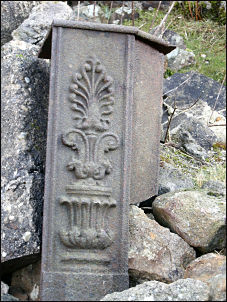
Part of the old cast iron fireplace in
the ruin |
|
There was no obvious path ahead so I
picked my way carefully to avoid some of the wet patches. I passed a
couple of the boundary stones shown on the map. They were square
sectioned stones with 'L' on one face and 'E' on the opposing face.
The two other sides had nothing on them. The ground underfoot wasn't
as bad as I was expecting and I managed to keep my feet reasonably
dry. In the distance was a wooden shooting hut below Knotteranum but
it was over the wall and not on my route so I didn't get chance to
check it out. The cloud was still low so there wasn't a great deal
to see. The hills of the Yorkshire Dales were lost in distant mist.
I reached the road at Bowland Knotts and crossed it where the cattle
grid is. I continued west and left the road behind. I hadn't gone
far when I noticed a wooden seat There was a brass plate on it
saying 'In Memory of Peggy Phillips' and underneath a smaller plate
saying 'John S Phillips 21.10.1913 - 4.11.1992' |
|
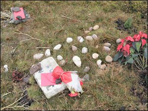
A grave on Bowland Knotts |
Close by was another memorial. In a
shallow hollow was a white stone with 'JOAN 2008' painted on it.
Plastic flowers had been left there and a couple of envelopes, one
having Joan + Nan written on it. It looked like a small grave but
there was no indication of who or what Joan was. I continued on my
way following the wall towards the trig point. The trig point is on
the other side of the wall and there is no stile crossing point
meaning that people have to climb over to visit it. An official
crossing point would mean less damage to the wall. I climbed over
and visited it and also got some good views down towards the Stocks
Reservoir area. My planned camp for the night was near an area shown
on the map as Knottend Well. It turned out to be a clump of rushes
with a small trickle of water in the middle. There was enough for my
needs and I camped just above. It had continued dull and grey all
day but the wind was very light so it was a quiet pitch. A little
rain fell during the night. |