|
|
Lat/Long: 57.071321, -04.037754
OS
Grid ref: NN 76470 99635
|
|
|
|
I reached the Ruthven Barracks car park shortly after 7am. There
were bits of blue as I set off and it was pleasantly warm. I
headed east along the road to Tromie Bridge firstly following
the footpath by the road then along a wide stretch of road that
had just been tarmaced. At the bridge I turned right and left
the adopted road and on to the main estate road. |
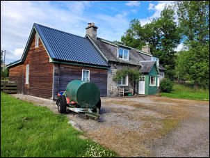
Keeper's Cottage. |
|
There was soon a sign saying no unauthorised vehicles. The road
was only stone but an excellent surface with a nice dry stone
wall to my left. The objective of the walk is to investigate the
north end of the old trade route from Atholl. I walked along the
glen by the east side of the River Tromie. A long way up the
glen is a pedestrian bridge crossing that was washed away some
time ago and never repaired. As far as I can see from the map
the only bridge crossing is at Woods of Glentromie. When I
reached the branch road over the bridge all was OK but wanted to
check if a crossing shown higher upstream was dooable. I
continued up the track to some buildings near the ford crossing.
I walked down to the river and could see the track on either
bank. The river near to me was wadeable but I couldn’t get a
full view of the far side. It was running fast but could be
waded. I returned to the road then back down the road to the
bridge I’d visited earlier. |
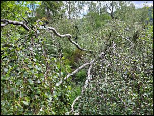
Terrible state of the path. |
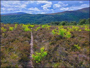
Over the summit. |
|
I crossed over and used the bench seat outside the keeper's
cottage to sit down and eat some food. This is the route I’d
planned to use so I crossed the field and started up the steep
hillside which was deep in undergrowth and shoulder high ferns.
The going was unpleasant and at one point a fallen tree had
obscured the path. The estate owners don’t seem concerned about
such paths so Have left it. |
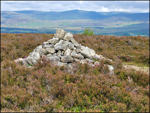
Cairn on the summit. |
|
|

Ruthven Barracks. |
|
Eventually I reached the high ground and the views opened up. On
the summit was a nice cairn with views ahead across to
Kingussie. Further on the original military came in from theleft
and I followed it down to a dilapidated barn and group of
walkers. From there it was an easy walk down the green track to
the Barracks. I put my bag in the car and walked up to the
Barracks which are now just a shell after the fire of 1746. |

Ruthven Castle before the Barracks. |

Ruthven Barracks. |
|
|
|
|
|
|
|