|
|
Lat/Long: 54.615477, -03.060213
OS Grid ref: NY 31630 24997
|
|
|
|
Driving north along the M6 the sky was mostly clear with very
picturesque clouds. By the time I reached Threlkeld the clouds
had rolled in. I was a bit earlier than usual and was the first
to park in the layby but shortly after I arrived another car
turned up and a young lady with a bike who set off riding along
the line of the old railway just before I started to walk along
it. |
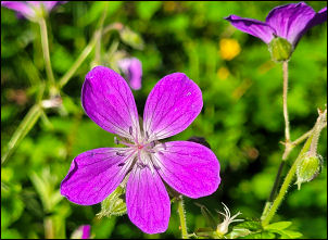
Mayflower. |

Roe Deer. |
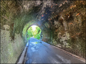 |
Old railwat cycle/walking route. |
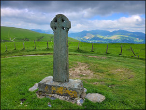
Shepherd's memorial |
|
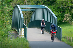
There were plenty of cyclists out as I walked along the track
towards Brundholme. I spotted a Roe Deer slowly wandering
through the tall grass and also many colourful Mayflowers. At
the shelter I left the track and joined the old road up to
Brindholme then the track up to the Skiddaw car park. Several
runners were also out. Many cars were parked when I arrived and
lots of people & families were on the main path up Skiddaw. I
reached the Shepherd’s Memorial cross and stopped for a while to
eat my sandwiches. Inscription on the cross reads: |
In loving memory of two Skiddaw shepherds
EDWARD HAWELL
of LONSCALE
Born Oct 21st 1815
Died Jun 2nd 1889
and
his son
JOSEPH HAWELL of LONSCALE
Born Dec 24th 1855
Died Feb 20th 1891Noted breeders of prize Herdwick SheepAlso to
ROBERT WALKER HAWELL
Born 16 Mar 1851 Died 29 Dec 1911
Great Shepherd of thy Heavenly Flock
These men have left our
hill
Their feet were on the living rock
Oh guide and bless
them still.
H.D.R |
|
A runner stopped and we had a short chat. He said he was heading
for Hall’s Fell so I told him it was the other way. He didn’t
have a map but said he had it on his watch! Another man stopped
to photograph the monument then continued over Skiddaw. He was a
tourist from Flanders. I continued up the main path to just
under the 600m contour where a minor path heads off to the
right. It took me up to Flag Pots and the fence line. |
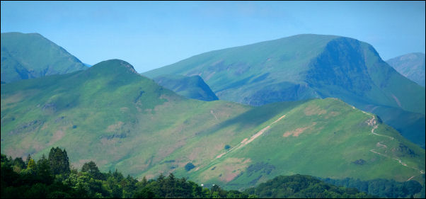
View towards Causey Pike. |
|
It was still overcast and felt cold in the strengthening wind. I
was glad I’d brought my gloves. I walked east to the main cairn
on Lonscale Fell then continued to the slightly lower summit in
the cliff top above Glenderaterra Beck. The weather was hazy so
the views weren't too good. |
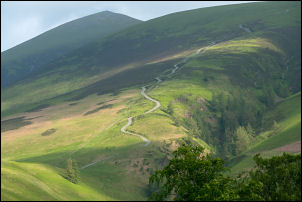
Track to Skiddaw. |
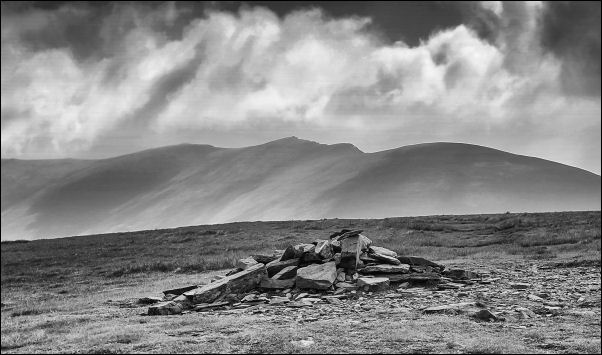
Lonscale Fell towards Blencathra. |
|
I followed the faint path NW along the top of the ridge to meet
the fence and descend steeply north and along Burnt Horse Ridge.
I reached the gat on the Cumbria Way and had a distant view of
Skiddaw House to the NW. I headed south along the path and met a
couple ladies heading north who were doing the Cumbria Way. They
were heading for Caldbeck today to stay in bed & breakfast then
continue to Carlisle tomorrow. I soon left the Cumbria Way to
cross Glenderaterra Beck and follow the east side of the valley. |
|
|

Distant view of Skiddaw House. |
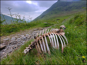
Dead sheep on the Cumbria Way. |
A vehicle was parked up and a man appeared from further up the
fell. The vehicle had:
Border Hydro Renewable Energy Systems.
www.borderhydro.co.uk
On the side and would have been
checking out the hydro building below. |
|
The track continued south and reached the tarmac by the
Blencathra Centre and steadily downhill towards Threlkeld. At
High Row Farm I left the road and heeded down across the fields
to Ings farm then the farmtrack down to the road and back to my
car. I don't know if it was due to being a Friday afternoon but
the traffic on the drive home was terrible. The roundabout at
Penrith was totally jammed then long tailbacks approaching
Preston |

Border Hydro Renewable Energy Systems |
|
|
|