|
|
Lat/Long: 56.952345, -04.211956
OS
Grid ref: NN 65483 86725
|
|
|
|
|
|
After a quick breakfast at Dalnaspidal I drove to the laybye
near the access track to Cuaich generating station. I didn't use
the laybye but parked on the wide verge to leave the laybye for
motorists. The weather was misty & overcast with heavy rain
forecast for later. I set off shortly after 6am heading along
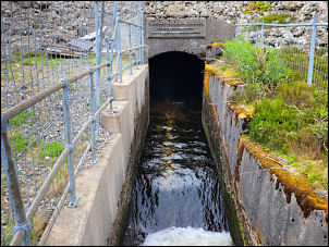
the track by the wide concrete watercourse. |

Cuaich Dam. |
Passing the main generating house I continued up towards Loch
Cuaich. A 4wd estate vehicle was parked on the track with a man
inside looking at something through a telescope. I said hello
but he didn't reply. I walked across the loch dam & followed the
undulating track along the west side.
The NE end of the loch
is the inlet side & I could see the tunnel portal that brings
water in from the distant Loch Seilich. Through a tall gate I
walked across to the inlet and was pleased to see a notice over
the concrete portal saying:
Cuaich - Seilich Tunnel
22,319
feet long
June 1938 - July 1940 |

Cuaich - Seilich Tunnel
22,319 feet long
June 1938 - July
1940 |
|
The weather was nice a |
|

|
The foundations of the depot, workshops & workers accommodation
can be seen.
I continued NE following the track heading
diagonally up the hillside. It was a steady climb up to the
highest point where a wide view of the hills opened up and I
could see the track descending and vanishing into the distance. |

Old foundations.
|
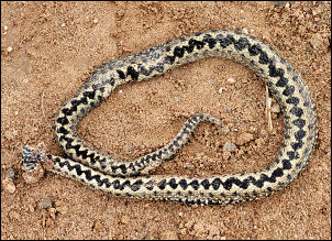
Dead Adder on the track
|

Phones or Phoines.
|

Towards
Ettridge
|
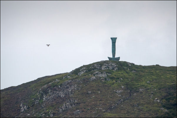
Interesting marker on the hilltop. |
|
There was no sign of the next buildings on the route which are
called Phones. This will cause problems for internet searches.
The 1860 map calls it Phoines. As the track approached the Falls
of Phones I could see Creagan an Fhithica outcrop up to my left.
There was a vertical structure on the summit but I couldn’s make
out what it was. I reached the lodge called Phones which the old
map calls Phoines. The private access road back to the A9 is
described as Wade’s Road on the map, presumably the line of the
old military road. I followed it to the buildings at Etteridge
and crossed the busy A9 to join the cycle track that took me to
the old line of the A9. I continued south along the wide but
mostly deserted road. Several cyclists came along, mostly
heading north. |
|
The weather deteriorated and for a while I needed my cape but
the rain wasn’t heavy. The road became increasingly boring as I
continued and was glad to see the bridge across the River Truim
in the distance. It is on a faint farm track and not a public
adopted bridge. I crossed over then through the buildings at
Cuaich and back to the car. I got back in time to avoid the
heavy rain approaching. |
|
|
|