|
|
OS Grid ref:
Lat/Long:
|
|
|
|
I was planning to catch what I thought was the first 125 bus to
Bolton at about 07:20am. I was eating my breakfast porridge and
checked on-line to see a bus was due in about 20mins at 05:54. I
rushed my final packing and walked up Shaw Brow to catch it. It
was on time. I got my ticket to Walker Fold Road End and started
my walk about 06:25am. I headed north along a misty Walker Fold
Road to a parking area on the left. There were seats and benches
but too early for families. It was also a pay for. I followed
the path which surprisingly had what looked like a car charging
point on it with no vehicular access. |

On the bus. |
Mist Walker Fold Road. |

Track to the Old Colliery. |
Old Brickworks on Winter Hill. |
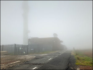
Misty TV Transmitter Station. |
|
The path swung to the left (west) along the line of the old
access to the long closed colliery. I continued up onto the moor
in thickening mist to the Winter hill TV mast access road. I
followed it to the buildings then further north turned off onto
the moor. There was little visibility but I’d previously gps
calibrated the map in Steve Morrins book on the Winter Hill Air
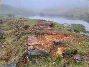
Crash on 27th Feb 1958. I was able to walk to the exact
locations of various parts of the wreckage. There is nothing at
all to see of it now. I was surprised how steep the crash area
is. |

First point of contact of the airplane crash. |
Using the Custom_Maps app on my phone I
had a calibrated map of the Winter Hill aircraft site showing
the plane fragments. The green arrow is my location near the
first impact point. |
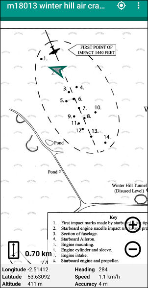
First point of contact of the airplane crash. |
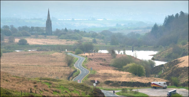
St Peters above Belmont. |
|
On reaching the first impact point I turned to the right and
descended steeply down to reach the path for the reservoir above
belmont. It's a little less wet than the main descent path to
Hordern Stoops. Over the footbridge I followed a little used
path up to the west that runs parallel to the road. After a
steep climb I joined the road and up to Hordern Stoops summit
where I turned north to follow the Spitlers Edge path. The first
part passes the source of the River Yarrow which is marked with
a stone and plaque. As expected the moor was wet but mostly I
was able to follow the line of stone slabs. Unfortunately some
have sunk into the mire over the years and soggy detours were
needed. More people were out and were a mix of walkers, runners
and mountain bike riders. I stopped for a while at the Great
Hill shelter walls and spoke briefly to 3 mountain bikers who’d
also stopped. They set off towards Drinkwater’s and I followed
soon after. |
|
|
Drinkwaters. |

Lost Phone. |
When I got there I met them again as one had punctured and was
just finishing the repair. I topped my water bottle up at the
spring. Descending through the woods near Brinscall I found a
mobile phone on the muddy track. I put it in a visible position
and thankfully as I descended 2 mountain bikers were pushing
bikes back up the track. "Have you seen a mobile phone?” Yes,
it's about 50m up the track.
At the bottom I followed the wet
path to the old railway line route then across the fields to
Blue Dye House. I soon turned right to follow the path up to
Monk’s Hill and join Briers Brow down to the Dressers Arms then
on to Wheelton, the canal towpath to Town Lane. Then a mile to
home. |

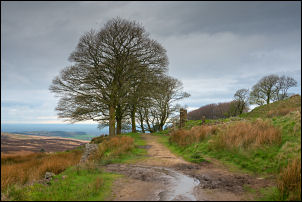
Woodsfold. |

Tenon Top Gatepost on Monk's
Hill. |
|
|
|