|
|
Lat/Long: 56.952345, -04.211956
OS Grid ref: NN 65483 86725
|
|
|
|
I’d spent the night near Dalnaspidal, hidden behind a pile of
spoil as the car park area was taken up by construction vehicles
as it looks like part of the cycleway is being repaired. There
was rain overnight and it was still raining when I temporarily
moved to Balsporran car park. I waited there until the rain
eased a bit then continued driving north to the start of my walk
at the entrance track to the Cuaich Hydro Power Station. It was
still raining a bit when I set off east along the unmade access
track. It rises then reaches a man made waterway of concrete
which was running full almost to overflowing. It is the Cuaich
Aqueduct and takes water by gravity to the River Truim near
Dalwhinnie. |

Aqueduct |

Cuaich Power station. |
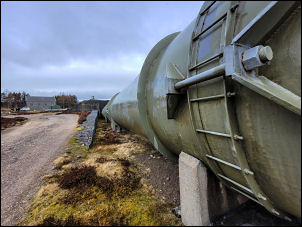
Pipeline. |

Pipeline. |
|
The track runs along the north side of the aqueduct all the way
to the Hydro Station building. It is interesting to note the
concrete struts across the top of the aqueduct to support the
side walls. There were some vehicles at the buildings and men
working. I stopped to ask one if he knew how old the building
was. 1930s he said. I turned right to follow a stoned track up
along the line of a large diameter pipeline I’m guessing 2m dia.
At the top of the rise it vanished into a large concrete block
and I can only assume it carries water from a tunnel under the
mountain. The track swings to the right then up into the high
valley and at the steep ridge edge becomes a quad bike track and
very rough in places. |
. |
|
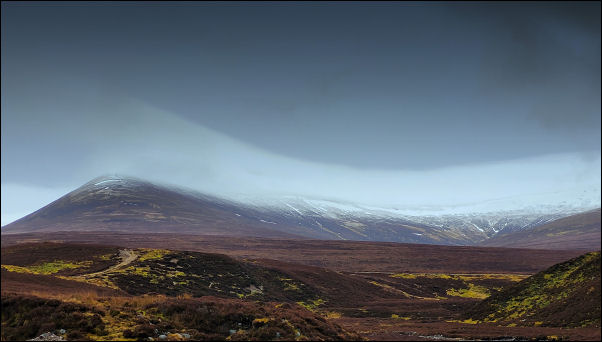
The earlier rain had stopped but I was soon in cloud and on he
highest point of the ridge it started snowing. There was already
a dusting of snow on the ground and thankfully little wind. |
|
Eventually I headed up by he ridge side to reach the Carn na
Caim summit and low cairn. I was here last month 8th Feb and
-10degC. Today it was 2degC. I followed a descent route to the
north over some rough ground with a faint deer track to follow.
I looked back and saw 2 people approaching the summit from the
SW, opposite direction to me. My descent continued and began to
get steep so I took a diagonal route to reach the head of the
stoned track. |

Quad bike track. |
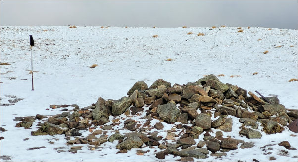
Carn na Caim summit
lat/long 56.911888, -04.173093, alt=946.9
m (3,107ft) |

View on the descent. |
|
There was then an easy mile walk to a side short cut track but
it petered out after a while but being on foot was no problem.
At the power station the men were still working as I rejoined my
original route and walked back to the car. |
|
|
|