|
|
Lat/Long: 54.615477, -03.060213
OS Grid ref: NY 31630 24997
|
|
|
|
|
After a dark rainy drive north along the M6 I reached
the old road by Threlkeld to dry weather but still gloomy and
overcast. Mine was the first vehicle in the layby parking and
there was still nobody about as I set off walking west along the
old railway footpath to Keswick. It was still very gloomy and I
needed my tripod to take some of the pictures. |
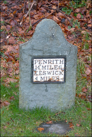
Milepost. |

Rivets on the railway bridge. |

Along the railway. |
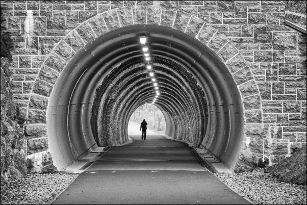
Bobbin Mill Tunnel. |
|
It wasn�t long before people started to turn up and there was a
steady stream of walkers and runners coming both ways. It was a
bit drizzly when I arrived at the old railway Station so I
stopped to have my sandwiches. There were no seats under the
platform roof so I had to sit on a wet seat outside the
sheltered area. I continued along the lane to the turn off up
Spoonygreen Lane and that was very busy with walkers. |

Bobbin Mill Tunnel. |
|
|
|
|

Keswick Railway Station today. |
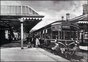
Keswick Railway Station before
closure. |
|
I continued steadily upwards until I came to a junction of
several paths. I took the right path up through the trees to a
forest track and eventually reached a path turn off that headed
straight up the fell. I was annoyed to see the metal gate was
chained and padlocked. Adjacent was a stile with a very high
step up. I followed the path steeply up to a flat area with a
bench and a nice viewing area. |

Locked gate. |

Derwentwater view from Latrigg. |

On Latrigg looking to Blencathra. |
Seen on a sign by the path:
William Calvert - an
agricultural leader.
In 1814 William Calvert, of Windebrowe,
attempted to grow corn high on Latrigg.
After building a wide
track, he ploughed the top of the fell! He was a keen chemist
and innovator but this time his experiment failed. |
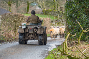
Herding sheep along the lane. |
|
The grass was extremely slippery on the last bit of the climb.
The path continued up to the actual summit which was a long flat
area with a slight dip. It was hard to judge which was the
highest end. 368m (1,207ft). The descent continued steadily down
in an easterly direction. Eventually I joined the track coming
down from the main car park and down to Brundholme. I then had
options. to join the railway path and a flat direct route to the
car. Or continue up the lane to Wesco. I took the Wesco route as
it gave me nice views of Blencathra from the lane. |
|
|
|