|
|
OS Grid ref: NY 31588 23213
Lat/Long: 54.599335, -03.059063
|
|
|
Slight drizzle as I drove north along the M6 to the Penrith
junction, where I got off & turned west.to head towards Keswick
then south to Wanthwaite. I parked in a small muddy laybye
between the road and hedge. The first part of the walk was south
long the road towards St John’s in the Vale. There were signs of
fallen trees being cleared after last Friday's storm Arwen. I
reached the entrance to Fornside Farm where I saw a prescriptive
path sign on the gate. |

Bridge near Bramcragg |

Treehouse. |

Well engineered path. |
The Ordnance Survey map doesn’t show a public right of way but
apparently it's shown in Wainwright's book Eastern Fells - Great
Dodd 7. Along the access drive were some farm vehicles but the
path turned left before reaching the main buildings. Through a
gate the path swung to the right and passed an impressive tree
house halfway up a tree. A gate in the wall higher up took me up
to an old path steeply up by the riverside. For a while the
gradient was along a diagonal route then steeply up a zig zag
route. It had been cut trough rock in places and must have been
of some importance in the path.
==
Wainwright says:
“One cannot but wonder at the industry of those who engineered
paths such as this.”
==
It's a shame that the weather was
overcast and gloomy as the views down to the valley and across
to Keswick were impressive. The track eventually petered out and
I was interested in finding out what a small square was on the
map. It turned out to be a very old and collapsed sheepfold but
was down to ground level so no standing walls. Up ahead I could
see calfhow Pike jutting up from the fell. It was now windy and
cold at just around 0degC. he path was now a firm way through
the grass until I got to the rocky outcrop where I managed to
find some shelter on the east side. I stopped for a while to
have my sandwiches. Up ahead to the north I could see Clough
Head which was my next objective.
Wainwright commented on
the climb as follows:
“This route is very rarely used. It is
steep as far as the sheepfold but there is recompense in the
lovely view of the valley above for Fornside. Thereafter it is
monotonously grassy with only the oddity of Calfhow pike to
relieve the tedium of progress.” |

Sheepfold. |
There was a descent on the way and many patches of ice on
the path. The rise up to the trig post at 725m was steady and
easy but cold with the cross wind. At the summit I turned
sharply left to head down towards Bennesty Knott and the start
of the descent across Red Screes. Many years ago I camped nearby
close to Jim’s Fold (sheepfold).urther down I met the p |

Sub-zero. |

Clough Head trig post - Blencathra in the background. |
|
The diagonal descent path is a steady gradient but the steepness
of the slope is severe in places. At the bottom an ancient track
took me down Wanthwaite Bank to Hilltop Quarries The large flat
area is where the old Mineral Railway ran. All the quarries have
been closed for ages and there were several along the vale. I
reached the old coach road where I saw more signs of storm
damage with freshly cut logs stacked up by the track. Further
down I saw the first person of the day when a lady runner came
up the track. I was soon back at the road and a short walk to my
car. |
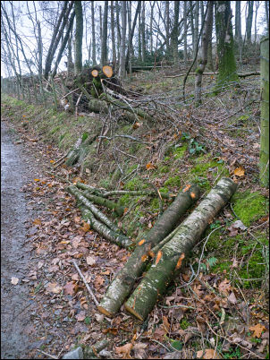
Cleared storm damage. |

Site of old Mineral Railway |
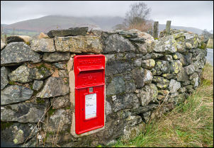
Wanthwaite, bright colour on a
dull day. |
|
|
|
|
|
|
|