|
|
OS Grid ref: NY 36478 30026
Lat/Long: 54.661294, -2.986240
|
|
|
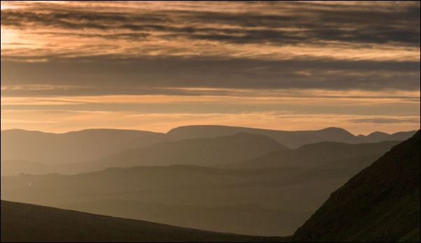
A cold clear drive to Mugrisdale where I parked on the grass
verge south of the village hall. There was already one car
parked there but nobody was about. I crossed over the wooden
footbridge to the Mill Inn then along the road to the gate
towards Bullfell Beck. It was a picturesque walk along the track
with the sun catching the east face of The Tongue. |

Morning sunshine. |
|
|
|
Along the path of stone slabs I came to the wooden footbridge
over Bullfell Beck and immediately left to the deteriorating
path along the River Glenderamackin. The main path heads up
towards the north end of Bannedale Crags and must have been
misleading for many who were heading for Scales Tarn or Scales
Fell. The path by the river needs several detours and some
sections have been washed away and no longer exist. |

Heading up Bannerdale East Ridge. |
View on the climb. |
|
By climbing up the fellside I was able to avoid the worst of the
wet ground. I had to cross Bannerdale Beck up ahead and on
previous visits I’d waded across due to recent heavy rain. I was
relieved to find its level relatively low and I was able to step
across the boulders and immediately start the steep climb up
Bannerdale East Ridge. The path is good and an easy steady
climb. As I got higher I could see Bannerdale opening up below
and the west face where I was heading. |

Stone platform by the mine. |
|
My objective was to try and find more old mine workings. I could
see a high level sheep track traversing the head of the valley
and left the comfort of the easy path up the ridge to descend
and cross some slate scree to join the sheep track. It headed
toward my first objective of what seems to be called the
Graphite level. I followed the sheep track to the grid
coordinates I’d found from the map. I couldn’t see anything
obvious until I looked up the steep slope above and noticed the
stone wall of a platform. |
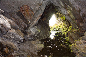
Looking out from the Graphite Level Mine |
|
I scrambled up onto the platform where a tree was growing out
and just above was the entrance to the mine. It was open and
easy to walk in but only about 10 or 15m long. From inside the
view looking out over Bannerdale was impressive. I continued
along the track to try and find another mine shown on the map.
When I arrived at the coordinates I found a very small trial
excavation which didn’t even penetrate more than a metre. My
original plan was to continue along the contour and join the
path coming up from the north side of Bannerdale. |
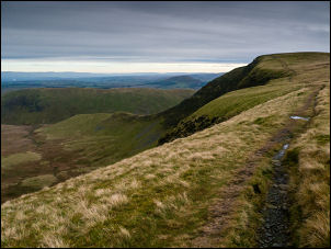
The path above Bannerdale. |

Ice on the fell top in the form of contours. |
|
The slope up ahead didn't seem too bad so I decided to take a
diagonal route up to the path along the rim of Bannerdale. It
was a bit steeper towards the top and I probably should have
traversed a bit lower first. At the top I followed the path
north towards Bowsacle Fell. The temperature was 0degC and
hardly any wind. Fortunately most of the very boggy areas wee
frozen so I was able to get across OK. At the stone shelter on
Bowscale Fell I met a walker coming up the other way. |
|
I followed the path to the NE which heads to Raven Crags. I
didn’t go too far, just to the first rise with a small cairn.
Here I took a direct line down to the north descending the ride
between Bowscale Tarn and Drycomb. There was no path but it was
a steady descent. I’m puzzled that people don’t use this route
more often. I reached the main track between Bowscale Tarn and
Bowscale houses and turned right to descend down to the road in
the village. |
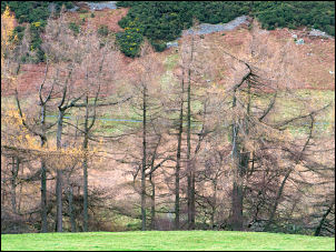
Trees on the approach to Scales. |

The Old School House, Mungrisdale.
|
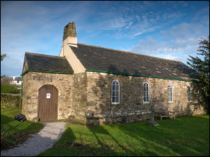
Saint Kentigern's Church in
Mungrisdale. |
|
I followed it back to Mungrisdale and took the path across the
field to the Village Hall where I descended the steps down to
the road and back to my car. |
|
|
|
|
|
|
|