|
|
OS Grid ref:
Lat/Long: 54.6799230,-3.0055320
|
‘Essential journeys only’ is still displayed on the motorway. I
returned to Mosedale and parked on the grass verge a short
distance to the west. Nearer the village the grass verge has
been churned to a muddy mess by workers vehicles working on the
adjacent farmhouse. It was overcast as I wandered north along
the road towards Quaker Hill.
|
|
There were no unfriendly locals around like last week. A woman
overtook me on an electric bike and said hello, presumably a
local. I made a detour across some very wet ground to inspect a
couple of mine adits and spoil heaps. There was no access as the
entrances were collapsed. The old map says ‘Copper Mine’. I
reached the ford and crossed by the footbridge. |
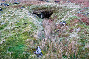
Copper Mine adit. |
|
|

Looking back along the road. |

Another view from the road. |
|
Instead of following the path through the gorse that’s shown on
the map I continued a short way and followed a well used path
with horse tracks up to the miners track. The weather had
improved and the higher part of the Carrock Beck valley was in
sunshine. It was very pleasant as I walked up to Willywood Well
which I visited last week. When I got there I decided to stop
for a while and eat one of my two sandwiches. |

Willywood Well. |
Heading up the miner's track. |
|
There was some sunshine higher up but I sat in shade. I
continued up the track to a minor branch off to the left that
headed to a ford and up Red Gate track. Carrock Beck was running
high but there was a narrow point where I could hop over. Red
Gate track continued up the hill and I soon stopped to eat my
last butty. The track continued up and was well defined due to
centuries of use. |

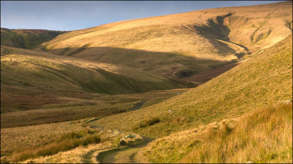
Looking back down Red Gate track. |
|
The views opened up and I stopped to look down on the ruin of
the smithy and across to the Driggith Mine spoil heaps. I
reached the high point on the main Carrock path and turned
right. My original plan was to head west to the Cumbria Way path
but decided to follow a faint path across to Drygill Head. I was
soon on pathless fell but the going was quite easy. |

Driggith Mine in the distance. |
I met the main path and tuned left to continue to the Ligy
Hut. So far I’d only seen walkers at a distance and still had
the place to myself. I peeked inside then left to descend
directly down to the SE. |

Lingy Hut. |
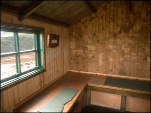
Inside Lingy Hut.
|
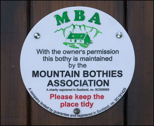
Maintained by the Mountain Bothies
Association. |
|
I continued upwards to t |

View down from the Lingy Hut. |
|
I followed the minor |
I reached the Carrock Mine aea and stopped to look at the
information board. A couple came up the track on electric bikes
and stopped to look around. I pointed out the excellent
information board then continued walking down to the road. I was
surprised to see only one car parked by the road. I continued
back to my car near the village. |

Illustration from the information board. |
Some text from the Carrock Mines information board.
==
Mining has taken place at Carrock for over 150 years. Deep
underground, miners extracted lead, arsenic and Tungsten ores.
Over ground, the ores were crushed and washed to extract the
valuable minerals. This is the only example of a tungsten mine
in England outside Cornwall.
There are five important mineral
veins at Carrock Mine. They are called Wilson, Smith, Harding,
Waterfall and Emerson. The most important ores mined here were
Wolframite and Scheelite, which made tungsten. The Emerson vein
was the first to be worked. It is named after miner F. W.
Emerson who first mined for lead here in 1852. In the 20th
century the Harding vein was the most productive.
==
Miners often referred to tungsten as 'wolfram'. The name is said
to have come from early German miners who called it 'wolfart,
wolfert or wolfrig'. They saw that tungsten ‘ate up the tin
among which it was found as the wolf eats up the sheep’.
==
“Your wolfram is wundershön - more than wonderful - far better
than all your Lakeland scenery!”
German prospector before
World War I.
Carrock Mine was managed by two Germans, William
Boss and Frederick Boehm, from 1906 to 1912. Germany was quick
to understand the importance of tungsten and its use in making
weapons and munitions. In the early days of World War I several
'sturdy Cumbrians' mistakenly captured a geologist from the
Geological Survey at Carrock Mine. They believed he was a German
spy. They confiscated his plans and tools, 'roughed him up a
bit', reported him to the police and bundled him into the local
school room for the night.
==
The Uproar of machinery and
stir of busy endeavour
What was it like to work underground
here? George D. Abraham, author of the Complete Mountaineer
visited the mine in 1917 and described what he found:
'Wonderful crystals and rare minerals glistened in the low,
narrow, rocky walls, and now and again, when the openings to
upper galleries were passed, the songs of miners echoed in the
silent gloom. Superfluous clothing was quickly discarded, for
compared with the chilly outer air the warmth was remarkable'
from The Autocar, 27 January 1917
==
Mining stopped here
in 1981. Many of the surface remains were demolished or
flattened. In 2007 The Cumbria Amenity Trust Mining History
Society (CATMHS) began a long-term programme of surveying,
recording and managing Carrock Mine - over ground and
underground. Their work continues today. Find out more at:
www.catmhs.org.uk
== |
|
|
|
|
|
|
|
|
|