|
|
OS Grid ref: NY 23531 35084
Lat/Long: 54.704940, -03.188239
|
The first part of my drive north to Cumbria was difficult in
the dark and rain along the M6. By Shap the conditions had
improved a bit. I left the motorway at Penrith and continued
past Bassenthwatie to the small muddy parking area below Binsey.
I was surrounded by mist and no views of the mountains. |
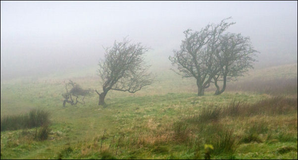
Starting in the mist. |
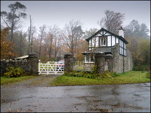
Binsey Lodge.. |
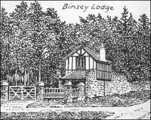
Binsey Lodge by Wainwright. |
|
This was |
|
Rain threatened but hadn’t started but I put my waterproof
leggings on anyway. I set off for my first objective of Latrigg,
not the main one near Keswick but the slightly lower one to west
of Scawthwaite Close. I followed the lanes towards Over Water
but before reaching it turned left to head up a muddy track
between an avenue of trees. The right turn heads to Overwater
Hall, a hotel. Heading up the lane there was no view due to low
cloud. |

Trees towards Latrigg. |

Ordnance Survey bench mark on gatepost.. |
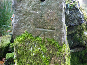
Ordnance Survey bench mark on gatepost. |
|
I came across a stone gatepost on the right with a nice OS
benchmark carved on the west face but a later check on the old
maps didn’t show it. NY 24117 35115 Before reaching the road I
left the path and turned right to head off across the very wet
open field. There was only mist ahead as I followed a fallen
down wall until I came to the summit. There was a small cairn
but no views. A brief cap in the cloud revealed a couple of
standing stones in the distance. |

Latrigg cairn. |
|
|
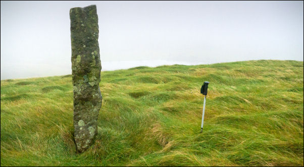
Standing Stone on Latrigg. |
|
Because of the mist I couldn’t judge how big they were so I
wandered over to investigate. The largest was about 2m high and
stood on its own with the smaller on to the right about 20m
away. They went part of a wall line and I've no idea what
purpose they serve. I was close to Scawthwaite Close Farm but it
was down a steep bank and wasn't visible. |
|
I wasn’t on a public footpath so decided to leave the fell
unobserved. Heading north I came to a fence and gate then down
to the farm access track to the road. I turned left to head
towards the next path but before I reached it noticed a gate
across the valley that would get me to the Ruthwaite Road and
save some needless road walking. I crossed the field and noticed
an animal trap on the way. I was baited with a couple of dead
birds so I assume it's for foxes. |

Latrigg cairn. |

Looking back to Latrigg. |

Stone arch. |

Stone arch date stone probably 1885. |
|
I continued to Ruthwaite and turned left along the narrow lane
to a point where it turns right. Here there is an interesting
stone arch across Mell Beck with a date on the top. It looked
like 1885. I continued along the leafy lane with the Ireby
Grange estate to my left. The impressive estate access gate on
the left was closed with a Private warning. |

No entry. |
I could see some of the access steps to what was the
High Ireby Grange House. Nothing is left of the building that
was burned down in 1957. |
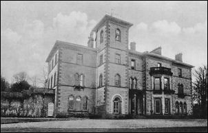
Ireby Grange in better times. |
An on-line search gave the following information:
The
mid-19th-century Ireby Grange was destroyed by fire in 1957. The
house and estate was acquired in 1841 by Henry Granger, a London
merchant, who in 1870 sold it to John Boustead. By 1906 it was
transferred to James Gurney, and by the 1930s was largely
unfurnished, and run-down when Hugh Walpole visited and decided
to set the house as The Fortress, one of the four stories in his
The Herries Chronicles novels. The glass plate photographer was
Henry Mayson (1845-1921), who was born in Keswick and who set up
a photographic studio there in the 1880s, producing postcards
under the 'Mayson Series'. His work concerned the landscape and
people of the Lake District. |
|
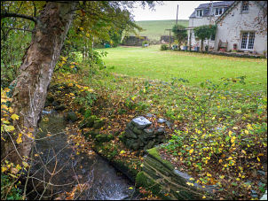
Further along the lane I came to an overgrown trough in the wall
and stopped to take a photo. A lady came down the lane and we
stopped briefly to chat. She said the High Ireby Grange House
used to have its own hydroelectric generator. Wainwright's
Northern Fells book says Ruthwaite was the home of John Peel the
huntsman (1776-1854) for most of his life. |
|
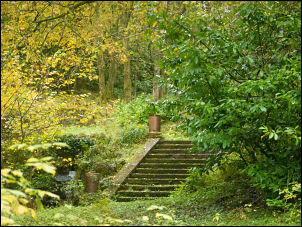
Ireby Grange steps. |

Trough by the road. |
|
|
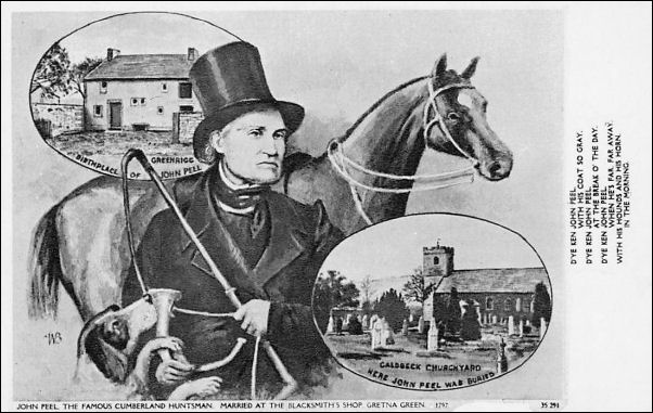
John Peel the huntsman (1776-1854) |
|
|

Another bench mark. |

Bench mark. |
|
There was a |
|
I left the village along a narrow muddy lane heading NW. A sign
says ‘closed’ but I assumed it referred to vehicles so
continued. Eventually it deteriorated and would only be passable
with a tractor. I found another benchmark on a stone gatepost
and took a photo. At the road I turned left and after a short
way came to Beck House cottage by the bridge and brook. I’d come
this way so I could comment on the wonderfully named Humble
Jumble Gill. |
Humble Jumble Gill in the
foreground. |

Trees by Humble Jumble Gill. |
The adjacent fields are Snittlegarth Park. A short way on
was an interesting hexagonal property on the right. It was well
maintained but nobody seemed to be in. There was an inscription
in the stone lintel over the door but I couldn’t read what it
said. |

Hexagonal house. |

Stangerhill |

On Stangerhill. |
|
|
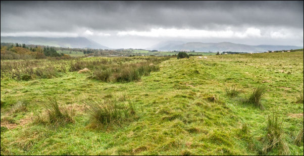
I continued along the road passing Stangerhill on to the
site of Caermote Roman Fort on the right. I went into the field
through the gate and walked round the rite before returning to
the road and up the track towards Binsey. |
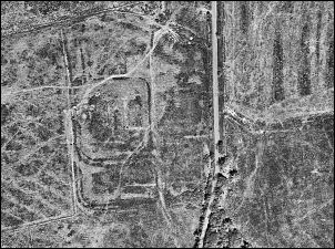
Caermote Roman Fort from the air. |
Caermote Roman Fort.
The 1st-century monument includes two
turf and timber constructed Roman forts at Caermote;
specifically a large early fort and a smaller later fort built
within the earlier fort. There were limited excavations at both
forts in 1901 and again in 1959. During this initial period of
occupation it would have been garrisoned by a unit of auxiliary
troops about 500 strong employed in policing the area, and in
particular controlling access into the northern Lakes. The
garrison appears to have been reduced in size after a short
period of time hence the construction of a smaller fort within
the defences of the earlier. The excavations revealed evidence
of lead production. |
Standing on a rampart of Caermote. |
I stopped by the chimney flue and fireplace in an alcove cut
in the hillside. It's an interesting spot but I couldn’t find
out anything about it. Wainwright covers Binsey but makes no
mention of it. |
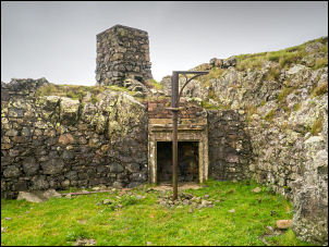
Fireplace and flue. |
Heading up the fell the distant Binsey was hidden in the
mist but as I approached the summit I could just make out the
stone shelter circle, trig post and summit cairn. |

Gate to Binsey. |

Binsey summit in the mist. |
|
|
|
There were a couple of walkers there and they left just as I
arrived. With no views I continued east on the easy descent.
It’s my third visit and previous visits had the same weather. I
was soon back at the car and enjoyed taking off my wet boots and
socks for something more comfortable. |
|
|
|