Lat/Long: 54.589845, -03.366467
OS Grid ref: NY 11798 22487 The weather forecast was
bad with strong winds and heavy rain due along the west coast of
Cumbria later in the morning. My planned route is a walk I did
in Mach 2007 over Blake Fell. I decided to reverse route and do
it clockwise and try and get to the summit as soon as possible
and hopefully avoid the worst of the weather. I drove to the
parking verge at the west end of Loweswater and set off along
the path crossing the fields to the road to Hudson Place.
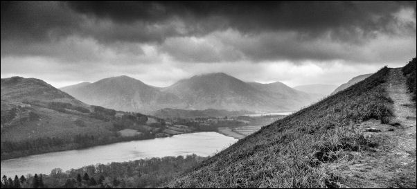
Gloomy view across Loweswater
Reaching the Old Corpse Road
I turned left down the stony track that heads towards Holme Wood
and Loweswater. I descended it for a while until I came to a
gate on the right. Over the gate I walked up the lower fell,
through a gate and steeply up the fell side to reach the Old
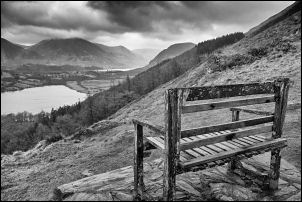
Corpse Road above. I turned left to the bench at the viewpoint.
The viewpoint
I managed a quick grab shot but the wind was getting up with rain
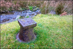
in the air. I continued to Holme Beck and photographed a water
valve lid in the grass before heading up the fell to join the
fence line running up towards Carling Knott. Approaching the
summit I took a line to the left to traverse Carling Knott to
the east and get better views across to Mellbreak.
I Climbed the last few
metres to the summit and small cairn then headed SW along the
ridge towards Blake Fell in the distance.
Water valve box
Fleetwith Pike centre distance
Useless stile
I was surprised that a I
could still see it in the deteriorating weather. The wind was
getting much stronger but thankfully the heavy rain hadn’t
arrived. Before the summit of Blake Fell a substantial fence has
to be crossed. All there was to aid the crossing is a rickety
stile that collapsed as I tried to climb up to it. On the final
approach to the summit the wind became rather serious and to
take a summit photo of the cairn had to kneel down as standing
up was impossible.
Blake Fell photographed from a
crouching position
It’s times like this that the efficiency of good clothing
becomes very important. Trying to zip up my jacket was extremely
difficult in the wind and the 2 degC temperature didn’t help. I
rushed off to the south and High Pen as fast as I could in the
side wind. On the steep descent of Low Pen I eventually stated
to find better weather.
Looking down to Cogra Moss
Below the pines I reached the forestry track but didn’t follow
it as my descent route was by a narrow and rutted path down to
the track by Cogra Moss. Near the dam that forms the expanse of
water was a parking area and seats. However access is only for
anglers. The reservoir was dammed in the 1980s to form a water
supply but hasn’t been used for that purpose since the 1970s.
Cogra Moss from the dam
I followed the unsurfaced track to a gate and memorial stone
seat to: Ronald F. Dickinson (1916-1985) By the Parishioners
of Lamplugh and Ennerdale in recognition of his services to the
Community.
Ronald F. Dickinson
Stone memorial seat
At the next track I turned right down a muddy lane to
Dockray Nook farm. The path continued through fields and
this where I found my first decent shelter of the walk. I
stopped behind a wall to eat my sandwiches as the rain
arrived. There was an easy ford at Wisenholme Beck then a
sign saying ‘No Access to the Open Fell’. Fortunately I had
the public path to follow back to the road by the church at
Lamplugh. The rain was now heavy and wind strong so didn’t
have a look at the church. I followed the lane off to the
right and was relieved to see a sign saying Loweswater 2 ½
miles. In the bad weather there was nothing for it but to
head along the lane as quickly as possible. There was an
interesting finger post at the top of the wonderfully names
Fangs Brow. At the bottom was the Grange Country House Hotel
then just a short walk back to my car.