|
Loweswater, Carling Knott, Blake Fell, Gavel Fell,
High Nook Farm, Cumbria. |
|
|
Lat/Long: 54.577105, -03.340497 OS Grid ref: NY 13449 21037 The weather forecast was variable with showers late morning for Northern Cumbria. It was quite warm as I drove north along the M6 to Penrith where I turned off west and returned to the small car park at Maggie's Bridge near Loweswater. My plan is to walk up Carling Knott which is a route I did way back in March 2007 but then it was from the other direction as I descended to Holme Beck. |
 By Loweswater |
| I set off in misty and overcast weather along the track to Loweswater and Watergate Farm. Immediately through the gate is a narrow path heading diagonally up through Holme Wood. It is a very pleasant climb steeply up to the high track at home Beck. This track is one of the popular walking routes around Loweswater. |
 Mellbreak |
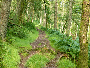 Holme Wood |
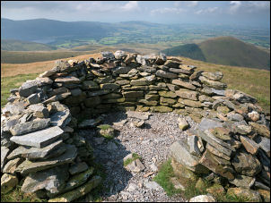
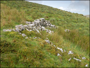 Possible sheep shelter |
| Open Street map calls it the Corpse Road but the Ordnance Survey map doesn’t. I followed it a short way towards Holme Back where I turned left to head up the north west flank of Carling Knott. There is no defined footpath here but I soon found a quad bike track which took me up to a gate in the fence. |
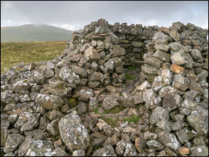 Carling Knott shelter |
| Through the gate I followed the fence steeply upwards and then onto the open fell to reach the lower summit at 519 m. Nearby was a depression in the hillside and an old wall which could have been a sheep shelter. There was a small cairn but up ahead I could see a higher point where there was a substantial stone shelter. It was very well constructed and must have been there a long time | |
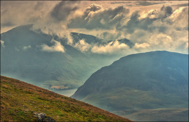 Grasmoor and Mellbreak |
|
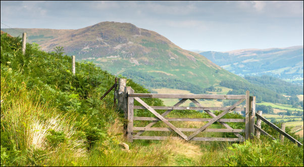
| Up ahead I could see Blake fell which was my next objective. The path was excellent and so were the views. I had rocky outcrops to my left and I found shelter from the wind behind one to have my sandwiches. It was extremely enjoyable with superb views of Mellbreak and all the fells behind. The path crossed a boggy area and then up to a high fence with a style that couldn't be used due to one side having deteriorated. There is a path which diverts away from the summit but I decided to climb the fence and up to Blake Fell shelter stones. |
 Blake Fell shelter |
| Although I was here last week this time there were better views as the weather had cleared a bit since leaving the car. I started my descent down to Fothergill Head and then follow the path up to Gavel Fell towards the summit. On the way I passed a couple of stone marker posts but close inspection didn't reveal any inscriptions, however they are on the boundary line. I was now following the route of a walk I did in April 2018 and once over Gavel Fell summit turn left and climbed the fence to cross a flat boggy area then a steep descent and easy descent until I reach the line of an old track which I followed along the contour north. | |
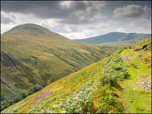
 On the track above Whiteoak Beck looking towards Loweswater Fell |
|
| After the first section of track it became much easier and extremely pleasant walking especially with the views of the fells ahead. As I approached High Nook Tarn I saw the first people of the day. Up to my left where a couple climbing up the route I'd been on last week and ahead I could see walkers on the path heading to the east of Carling Knott. |
 Looking back up the track to Hen Comb |
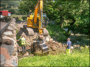 Working on the bank last week |
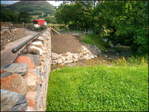 Embankment completed |
| I followed the main track down and through High Nook farm-yard just below is the repaired bridge I stopped at last week to watch the workmen setting boulders into the bank side. I was now able to see the results of their work which looked quite good and the spot where the machine was had been top-soiled and tidied up. It was then a short walk down the track to Maggie's Bridge car park and my car. It is a shame that the donation box for the car park is not sign posted as I'm sure people would make a donation if they knew it was there. | |