|
Loch Rannoch, Meall Breac, Glen Sassunn, Scotland. |
|
|
Lat/Long:
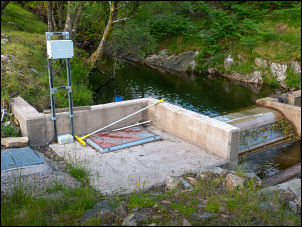
56.693135, -04.190658 OS Grid ref: NN 65937 57856 Drove to the small parking area on the east shore of Loch Rannoch and set off walking along the road on the west side of the Loch. I soon reached a gate on the left which is where I left the road to follow the track up between the trees and by the burn. The map shown the track ending up ahead and I wondered what it could be for. As I approached the end I saw a vertical flanged pipe ticking out of the ground and just behind it a concreted dam and weir in the river. |
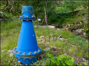 Storage tank vent |
| It looked like a water supply intake but could also be an intake for a hydro power generator below. A later on-line search showed that it is the Allt DruidheHydroelectric Scheme constructed around 2014. The track ended here and I now turned straight up the hillside in a south east direction. It was a steep steady climb and thankfully the ground wasn’t too wet. |
 Intake |
 Looking down to Loch Rannoch |
|
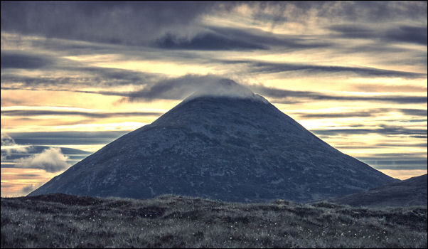 Schiehallion looking impressive |
|
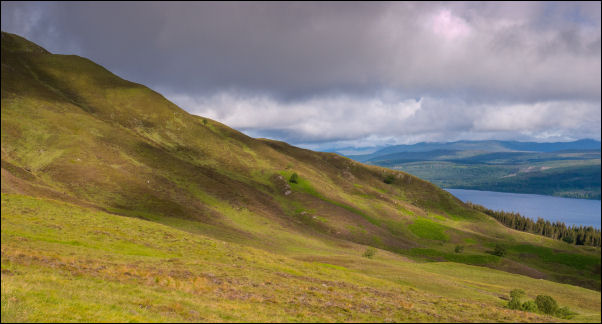
| The weather was fine and I had good views of Loch Rannock as I continued up and over a couple of false summits. The highest point on my walk is Meall Breac (Speckled Hill) and I thought I could see it up ahead with a cairn on top. I headed for a ridge ahead and when I reached it had a nice view of Schiehalion. The ridge was flat and boggy in places but as I arrived at what I though was the summit I saw the actual summit some way ahead. |
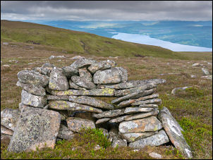 Cairn and Loch Rannoch |
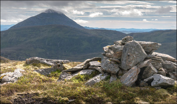 Looking back to Schiehallion |
|
| I was following a fence over the summit and had to make a detour to reach the actual summit cairn at 809m. I started my descent by re-joining the fence but as I was heading for Glen Sassunn directly below I started my descent almost immediately. The glen side wasn’t too steep and wasn’t difficult. Across the valley bottom I reached the route of a track which I followed down to the Sassunn Bothy that I’ve visited before. |
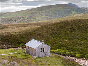 Glen Sassunn Bothy |
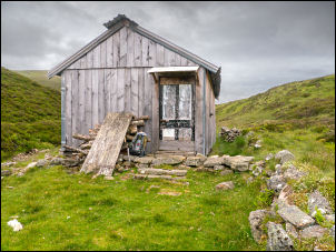 Bothy exterior |
 Bothy interior |
| I went inside and was concerned about the door catch and bold which weren’t working too well and I had difficulty getting the door to shup properly. Inside was cosy with a fine stove and lare pole of wood. Another pile of wood was stacked up against the bothy wall outside. I rejoined the track and noticed several old shielings around. Even the hut is built in the confines of an old shieling. I rough stone hut was up by the track but the roof had long since fallen in. Nearby was a dam and weir in the river and I commented on this during my last visit almost 2 years ago. I couldn’t see an outlet pipeline for a water supply so not sure of its purpose. | |
 Colour at Innerhadden buildings |
|
| The track down seemed to take a long time but I eventually reached Innerhadden building by the road then tuned left for the mile walk back to the car. | |