|
Swindale, Old Corpse Road, Naddle Beck, Rosgill Moor,
Cumbria. |
|
|
Lat/Long:
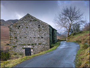
54.521120, -02.740837 OS Grid ref: NY 52144 14233 A dark drive north along the M6 where I left at Shap to turn west through the village and via the lanes to Swindale Valley. There is a small car park area by the single-track road at the east end of the valley. Just after this is a sign saying no parking on the road further on. It had come light when I set off to head south west along the road. I passed the water intake weir and on to Truss Gap farm buildings and on to a point where a rough track turns off left. |
 Fox on the way |
 Heading up Swindale |
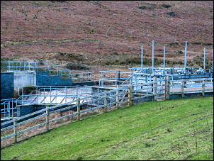 Water intake |
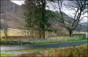 Site of Swindale Church and School |
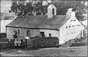 Swindale Church and School |
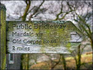
| This was the location of the Swindale Church and School. All that remains is a low pile of rubble behind the wall. I have a picture of the school from an old postcard showing the building, children and teacher. I did my best to take a photo of the same view. There was low cloud as I continued along the road and it still felt quite chilly. The road ends at Swindale Head where I turned right to follow the sign saying Old Corpse Road. |
 All that's left - a bit of rubble |
| The path heads up a wet and partly muddy grass track to a ford where the track gets even worse and extremely wet. A sharp left turn took me up the fell to another ford which wasn't very obvious as a point that needed crossing. After that the track was in better condition and easier under foot. Near the summit I stopped to take a photo looking back down the way I'd come. I continued over towards the summit and left the track to turn right across open fell which still had several snowfields lying on the ground. |
 Heading up The Old Corpse Road |
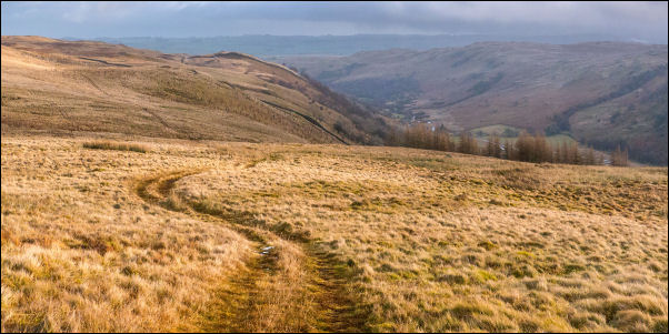 From the Old Corpse Road looking down Swindale |
|
| My first objective was to have a look at a minor summit called Brown How which I passed and started my descent to the north east across some very boggy ground to Aaron's Beald which is a ruined stone wall rectangle. It was difficult finding a way down to avoid the running water coming off the fell. I reached a track at Guerness Gill which crosses the gill buy a small stone bridge which has a steel pipe carrying the water underneath. A little downhill is a 12 inch cast iron pipe. The continuing path to the north east started off quite good but soon vanished completely and there was nothing on the ground to follow. |
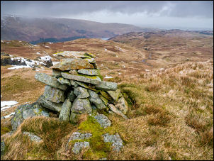 Looking towards Haweswater |
| There were the occasional concrete marker posts for the pipeline I’d seen earlier. The gloomy weather was quite windy and the rain started with a vengeance. I hurriedly put my waterproof trousers on and continued walking along the line of a stone wall. The map I was using appears to cross the wall but there was no stile or crossing points. I stayed with the wall until I found a gate through which I was able to regain my original planned route. Off to my right is a route I've walked before that follows a wall over Harper Hills. I turned off left to follow another non-existent track down into Naddle Beck. |
 MCWW Manchester Corporation Waterworks |
| It is shown on the map but there is no track of any kind on the ground. At High Forest the route crossed a river where I saw an interesting ‘V’ notch weir fitted in the river to monitor the flow. However there was no level recording equipment. I set off down the stream and turned left to head for a gate across some terribly boggy ground. After passing through two gates I noticed one of my gloves had dropped out of my pocket so I had to return almost a kilometre to the v-notch Weir. |
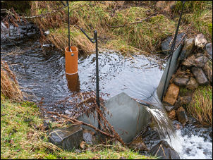 Makeshift V notch |
| That was where I'd taken my gloves off to take a photo. I hadn't seen the missing glove so I turned round to follow my GPS route that I'd recorded earlier. Fortunately on the way back I found the glove lying on the heather. I continued through the gates where I came to a stone a track that took me down to Naddle Farm. Before the farm buildings I turned right to take the track over Naddle Beck. The map shows a ford but there was hardly any water in the river. I assume this is due to an intake weir just upstream. The rain had stopped and I continued up the rough track to eventually reach a wall where I reached the moor tops with improved views though there was still lots of low cloud. The track was indistinct for a while but improved as it descended back into Swindale. Most of it was horribly wet. |
 Ford at Naddle Beck |
|
|
|