|
Martindale, High Street, High Raise, Rest Dodd, Old
St Martin's Church, Cumbria. |
|
|
OS
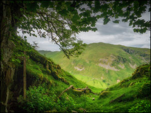
Grid ref: NY 43395 18370 Lat/Long: 54.557387, -02.876772 Drove via the M6 and left at Penrith to drive to Pooley Bridge. I then headed along the east shore of Ullswater to Martindale where I parked by the old church. I followed the path to the east of the church which is an old green track heading diagonally up the fell side. It was wet in places and soon deteriorated to a narrow path through the deep ferns. As I climbed higher I could see remains of the stoned track which would have gone up to the old quarry site. |
 The cave entrance |
 Cave interior |
 Looking out from the quarry cave |
| My first objective of the day is to revisit a cave that is shown on the map. It is actually part of a quarry where there is a spoil heap outside. I was last here in 2005. The cave is not very large and probably only used as a slate quarry. The access track continued a little further and then deteriorated to nothing. I then headed steeply up to the east to reach the flatter area of Brownthwaite Craig. Thankfully the steep scramble up from the cave gave way to a nice flat grassy area where I followed a path to an old ruined by a stream. This is where the path starts to head up towards High Street. It is a steady climb and reaches Mere Beck where it continues up the north side to reach the High Street path. The overcast weather continued as I headed south towards High Raise. |
 Steep climb above the quarry |
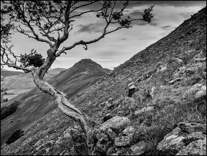
| The path is easy to follow and on the approach to Rampsgill Head I could see some people walking over Kidsty Pike to my left. I'd originally planned to walk to the head of Riggindale but change my mind and took a quiet path along the top of Rampsgill Head which gave me excellent views down into the valley to the north. I follow the path down towards the main path coming up from Angle Tarn. Fortunately I didn't need to go as far as this path as it was quite busy with many people walking up from the tarn. I continued down to the base of Rest Dodd and followed the side of the wall heading up to the summit of Rest Dodd. |
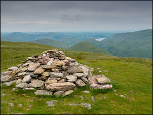 Rest Dodd |
| The wall leads to the west and I continued north to reach the summit and its small cairn. I could see another walker in the distance heading the same way as me. I then descended the northern ridge steeply down to a wall where there was a gap and rotten wooden stile. The style served no purpose and I just walked around it. Ahead was an area of open boggy ground but the track across it was good enough to get through without any problems. The final climb was up to The Nab where I met the walker I'd seen earlier but he was now on his way down. He was returning the way he come but my planned route was to continue and descend to the north. I should have checked the map better because the northern descent was extremely steep and checking the map later I could see a much better route circling round to the west. |
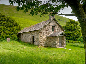
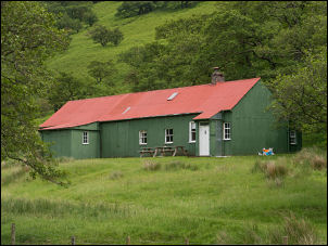 The Bothy (private) |
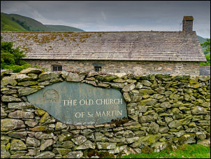 St Martin's Church |
 St Martin of Tours |
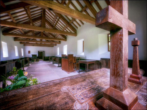 St Martin's Church interior |
|
|
As I descended I could see a gap in the wall
below and crossed it over a wooden stile. Further down I descended through
deep ferns to a new metal gates in a gap in the wall near the property
called The Bungalow. Apparently this is an area of private ground and not
available for public access. I wasn't aware of this until I followed the
track down to reach the road at a gate where there was a sign. There were
no signs up on the fell top. I reach the lane and turn right to follow it
for just over a mile back to the car outside St Martin's church. When I
originally arrived mine was the only car but now there were about 7 or 8
parked. I had a look inside the church before setting off for the drive
home. |
 St Martin's Church |
|
The Old Parish Church of St Martin of Tours Martindale There has been a church of this site for more than 700 years. In 1266 it is referred to as the Chapel of St Martin. Some traces of the first church from which the dale takes its name can be seen protruding on the south side of the building which took the place of the older church around the end of the 16th century. Until 1881 this was the Parish Church of Martindale. Until the Dissolution of the Monasteries in 1536 the Chapelry of Martindale was served by the monks of Barton and it remained part of the parish of Barton until 1633 in which year the first vicar was appointed. Richard Birkett was inducted to the living on June 16th 1633 with a yearly stipend of £6 13s 4d. He survived the religious and civil upheaval of the 17th century and died on Christmas Day 1699. At the south east corner of the church is the tomb. The epitaph reads: "Here lieth interred Richard Birkett, Clerk who procurred this chappell to be consecrated with Parochial rights. As curat he remained here 67 years. And as benefactor he gave ye Chappell One Hundred Pounds. As a most affectionate husband he left to his wife a comfortable subsistence who in token of her gratitude and to perpetuate his memory caused this tomb to be erected. He died on the 25th December in the 95th year of his age Anno Domini 1699." |
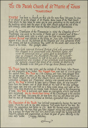 Information notice in the Church. Its not very legible so I've put a transcript adjacent. |
|
The Pulpit bears the date 1634 and the initials of the donor. John Dawes.
It was originally an two decker. The Flagged Floor was laid in 1714 to
replace the earthen floor. The Pewes are 17th Century and have been
adapted from the old box pews. In 1882 on the day of the Consecration of
St Peter's as the Parish Church, the roof of this church fell in, and in
the substantial restoration a Singers' and Musicians' Gallery was removed
and new windows put in. The Font is believed to have been a Roman altar.
It was brought down from the Roman road of High Street at the head of the
dale perhaps 500 years ago and was used firs as a Holy water stoup and
later as the fort. The deep striations are marks made centuries ago in the
sharpening of tools. The Bell is medieval and bears an inscription which
has not yet been deciphered. In the North East Corner of the Churchyard is
the ancient yew, not less that 700 years old. It was from this tree and
others now gone that the men of Martindale, famous as bowmen, replenished
their arms. The Population of the Parish has declined progressively during the last5 200 years. From the 16th to the 18th centuries 200 people lived in the dale. By 1900 the population had fallen to 123. Now the normal winter population is less than 80. We hope that you have enjoyed seeing this ancient building. Say a prayer for those who live here. And if you would like to help with the church upkeep and preservation we shall be glad of your offering in the wall safe below. Happy Holiday. |
|
|
|
|