 Return to
Whittle Wanderer
Return to
Whittle Wanderer|
Feadaig Bothy, Schiehallion, Strath Fionan, Scotland. |
|
|
OS
Grid ref: NN 70125 57749 Lat/Long: 56.693353, -04.122263 Set off for Scotland in the car to do some walking. The weather forecast was bad. While driving north on the M6 I was pleasantly surprised to see the roadworks at Lancaster were no longer there. It is the first time I've been able to drive through without a 50 mile per hour speed limit for years. |
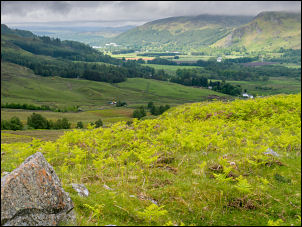 Looking back to Kinloch Rannoch |
| After Glasgow and heading for Stirling the road signs showed the A9 north of Dunblane closed. It turned out that there was an accident that had closed the road. This was my planned route so I had to change and head via Callander and over Glen Ogle to reach the Schiehallion area. I reached a car park in a lay-by adjacent to Dunalastair Water and stopped to decide what to do next. |
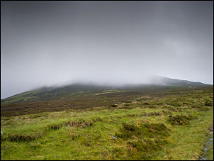 Schiehallion in the cloud |
 Feadaig bothy |
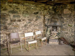 Feadaig bothy interior |
| My original plan was to walk by the loch to find MacGregor's cave. It is only a short walk and would have been ideal to fill the afternoon. However the weather forecast for tomorrow, when I planned to do my main walk, is for rain through the day. As the weather improved slightly I decided to do the main Schiehallion walk this afternoon. As there is plenty of daylight left this shouldn't be a problem. |
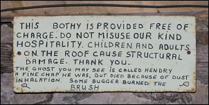 Bothy notice about the ghost |
| I set off West along the road to the properties called East Tempar. There was a gate here that led to a track going up the Glen. The map shows an ancient cup marked rock somewhere in the vicinity but I couldn't find it. I continued up the track which climbed steadily up the glen but eventually started to deteriorating as I approached my first objective. I was heading for a bothy that is marked on the map and as I a rounded a corner the roof of the bothy appeared in front of me. |
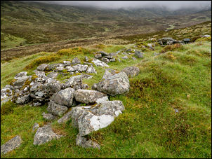 Schieling remains |
| It turned out to have been cut into the hillside adjacent to a stream. It was open to the public and inside were chairs and a small area for a fire. My next objective was to check out some old shielings shown on the map. They were directly below the bothy so I followed the stream line down the hillside until I came to the remains of the building foundations. They were the traditional bothy layout but as I returned up the hill following the stream there were a few that were partly cut into the hillside. |
 Schieling |
| This made me think that the bothy I visited may have been an old shieling and just been enlarged and improved. My next plan was to climb Schiehallion from the west and I started by following the line of grouse butts shown on the map. It turned out that there were only about two or three and they were very old and in a dilapidated state. Once above the last one I continue straight up the hillside without any problems. When I reach the main west ridge I continued up and found a faint track which is not shown on the map. I was very fortunate with the weather as the sky cleared in places and as I reached the mountain summit I had some nice views. |
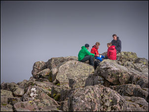 Schiehallion summit |
| At the summit trig post location was there were a group of young people who had climbed up on the main path from the car park to the east. As I approached the foundation remains of the trig post they set off back down. I followed them and soon caught them up and we chatted briefly as we walked down together. However, they were going back to the car park and I was about to descend the north slopes down to the old observation station to the north. This is where Nevil Maskelyne made his measurements in 1774. I was following the exact descent route I used on my last walk here. |
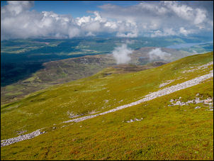 Descending to the north observatory |
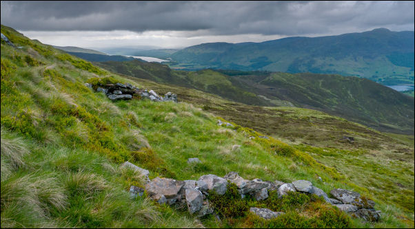 Site of the 1774 north observatory |
|
|
I reached the survey station remains and continued down the hillside
towards the road. However, before reaching it I turned slightly to the
left to investigate an old hut circle shown on the map. It was visible
but fairly indistinct so not worth a photograph. Unfortunately the
weather had deteriorated and it was now raining quite heavily. I
followed the nearest way I could back to the road and began to descend
to the west. It was an easy walk back to the car.
|
|