|
Braes of Foss, Schiehallion & 1774 observation
stations, Perth & Kinross, Scotland |
|
|
OS
Grid ref: NN 74566 56073 Lat/Long: 56.679525, -04.048980 An overcast gloomy morning with low cloud. The temperature was 5 deg C. I walked along the road then turn right into the Schiehellion car park at Braes of Foss. There was one car and a man asleep inside. I continued up the main path that follows the east ridge up the mountain. |
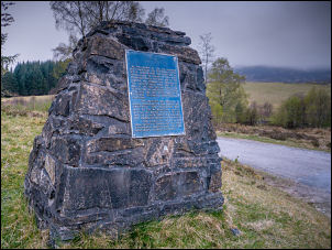 Monument to the Schiehallion experiment mostly by Nevil Maskelyne |
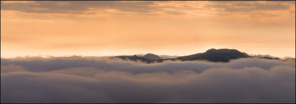 Looking east from the climb of Schiehallion |
|
|
I soon reached the cloud level and was walking
through mist for a while then at 700 metres I got above it and had good
views. I continued up the well-made path to 725 metres where I decided to
leave it and head across the slopes across the south face of the Mountain.
After leaving the main path it was rough going for a while through the
heather. However I came across a faint track which seem to have been
created by sheep and deer. It traversed the mountain a little higher than
my planned route but I stuck to it as it was heading in the right
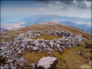
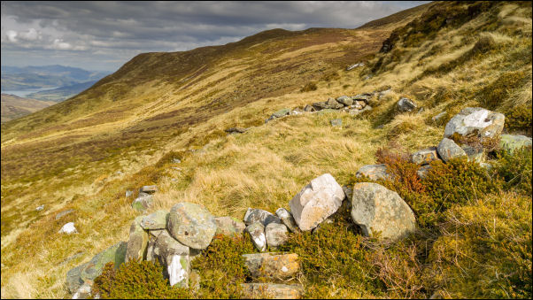
direction. The track path started to descend slightly as I approached the location of the scientific observation point. I checked my notes and set the coordinates into my GPS and descended steeply to a small flat area where the observation instruments would have been in 1774. It was obvious that someone had visited it in the not too distant past as a small cairn had been set up in the west corner. Just to the west and a few metres higher was the site of the accommodation bothy. This was very overgrown and it could only be identified by stones under the heather. |
|
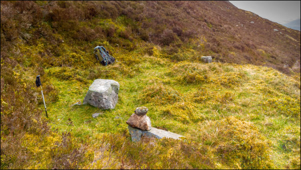 The South Observatory site, 724m lat/long: 56.661331, -04.089873 OS grid ref: NN 72000 54124 |
|
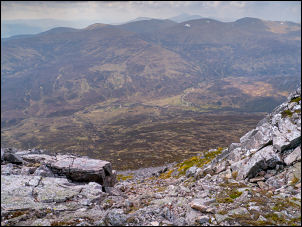 Looking down the south slopes of Schiehallion |
 Circle of stones on the ridge |
|
About 10 metres to the south and slightly lower
was another flat area but it was rather small and no evidence that it was
man-made. After taking a few photographs and sending a Facebook post as I
had a 4G connection I decided to head straight up the south face. It was
steep going through the heather and at times was very steep with a fair
degree of exposure. There were some boulder fields which were difficult to
cross as they were generally loose in places. I kept going and eventually
reached the summit ridge of Schiehallion and to my relief was on the
official path. Nearby was a circle of stones which looks like a wind
shelter but could also have been a much older structure. I turned left and
followed the path towards the summit and although I was walking across
stones there was a faint path to follow marked by the occasional cairn. It wasn't too far to the actual summit and I could see two people were already there. The weather had cleared and I had reasonable if hazy views of the surrounding mountains. |
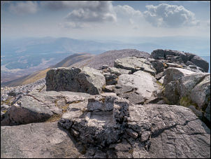 Schiehallion summit in the foreground are the remains of the old trig post |
|
On the final approach I met the couple coming
down it was a man and a woman. We start to chat briefly and the woman
seemed quite interested in the history of the Maskelyne experiment as she
had read about it in guide note for the mountains. They continued down and
I continued up. I reach the tangle of boulders at the highest point and
could see the concrete remains of the trig post that used to be there. It
was considerably different to the last time I was here when it was thick
cloud and everything was covered in ice. I spent a few moments taking in the views and walked a little further to the west to see what the descending ridge looked like. I then then started my descent to the east and retraced my steps to where I had joined the path from the south observatory. I wanted to revisit the north observatory site so I continued down to a point where I could see a clear grassy descent. |
|
 The North Observatory site, 641m lat/long: 56.673296, -04.089023 OS grid ref: NN 72093 55454 |
|
|
I could see boulder fields and wanted to
avoid them at all costs. I managed to find a clear area between them
and eventually finish up on the less steep slower slopes. I have the
gps waypoint marked in my gps unit so was able to find the observatory
site without any problems. Everything was as I left it yesterday and I
spent a few moments walking around the site before continuing my
descent down to the road. I followed the same descent route as
yesterday even though there was no path to follow. At the road I turn
right to head back to the car but stopped briefly where a group of
young people were rebuilding one of the dry stone walls. There was a
lady ranger supervising them and I stopped briefly to chat about the
work they were doing and about the Maskelyne experiment which she was
aware of. Back at the road was a man who was supervising the wall
building as he was a qualified dry stone waller. We chatted briefly
about the different kinds of walling techniques and I then left and
continued back to the car.
Schiehallion 1774 Observatory North Observatory 641m 56.673296, -04.089023 NN 72093 55454 South Observatory 724m 56.661331, -04.089873 NN 72000 54124 |
|