|
Silloth, Grune Point, Skinburness, Bitterlees,
Cumbria |
|
|
OS
Grid ref: NY 11341 54461 Lat/Long: 54.877020, -03.383293 The drive along the M6 to the start of my walk in Silloth was extremely lively due to strong winds. I left the motorway north of Penrith at exit 41 and continued along the B5305 through Wigton and on to Silloth where I parked on one of the three car parks at the seafront. It was very exposed with a strong westerly wind coming in off the sea. |
 Windy Promenade at Silloth |
| I set off north along the promenade and kept to the footpath until it reached Skinburness where the path follows a muddy track behind houses. The signage was very poor out a long open grassland just in from the shoreline. I followed the official path which is also the Cumbria coastal way as far as the marker post which turns right to head for Skinburness Creek. |
 Concrete sack Pill Box interior |
| However I saw a path continuing out to Grune Point so I followed it and was thankful that I did. In a thick Bush of spiny Gorse I found a pill box which can hardly be seen at a distance. It is constructed of concrete bags and dates back to WWII when Silloth had an airfield. It was in surprisingly good condition and it is a shame that the surrounding bushes obscure it. I went down to the shore line followed a very wet track where I took the opportunity to have an early lunch and look across Skinburness Creek and a picturesque sky as the sun tried to break through the clouds. |
 Concrete sack Pill Box |
 The sun trying to break through while I had my butties |
|
| I continued to the road at Skinburness and followed it round and along the ancient Sea Dyke where it is possible to climb up onto the grassy embankment and enjoy the views. At Harlow I left the road to follow a very muddy footpath through the fields. The gate had been tied shut by the farmer so I had to climb over even though it is an official footpath. I reached the B5302 road and turn right to follow it to the church |
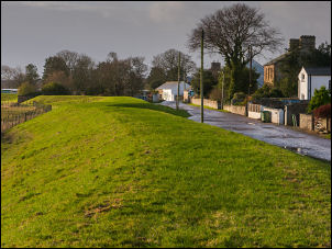 Sea dyke |
| I reached St Paul's at Causewayhead and stopped to have a look inside. It was quite basic but still used thankfully. Across from the church entrance and over the road is a separate Cemetery which was used for the airfield and those killed during training during World War II. |
 St Paul's at Causewayhead |
| As I continued along the road to my rights was the site of the original Silloth Airfield which is no longest used. At the sharp bend I followed the minor lane straight on and to the B5301 where I went back into the fields to follow another wet foot path. |
 St Paul's interior |
 Bit of a mouthfull |
|
| I continued towards The Close farm buildings where I turn right and followed the path to Bitterlees Farm on the B5300. I went straight across the road along the track towards the golf course. On the golf course which seems to be called Bitterlees on the map I crossed the grassy area along the track and on to the Cumbria Coastal Way path which follows the coastline. |
 Ships in Silloth Harbour |
| When I reached an area of sand dunes I climbed over the top and down past the Golf Course Clubhouse and onto the road around the dock area. I follow the road round and back to the seashore at the lifeboat station where there is another car park. |
 Silloth Lifeboat Station |
 Silloth promenade was still windy |
|
|
|
|