|
The night was calm but still overcast. The morning temperature was
at 0 degC but there was no ice on the tent. I packed up and was on
my way by 07:30. I was disappointed in how busy the road was and was
concerned about theA74 I would be joining in a while. Approaching
the A74 all I could see was an unbroken line of traffic trundling
along with Heavy Goods Vehicles predominating. I joined the other
road users and cycled on. I was looking forward to reaching Necton
where I would turn right and leave the madness. I put up with the
ride until the turn off and bliss. Turning right I was back into
sanity and a quiet road. Although mostly quiet the landscape was
very empty and my rise was surrounded by fields and not much else.
For someone from Lancashire I found the place names of unfamiliar
interest. |
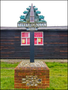
Little Dunham |
|
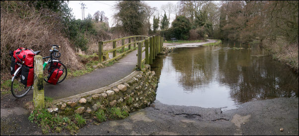
River Nar at Castle Acre |
|
Little Dunham had an interesting ring about it. I wanted
to have a look at Casle Acre as the map shows a ruined abbey. I
headed along a minor track and at first thought I’d gone wrong way.
I knew there was a ford and when it came into view was a bit
concerned because I couldn’t see a footbridge. The bridge was there
but obscured at first by bushes on the left. Also on the left were
the Abbey ruins across a field with a muddy track leading towards
it. It was surrounded by a fence so probably wasn’t accessible. I
continued up the track and into the village. |
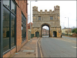
Gatehouse in King's Lynn |
|
At the top the road
went through an old stone arched gateway. I continued north along
the line of the old Roman Road for a few miles then turned left and
on through Gayton and on to King’s Lynn. I’d planned to cycle round
the town centre and follow a cycle track by the river. There was an
impenetrable one way system that didn’t seem to take me anywhere in
particular. The signposts are for cars and of no use to cyclists. I
gave up looking for the riverside cycle track and concentrated on
getting out into the countryside. |
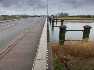
New bridge and Old across River Great Ouse |
|
I took the minor road through Terrington-St-Clement
and hoped that I’d see shops and hopefully a chip shop. There didn’t
seem to be any particular centre so I pressed on. For a while I had
to join the very busy A17 but only as far as Sutton Bridge. The
bridge is a swing bridge so I stopped to give it a closer look. I
couldn’t see anywhere for pedestrians to get across. I took the
minor road into Sutton Bridge and found a chip shop where I stopped
for a bag of chips. So far on the ride I hadn’t seen a single
lay-bye transport cafe which seem quite popular further north. The
terrain east of King’s Lynn had been fairly empty of villages but
now there were more settlements about. |
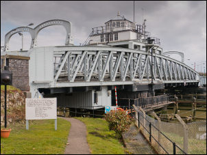
Sutton Bridge |
|
I kept to the
B1359 and B1515 to Holbeach where I turned off on to minor lanes
across open fields which had all recently been ploughed. I crossed
the bridge over the River Welland and was amazed how large it was
and how dark and dirty the water was. Into Spalding I rode into the
traffic free area of the town. It was such a refreshing change from
the traffic madness of Norwich and King’s Lynn. I saw the sign for
the railway station and headed there as I knew a Tesco store was
nearby. I called into the store to buy some water then continued on
my way. I left the town to the west, heading for Pode Hole. This
morning’s weather forecast was for heavy snow overnight and my
planned camp was near Guthram Gowt along a long minor road. I
reached the point but though it best to press on and not risk
getting snowed in. A long rural lane took me by a large scrap metal
processing plant with large lorries rushing to it. I reached the
town of Bourne and decided to ride on till I found somewhere to
camp. To the right of the A151 was a forest area with a parking
sign. I wheeled my bike into a thinly wooded area and found a nice
flat spot to camp. |
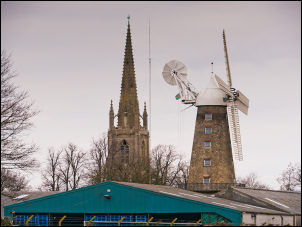
Moulton Church and Windmill |
|
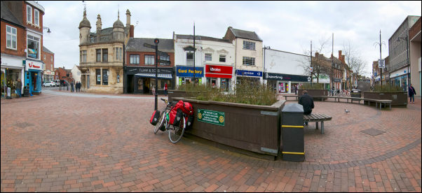
Bike friendly Spalding |
 Return to
Whittle Wanderer
Return to
Whittle Wanderer